Here is a summary of the expected weather conditions for the Big Island as Madeline approaches and affects Hawaii County. Meteorologist Malika Dudley will be doing LIVE weather updates on our BigIslandNow.comFacebook page. Here is a link to the 5 p.m. video forecast.
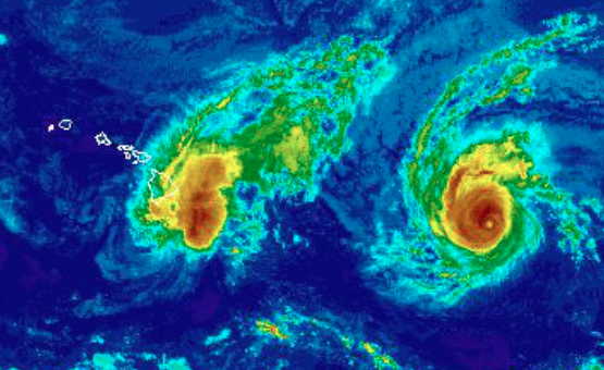
According to the Central Pacific Hurricane Center, Madeline continues to weaken as it passes south of the Big Island. While the center of Madeline will not make landfall, strong winds and heavy rain on the northern side of the system will continue to impact the Big Island tonight.
ARTICLE CONTINUES BELOW AD
ARTICLE CONTINUES BELOW AD
WIND:
TROPICAL STORM WARNING – Big Island, coastal waters
*This evening – North 30 – 50 mph + / Higher gusts possible 50 -75 mph in mountain / high terrain / through passes / downsloping areas / top of buildings
*Thursday – Northeast 20 – 35 mph +
Thursday night into Friday: Back to normal trade wind weather
Gusts to 60 mph have already been measured near the Kohala mountains upslope from Kawaihae. A wind gust to 51 mph occurred at Kamuela airport late this morning. In some areas, sustained winds of 45 to 65 mph with gusts to 80 mph will occur through tonight. The areas most likely to have the strongest winds will be over mountainous terrain, through passes, and where winds blow downslope. Winds are forecast to fall below 39 mph for all areas by early Thursday morning.
Tropical storm force winds continue over portions of the Big Island and winds are expected to peak this evening before starting to subside. Locally heavy rain and isolated thunderstorms will continue to impact the Big Island tonight. These rains could lead to flash flooding and mudslides.
ARTICLE CONTINUES BELOW AD
Extensive damage to power lines and poles could result in widespread power outages that could last from several days to weeks.
RAIN:
FLOOD WATCH in effect / Any advisories will be posted in our updates
5 – 10″ with maximums of 15″ in some windward spots
Today into tonight with heavy rain and thunderstorms that could lead to flash flooding, rock/mud/land slides.
Thursday rain begins to taper off slowly.
Outer rainbands from Madeline have moved onshore and additional heavy rainfall will continue tonight. Many windward Big Island locations have already received 5-6 inches of rain and an additional 5 to 8 inches is possible overnight, especially over windward and southeast portions of the Big Island. This rainfall may lead to dangerous flash floods and mudslides. Refer to the flood watch for more details.
ARTICLE CONTINUES BELOW AD
SURF:
HIGH SURF WARNING for eastern exposures
Peaking later today at 15 – 25 foot faces
Storm surge + high tide an additional 1 to 3 feet above sea level
Large and damaging surf is happening along east facing shores. Surf will build today, and peak at 15 to 25 feet tonight. Wave runup may cause significant coastal flooding and damage to coastal properties and infrastructure, including roadways. Of particular concern is the the Kalapana-Kapoho highway between Pohoiki and Kapoho. Powerful longshore and rip currents will be present at most beaches. Large breaking waves and strong currents may impact harbor entrances and channels causing challenging boat handling.
This comments section is a public community forum for the purpose of free expression. Although Big Island Now encourages respectful communication only, some content may be considered offensive. Please view at your own discretion. View Comments