The Paradise Helicopters crew conducted a flyover of Kīlauea Volcano’s lava-covered Kalapana and Pu‘u ‘O‘o areas on Thursday, Aug. 25, 6 a.m
Kilauea’s ongoing eruption on its east rift zone continues to feed flow 61G, as it pours into the sea at Kamokuna within Hawai‘i Volcanoes National Park. Fingers of lava continue to drip into the sea at Kamokuna, creating a steamy, surreal scene.
The ocean entry zone, now more than a half-mile wide, hosts two deltas that continue to increase in size as the robust activity persists.
ARTICLE CONTINUES BELOW AD
ARTICLE CONTINUES BELOW AD
The eastern delta, the larger of the two, has a more significant plume, as the volume of lava entering the ocean appears to be more concentrated than on the other. Additional points of entry are scattered between the two ends.
Surface activity near the sea cliffs also continues, as the recently established tube system is not able to accommodate the entire volume of the flow.
Breakouts on Pulama Pali and extending onto the coastal plain are more than likely a result of the steep period of inflation the summit of Kīlauea experienced over the past few days, but with the recent transition to deflation will probably mean those will be short lived.
ARTICLE CONTINUES BELOW AD
The Hawaiian Volcanoes Observatory substantiated this report on its website this morning. The 61 g flow is entering the sea at several places near Kamokuna, spanning about 1 km (.6 miles) of coastline, and building an increasingly large lava delta at the base of the sea cliff. Scattered breakouts continue, predominantly on the pali and the makai (seaward) portion of the coastal plain.
Lastly, the lava pond within Pu‘u ‘O‘o is still active, but covered by clouds and gases, so no photo of decent quality was taken, the Hawaiian Helicopters crew reported.
Hawaiian Volcanoes Observatory UPDATE for Friday, Aug. 26, 2016, 8:54 a.m.
ARTICLE CONTINUES BELOW AD
Activity Summary: Kīlauea Volcano continues to erupt at its summit and from its East Rift Zone. The 61g lava flow continues to enter the ocean at Kamokuna and produce scattered breakouts on the coastal plain and pali. The flow poses no threat to nearby communities. The summit lava lake level dropped slightly during the past day and the surface is about 37 m (120 feet) below the crater rim this morning.
Summit Observations: The circulating lava lake within the Halema‘umaʻu Overlook crater remains active. The deflationary phase of the DI event that began Wednesday evening continues, though the tilt rate has slowed during the past day. The lava lake level has dropped in concert with the tilt, and the lake surface is approximately 37 m (120 feet) below the floor of Halemaʻumaʻu this morning. Tremor fluctuations associated with lava lake spattering continue. The average daily summit sulfur dioxide emission rate ranged from 4,000 to 4,300 metric tons/day over the past week.
Puʻu ʻŌʻō Observations: Webcam images show no significant changes at Puʻu ʻŌʻō; intermittent views show that persistent glow continues at the long-term sources within the crater. There was no significant change in seismicity during the past day. The tiltmeter on Puʻu ʻŌʻō cone did not record any significant net tilt over the past day. The sulfur dioxide emission rate from all East Rift Zone vents was about 270 metric tons/day when last measured on Aug. 25.
LAVA VISITOR PRECAUTIONS
As a strong caution to visitors viewing the 61g flow ocean entry, there are additional significant hazards besides walking on uneven surfaces and around unstable, extremely steep sea cliffs.
Venturing too close to an ocean entry exposes you to flying debris created by the explosive interaction between lava and water.
Also, the new land created is unstable because it is built on unconsolidated lava fragments and sand. This loose material can easily be eroded away by surf causing the new land to become unsupported and slide into the sea.
Finally, the interaction of lava with the ocean creates an acidic plume laden with fine volcanic particles that can irritate the skin, eyes, and lungs.
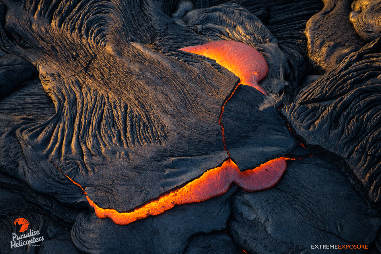
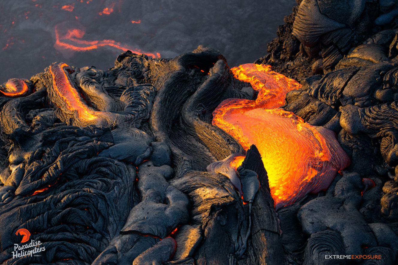
A toe of pahoehoe oozes out from beneath the ruptured crust of the leading edge. Paradise Helicopters, Aug. 25, 2016.
A river of pahoehoe feeds a lava fall over the 60 to 70 foot sea cliff at Kamokuna. Paradise Helicopters, Aug. 25, 2016.
Lava spills over the 60 to 70 foot sea cliff at Kamokuna, adding to the wall of incredible textures. Paradise Helicopters, Aug. 25, 2016.
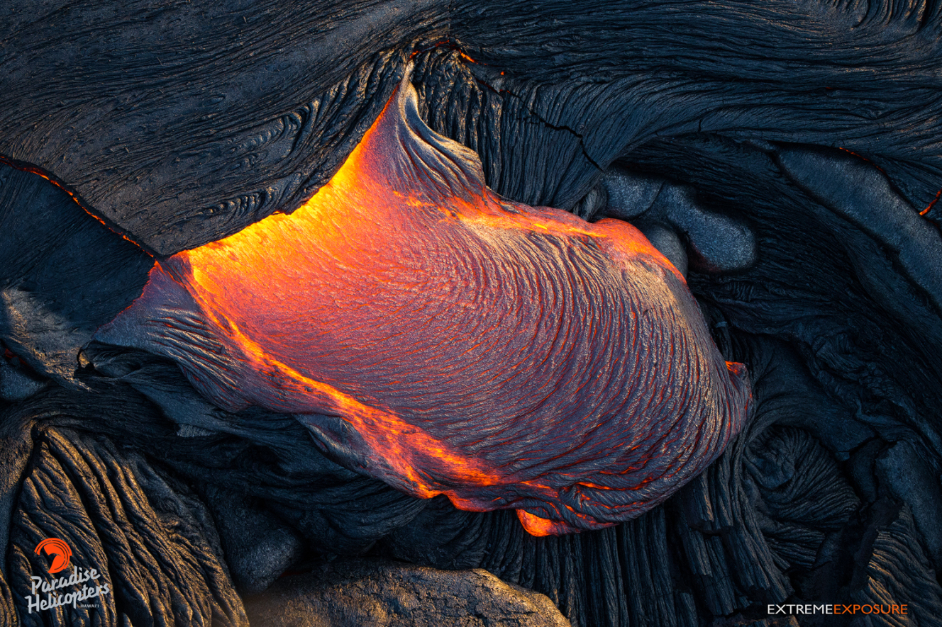
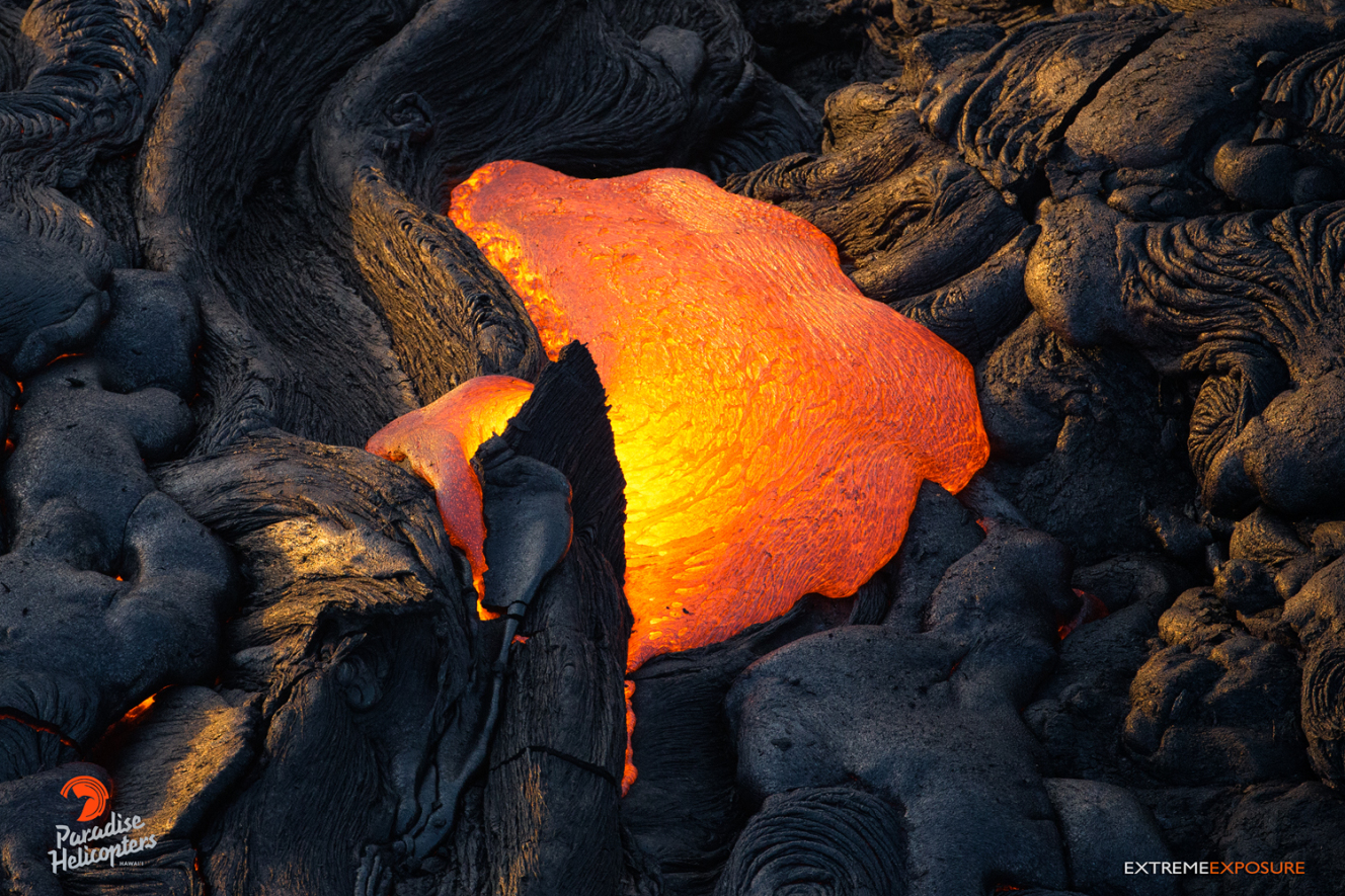
The hardened crust of a lobe cannot contain the pressure building within, cracking and lifting, releasing the molten lava to flow where gravity takes it. Paradise Helicopters, Aug. 25, 2016.
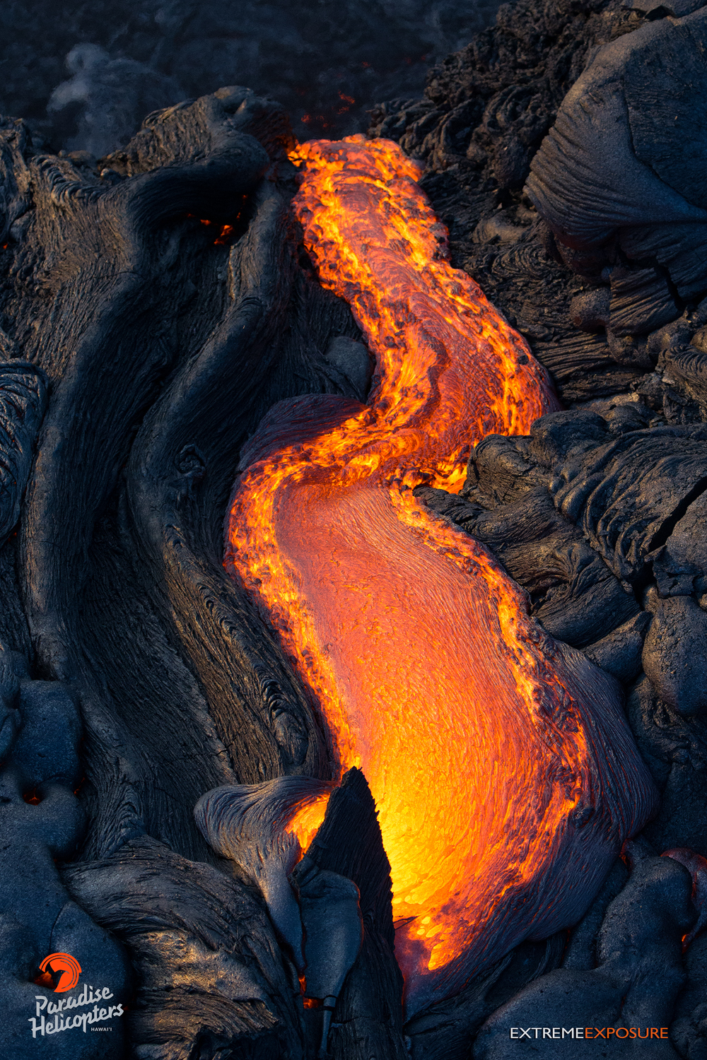
Pressure from within ruptures the crust of a tube, releasing molten pahoehoe. Paradise Helicopters, Aug. 25, 2016.
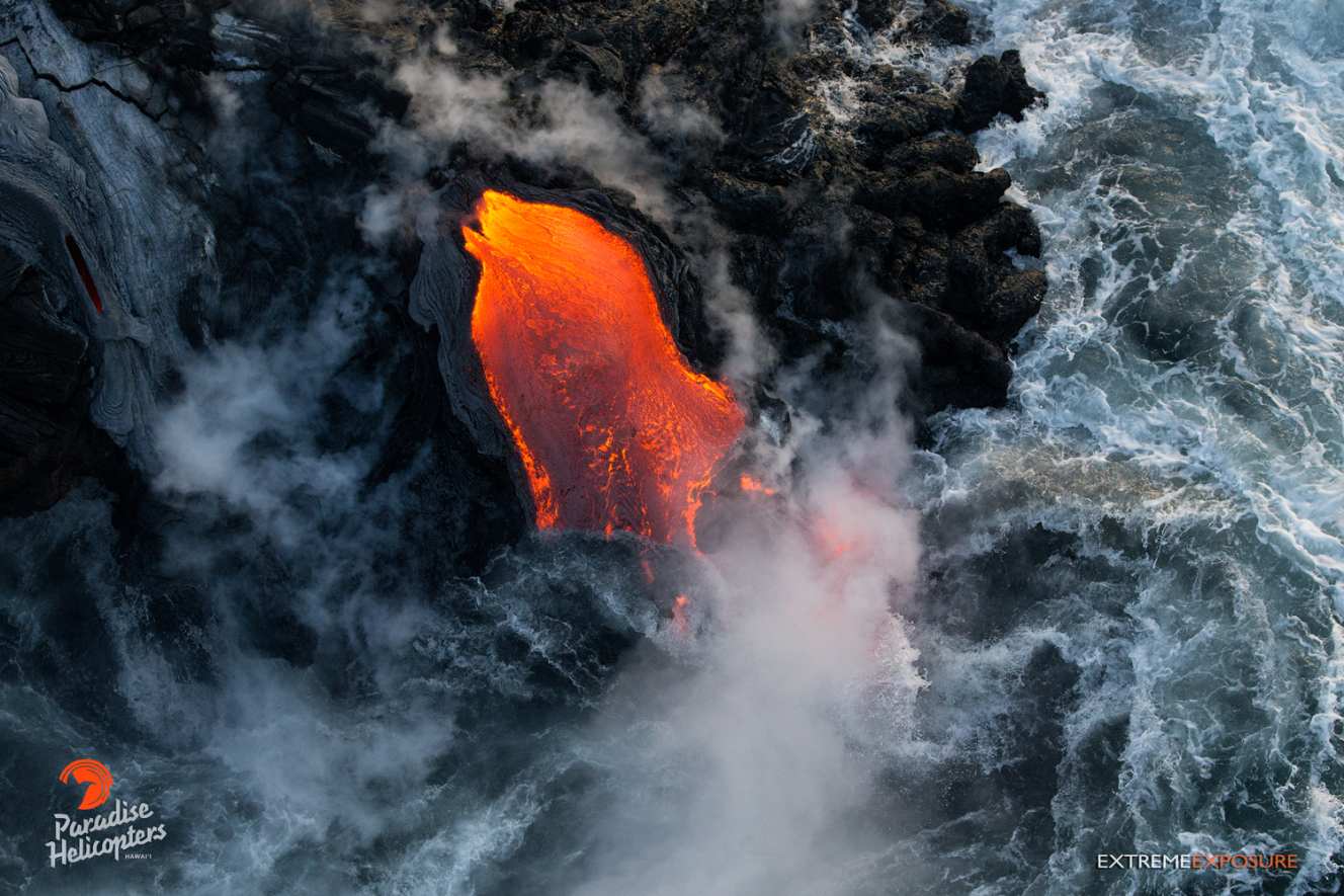
Fingers of lava drip into the sea at Kamokuna, creating a steamy, surreal scene. Paradise Helicopters, Aug. 25, 2016.
Flow 61g continues to pour into the sea at Kamokuna. Now more than a half-mile wide, numerous point of entry were visible, with the largest plume rising from the eastern delta. Paradise Helicopters, Aug. 25, 2016.
Lava continues to pour into the sea, growing the new delta of land at the base of the sea cliff at Kamokuna. Paradise Helicopters, Aug. 25, 2016.
A finger of lava cascades into the ocean near the western delta. Note the surface of the molten lava beneath the water immediately turns black. Paradise Helicopters, Aug. 25, 2016.
Two rivers of lava pour over the 60 to 70-foot cliff at Kamokuna. Paradise Helicopters, Aug. 25, 2016.
This comments section is a public community forum for the purpose of free expression. Although Big Island Now encourages respectful communication only, some content may be considered offensive. Please view at your own discretion. View Comments