A Tropical Storm Warning is posted for Hawaii County.
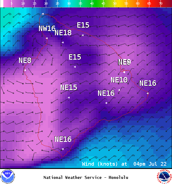
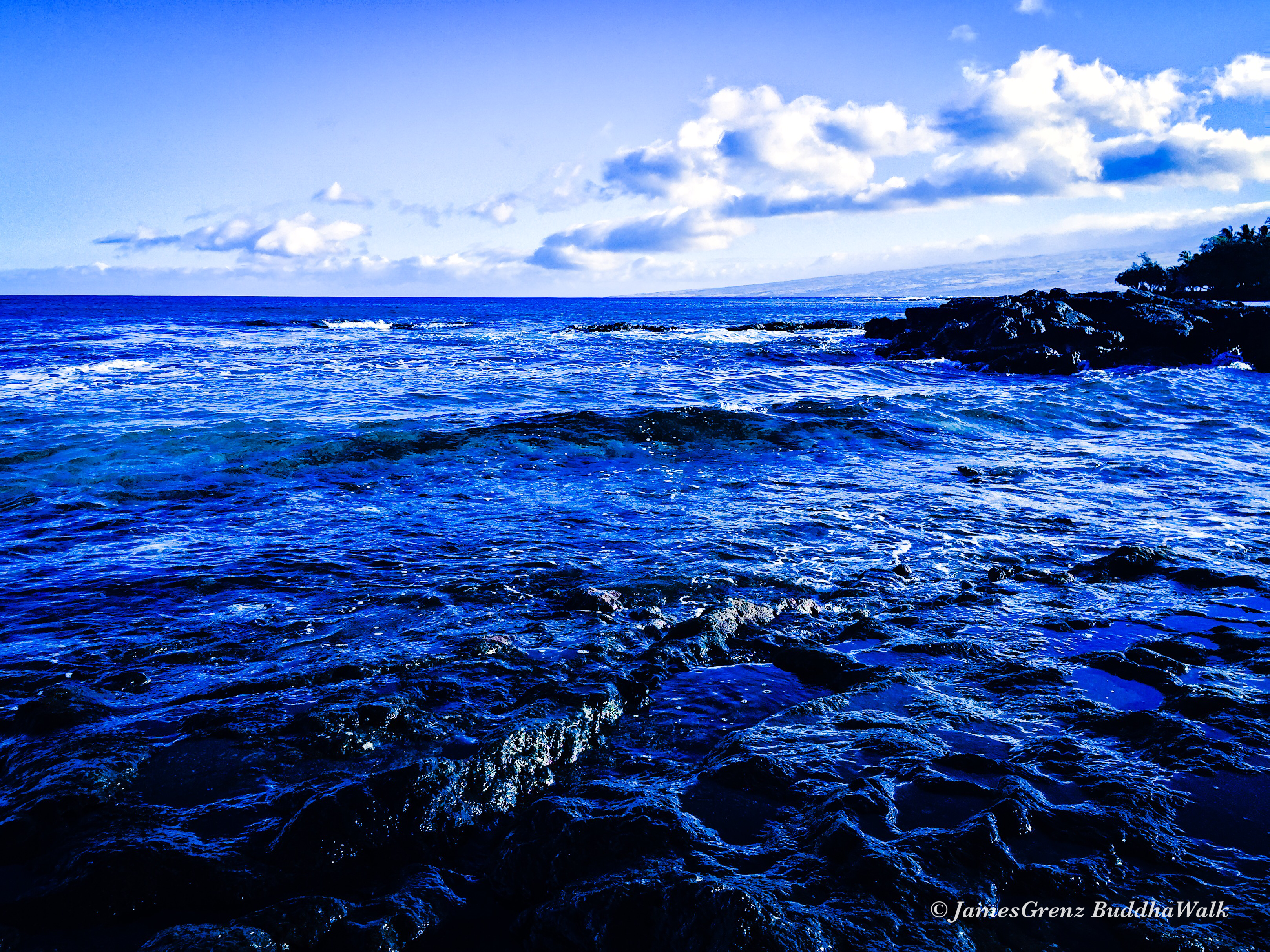
A High Surf Warning is also posted for the east facing shores of the Big Island from 6 a.m. Friday to 6 a.m. Sunday. Surf is forecast to build to 12 to 20 foot faces Friday with higher sets at the best exposures. Waves this big can cause coastal flooding and lead to dangerous ocean conditions. Powerful currents are also a concern and large breaking waves can impact harbor entrances and channels.
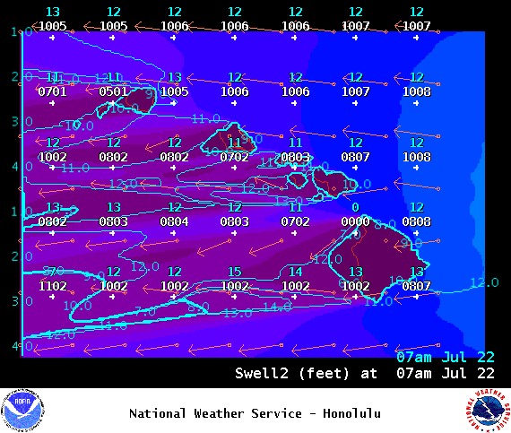
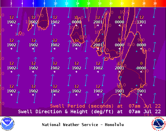
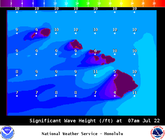
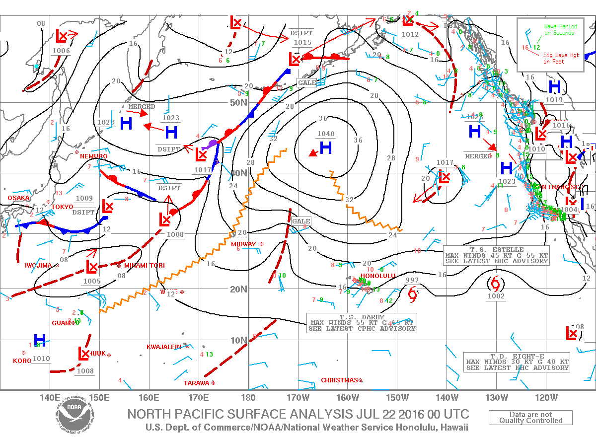
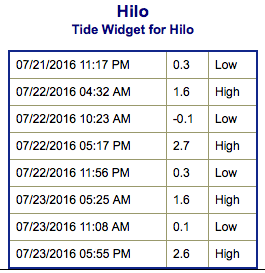
**Click directly on the images below to make them larger. Charts include: Big Island projected winds, tides, swell direction & period and expected wave heights.**
+
SWIPE LEFT OR RIGHT
Big Island Surf Forecast
ARTICLE CONTINUES BELOW AD
Hilo side: Wave heights for spots exposed to the tropical swell are expected to be around overhead to double overhead or more today.
Kona side: Wave heights are expected to be knee/chest high today.
South: Wave heights are expected to be tummy/chest high today. Spots catching tropical swell will be up to overhead/double overhead or more today.
Our current south-southwest swell is still fading. A new southerly swell is expected for around July 31st.
ARTICLE CONTINUES BELOW AD
Darby swell is expected to peak Friday at warning levels before slowly fading through the weekend. Still highly dependent on Darby’s progress as it approaches the state. At this point, Estelle and Frank are not likely to send significant swell to the Hawaiian Islands.
Keep in mind, surf heights are measured on the face of the wave from trough to crest. Heights vary from beach to beach, and at the same beach, from break to break.
This comments section is a public community forum for the purpose of free expression. Although Big Island Now encourages respectful communication only, some content may be considered offensive. Please view at your own discretion. View Comments


 Big Island Surf Forecast
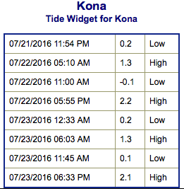 Our current south-southwest swell is still fading. A new southerly swell is expected for around July 31st.