

Trade Swell Picking up, More Swell on the Way

Image: Beau Jack Key
Alerts (as of 1:00 a.m.)
A Gale Watch is posted starting Thursday night for the typical windy waters around the Big Island and Maui County.
A Small Craft Advisory is posted until 6 p.m. Saturday for gusty northeast winds.
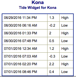
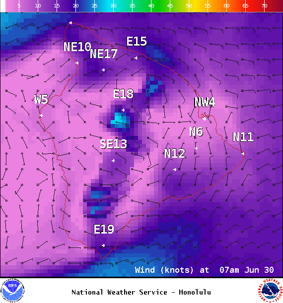
**Click directly on the images below to make them larger. Charts include: Big Island projected winds, tides, swell direction & period and expected wave heights.**
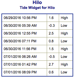 Big Island Surf Forecast
Hilo side: Wave heights for spots exposed to the trade swell are expected to be around knee/waist/chest high.
Kona side: Wave heights are expected to be knee/waist high today with the best breaks getting tummy/chest high on the sets.
South: Wave heights are expected to be knee/waist high today with the best breaks up to tummy/chest high occasionally. Strongest around South Point.
 An overlapping pair of southerly swells will linger today and fade through the weekend. We may get some small overlapping swells for the first week of July. Looking farther out, we may see another round of swell starting around July 7th.
Trade swell will bring surf to northeast exposures but onshore breeze will pick up quickly during the day to chop it up. Trade swell is expected to pick up this weekend.
Quiet in the North Pacific at this time. A possible swell may be generated in the Eastern Pacific later this weekend or early next week. We will keep an eye on it.
Keep in mind, surf heights are measured on the face of the wave from trough to crest. Heights vary from beach to beach, and at the same beach, from break to break.
**Click here for your detailed Big Island weather report.**
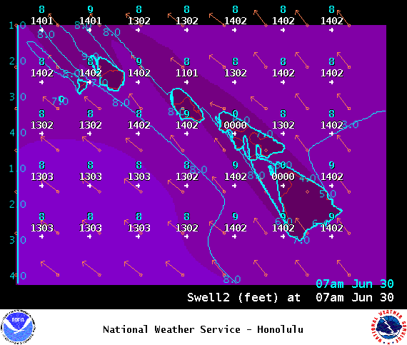
Image: NOAA / NWS
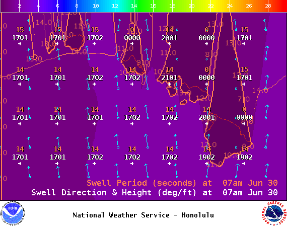
Image: NOAA / NWS
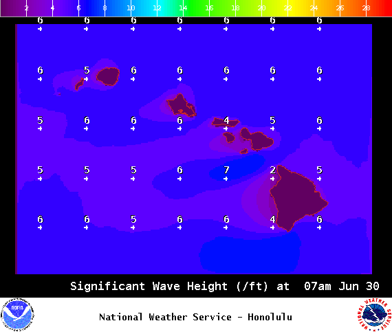
Image: NOAA / NWS
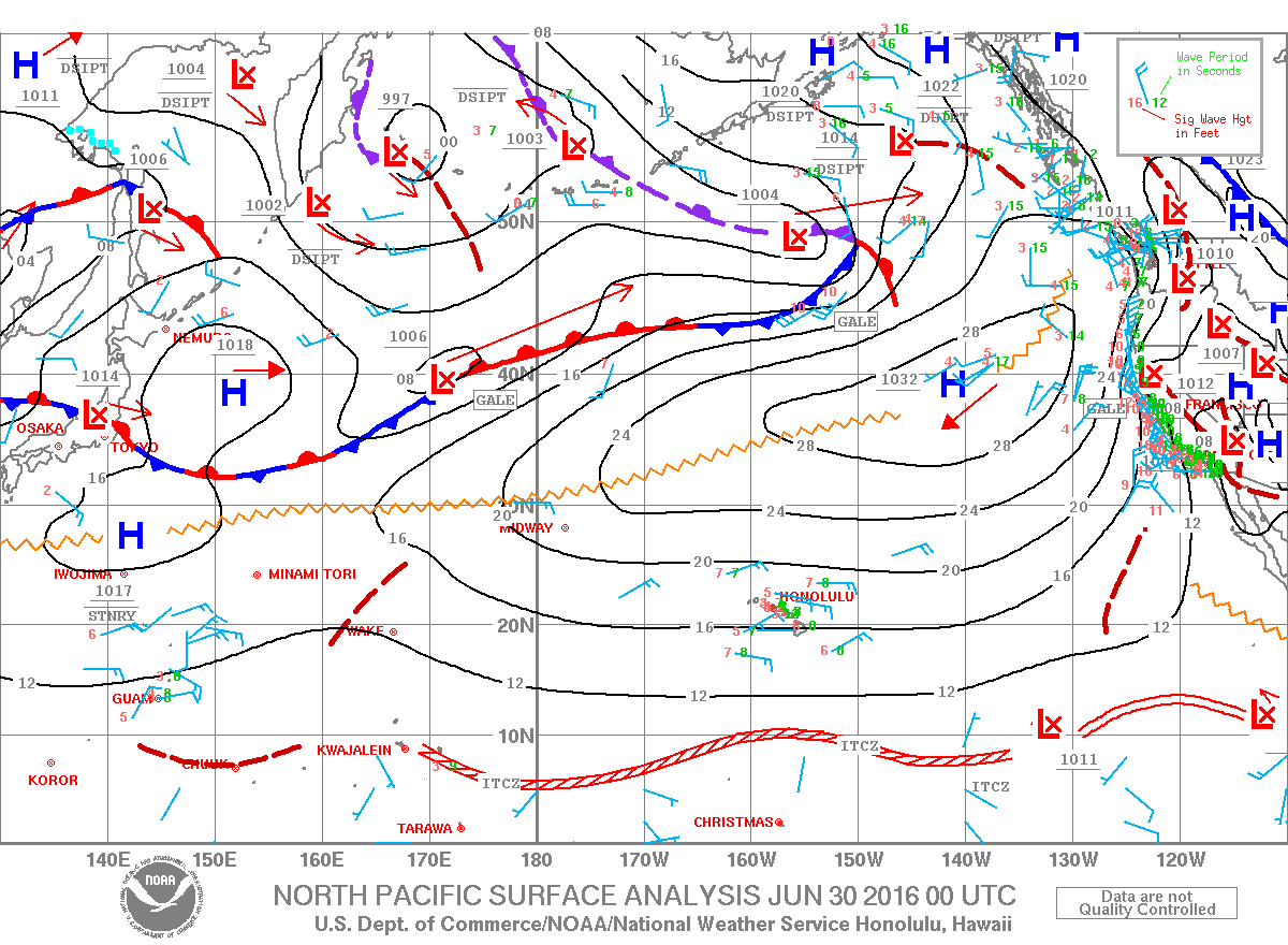
Image: NOAA / NWS
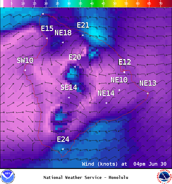
Image: NOAA / NWS


Sponsored Content

