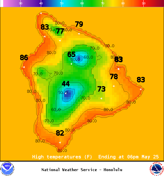
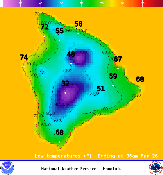
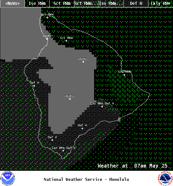
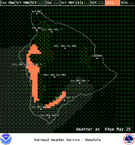
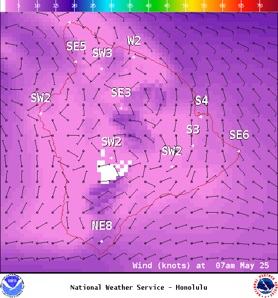
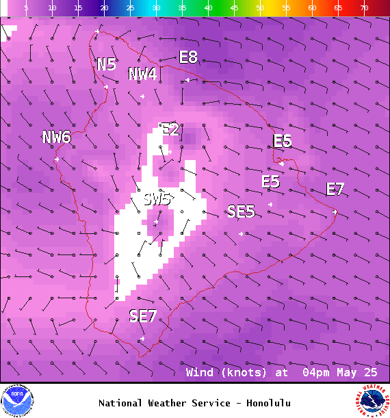
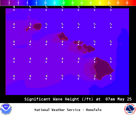
**Click directly on the images below to make them larger. Charts include: Big Island high/low forecasted temperatures, projected winds, chance of cloud cover, projected localized weather conditions, vog/SO2 forecast and expected wave heights.**
+
SWIPE LEFT OR RIGHT
ARTICLE CONTINUES BELOW AD
ARTICLE CONTINUES BELOW AD
Looking Ahead
Trade winds will continue to weaken, with showers remaining focused over windward slopes through early Wednesday. Widespread afternoon sea breezes are expected to trigger isolated heavy downpours on Wednesday, mainly over interior and mauka sections, as the atmosphere becomes increasingly unstable. A more stable but humid, hybrid trade wind and weak afternoon convective pattern will prevail on Thursday, followed by light and variable winds and a land and sea breeze weather regime heading into the weekend.
ARTICLE CONTINUES BELOW AD
Today
We expect sunny skies in the morning with mostly cloudy skies and showers likely in the afternoon for the Kona side. Thunderstorms are also a possibility. Partly cloudy skies are expected for the Hilo side with scattered showers. Winds are out of the east around 15 mph. High temperatures from 81° to 86°.
UV index at 10 (“very high” exposure level)
ARTICLE CONTINUES BELOW AD
Tonight
East winds tonight around 15 mph. Mostly cloudy skies are forecast with scattered showers. For the Kona side, clouds will clear as the night goes on. Low temperatures from 69° to 74°.
This comments section is a public community forum for the purpose of free expression. Although Big Island Now encourages respectful communication only, some content may be considered offensive. Please view at your own discretion. View Comments