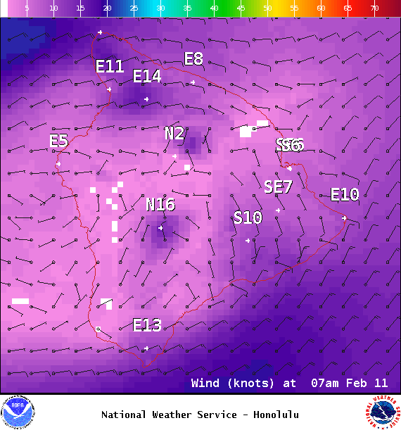
A Small Craft Advisory is in effect for all Big Island windward waters through 6 a.m. Friday.
A High Surf Warning is posted for the west side of the Big Island through 6 p.m. Thursday.
A High Surf Advisory is posted for the north shore of the Big Island through 6 p.m. Thursday.
ARTICLE CONTINUES BELOW AD
ARTICLE CONTINUES BELOW AD
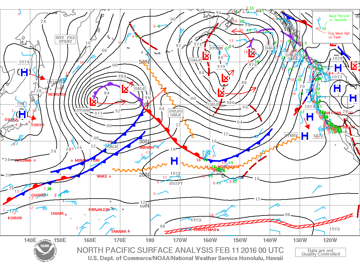
Marine Alert – Beginning Wednesday a large, very dangerous northwest swell will produce harbor surges and large breaking waves at the harbor entrances exposed to this swell. This includes Honokohau boat harbors.
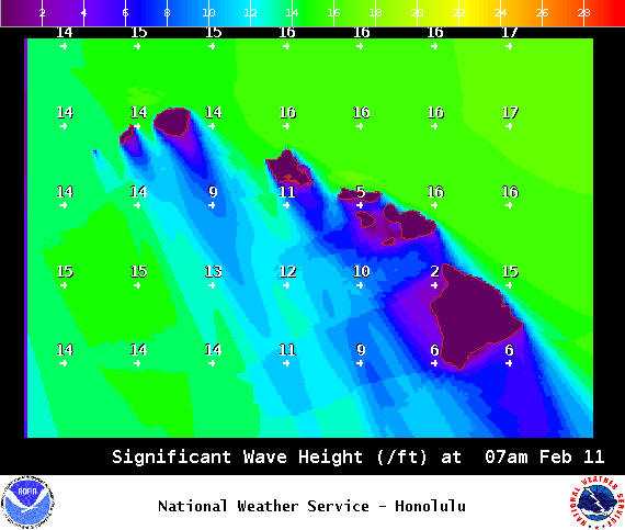
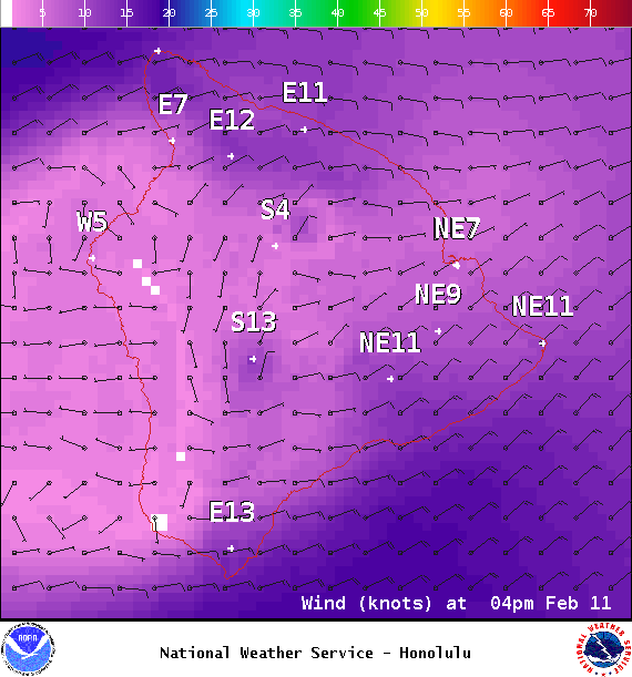
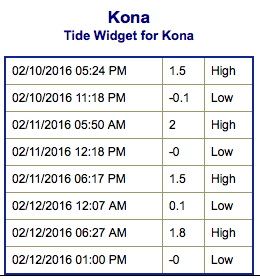
**Click directly on the images below to make them larger. Charts include: Big Island projected winds, tides, swell direction & period and expected wave heights.**
+
SWIPE LEFT OR RIGHT
ARTICLE CONTINUES BELOW AD
Big Island Surf Forecast
Hilo side: Wave heights for spots exposed to the north-northwest are expected to get elevated surf today. The best breaks will be overhead or more on the sets.
Kona side: Wave heights for spots exposed to the north-northwest are expected to get chest/head high surf. The best breaks will get up to a few feet overhead on the sets.
ARTICLE CONTINUES BELOW AD
South: Kona side expected to get mainly wave heights chest/head high. The best breaks will be bigger.
A heavily shadowed swell is building and will peak on Thursday. The swell will likely reach the west side of the Big Island and a high surf warning has been posted for the west facing shores. Surf is also expected to rise along the north facing shores of the Big Island, where an advisory has been issued. Surf along that coast will be significantly higher than the west side.
A good sized west-northwest is due in late on Valentine’s Day.
Our current southwest swell continues to slowly fade Thursday. A small new south-southwest is expected Friday and Saturday.
Keep in mind, surf heights are measured on the face of the wave from trough to crest. Heights vary from beach to beach, and at the same beach, from break to break.
This comments section is a public community forum for the purpose of free expression. Although Big Island Now encourages respectful communication only, some content may be considered offensive. Please view at your own discretion. View Comments


 Big Island Surf Forecast
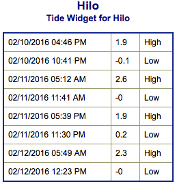 A heavily shadowed swell is building and will peak on Thursday. The swell will likely reach the west side of the Big Island and a high surf warning has been posted for the west facing shores. Surf is also expected to rise along the north facing shores of the Big Island, where an advisory has been issued. Surf along that coast will be significantly higher than the west side.