A Small Craft Advisory is posted for all Big Island coastal waters and the ʻAlenuihāhā channel through 6 a.m. Tuesday for northeast winds up to 30 knots and seas up to 13 feet.
A High Surf Advisory is in effect for east facing shores through Tuesday at 6 p.m. Surf heights of 5 to 8 foot faces are expected.
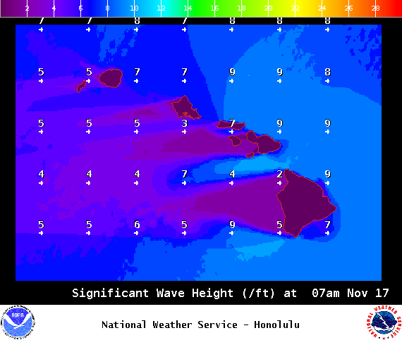
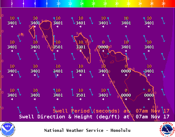
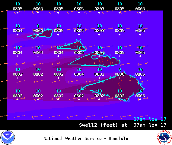
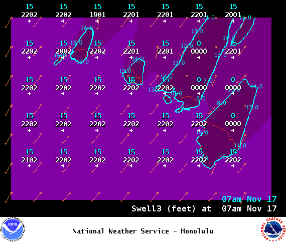
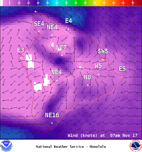
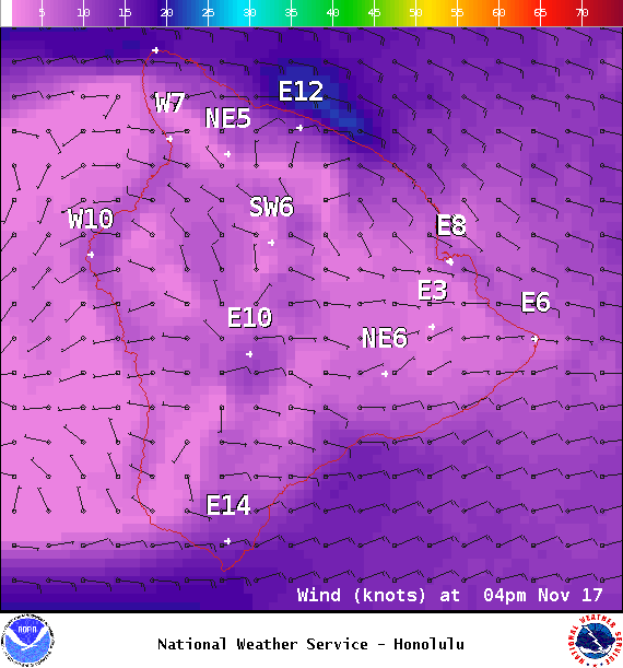
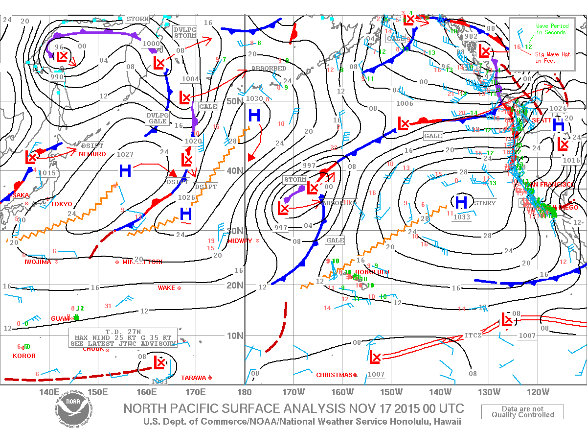
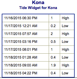
**Click directly on the images below to make them larger. Charts include: Big Island projected winds, tides, swell direction & period and expected wave heights.**
ARTICLE CONTINUES BELOW AD
ARTICLE CONTINUES BELOW AD
+
SWIPE LEFT OR RIGHT
Big Island Surf Forecast
Hilo side: Wave heights are expected head high today with the best breaks getting up to a few feet overhead from time to time on the sets. Onshore wind will chop it up.
ARTICLE CONTINUES BELOW AD
Kona side: Wave heights well below waist high for most spots today – just small leftovers.
South: Most breaks are well below waist high – just small leftovers. Breaks open to the trade swell could still get up to head high or even overhead.
An advisory level east-northeast trade swell will continue to affect windward coasts.
Our current south-southwest continues to trend down today. A new south-southwest is expected later this week.
ARTICLE CONTINUES BELOW AD
A larger west-northwest swell is expected to build midweek with knee/waist high waves Wednesday into Thursday and fading Friday into Saturday. Thursday and Friday the swell will shift more out of the northwest and affect the northeast coast of the Big Island with waist/head high waves. The swell fades over the weekend.
Keep in mind, surf heights are measured on the face of the wave from trough to crest. Heights vary from beach to beach, and at the same beach, from break to break.
This comments section is a public community forum for the purpose of free expression. Although Big Island Now encourages respectful communication only, some content may be considered offensive. Please view at your own discretion. View Comments


 Big Island Surf Forecast
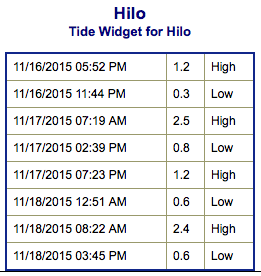 An advisory level east-northeast trade swell will continue to affect windward coasts.