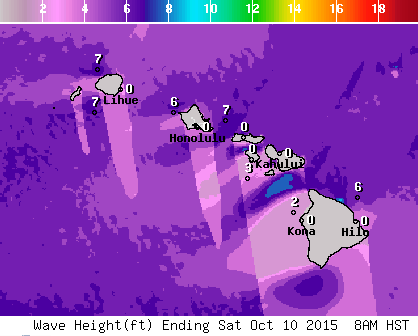
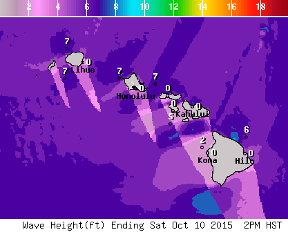
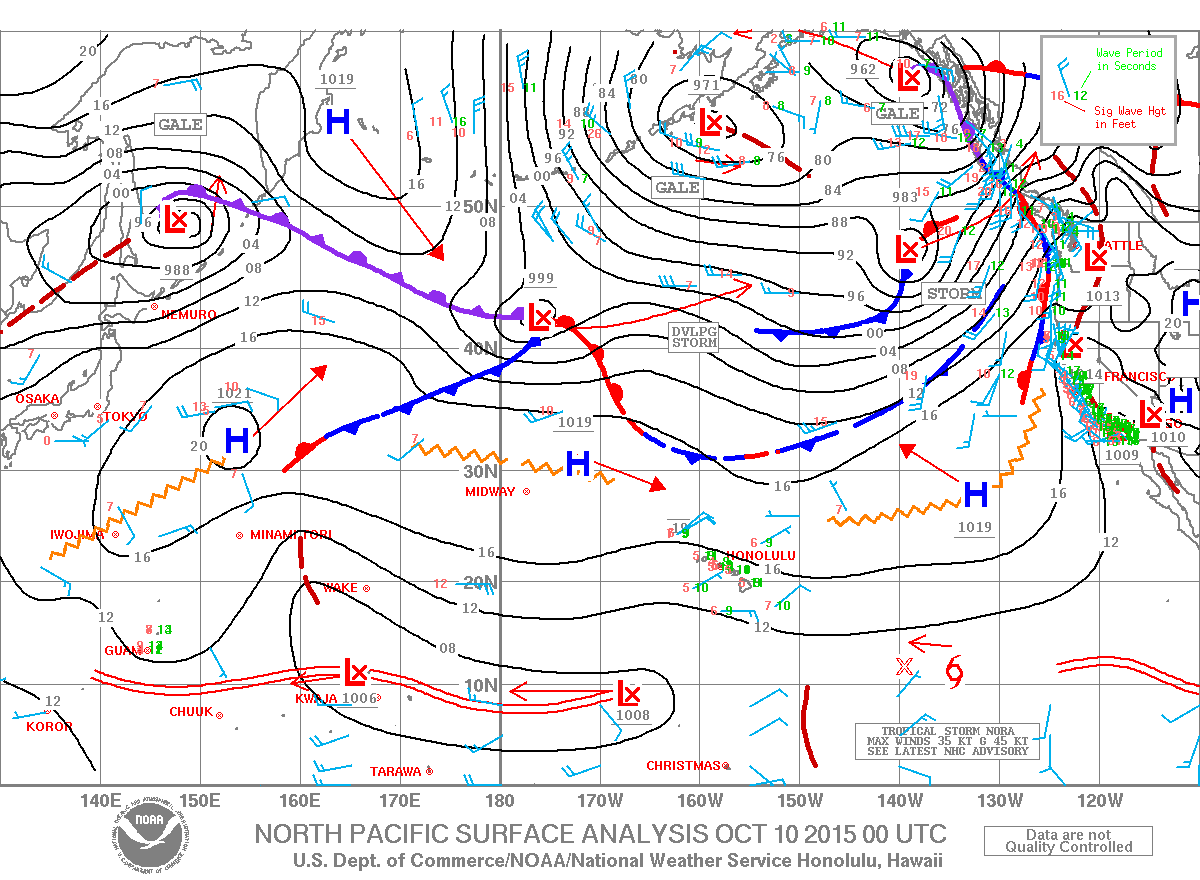
A High Surf Advisory is expected for the south and west facing shores of the Big Island through 6 a.m. Sunday. A long period Tasman swell is expected to boost wave heights and produce strong currents.
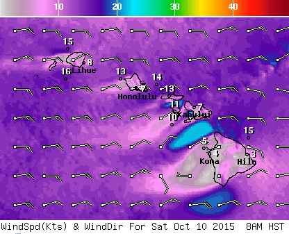
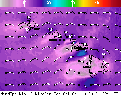
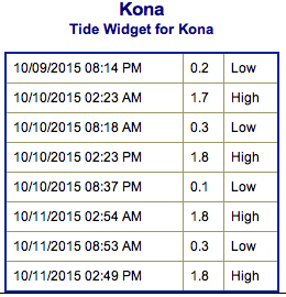
**Click directly on the images below to make them larger. Charts include: Big Island projected winds, tides, swell direction & period and expected wave heights.**
+
SWIPE LEFT OR RIGHT
ARTICLE CONTINUES BELOW AD
ARTICLE CONTINUES BELOW AD
Big Island Surf Forecast
Hilo side: Wave heights are expected knee/waist high today. The best breaks could get up to waist/chest high on the sets as new NNW builds late in the day.
Kona side: Wave heights waist/shoulder high are expected today. Best breaks could get up to head high on the sets. Smaller waves are expected for spots not open to the south-southwest.
South: Wave heights waist/shoulder high are expected for the breaks open to the south-southwest. Best breaks could get up to head high or more on the sets.
ARTICLE CONTINUES BELOW AD
Our current north-northwest is expected to fade into the weekend. A moderate north-northwest swell is expected to build late Saturday, peak Sunday and maintain through the middle of next week.
Long period south and west swells will persist through the weekend.
East shores should remain small as light to moderate trade winds prevail. No small craft advisories are expected through the forecast period.
Nora may bring some east-southeast swell to the islands as early at Tuesday. Will keep an eye on this and see how it develops.
ARTICLE CONTINUES BELOW AD
Keep in mind, surf heights are measured on the face of the wave from trough to crest. Heights vary from beach to beach, and at the same beach, from break to break.
This comments section is a public community forum for the purpose of free expression. Although Big Island Now encourages respectful communication only, some content may be considered offensive. Please view at your own discretion. View Comments


 Big Island Surf Forecast
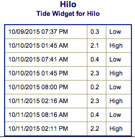 Our current north-northwest is expected to fade into the weekend. A moderate north-northwest swell is expected to build late Saturday, peak Sunday and maintain through the middle of next week.