

Swells Fade Today, High Surf Advisory Dropped
Alerts
There are no weather alerts posted at this time.
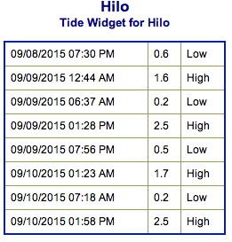
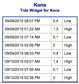
**Click directly on the images below to make them larger. Charts include: Big Island projected winds, tides, swell direction & period and expected wave heights.**
 Big Island Surf Forecast
Hilo side: Wave heights are expected knee/waist/chest high today with a downward trend.
Kona side: Wave heights waist/chest high are expected for the best breaks open to the south-southwest swell. The best spots could get up to shoulder/head high on the sets.
South: Wave heights waist/chest high are expected for the best breaks open to the south-southwest swell. The best spots could get up to shoulder/head high on the sets.
 North-northeast Jimena swell is expected to fade today. The high surf advisory for east-facing shores has been canceled. The swell is expected to shift out of the north and drop out on Thursday.
Our current long-period swell from the south-southwest is expected to gradually fade through the rest of the week. A storm in the South Pacific is expected to send us another round of fun south-southwest swell starting Sunday.
Keep in mind, surf heights are measured on the face of the wave from trough to crest. Heights vary from beach to beach, and at the same beach, from break to break.
**Click here for your detailed Big Island weather report.**
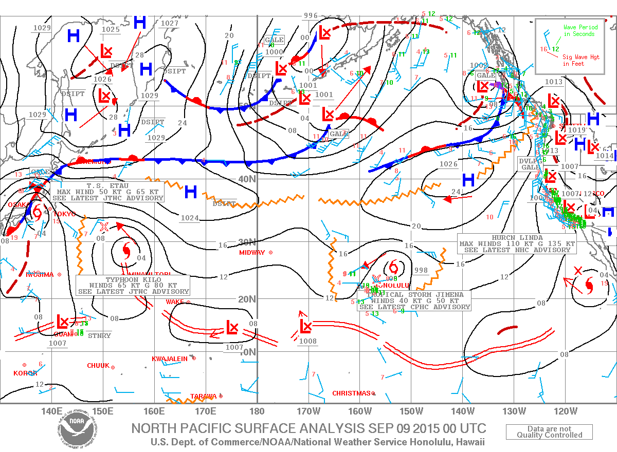
Image: NOAA / NWS
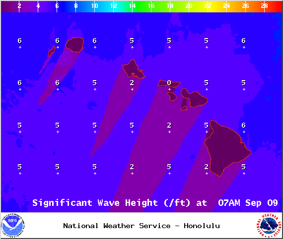
Image: NOAA / NWS
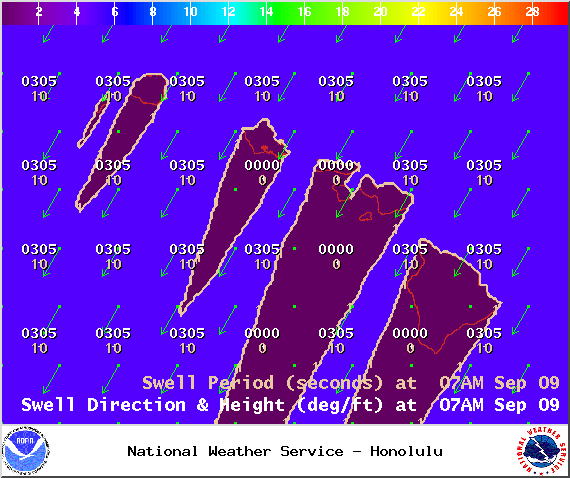
Image: NOAA / NWS
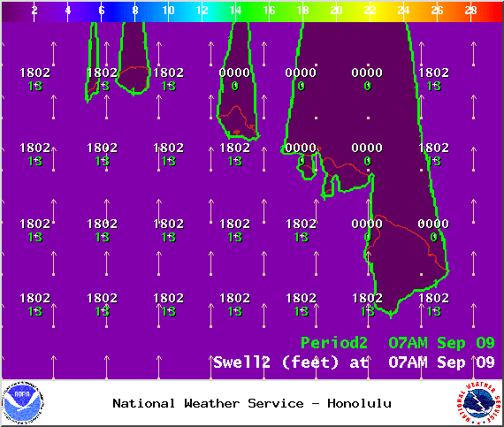
Image: NOAA / NWS
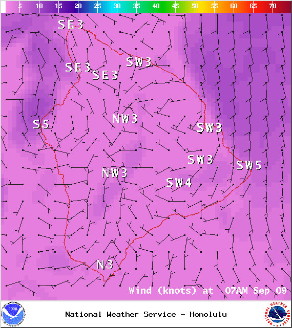
Image: NOAA / NWS
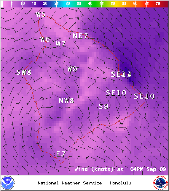
Image: NOAA / NWS
Sponsored Content


