A High Surf Warning is posted for east facing shores of the Big Island through 6 p.m. Saturday with wave heights rising to 12 to 18 foot faces in some spots Tuesday. Expect ocean water occasionally sweeping across portions of beaches, very strong breaking waves and strong longshore and rip currents. Breaking waves may occasionally impact harbors making navigating the harbor channel difficult. Large breaking surf, significant shore break and dangerous currents will make entering the water very hazardous. Boaters should be aware of an increased number of surfers in the water.
A High Surf Advisory is posted for south facing shores through 6:00 p.m. Saturday. Expect strong breaking waves, shore break and strong longshore and rip currents making swimming difficult and dangerous.
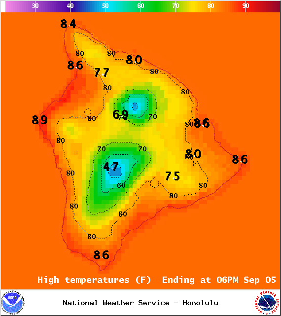
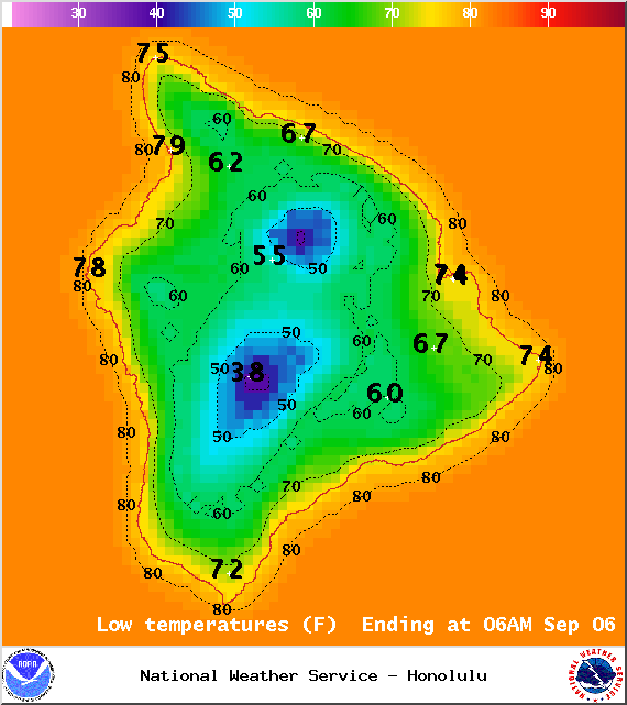
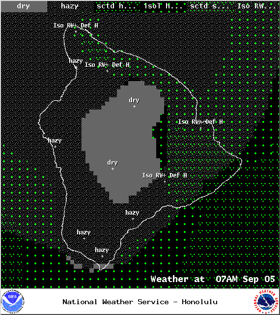
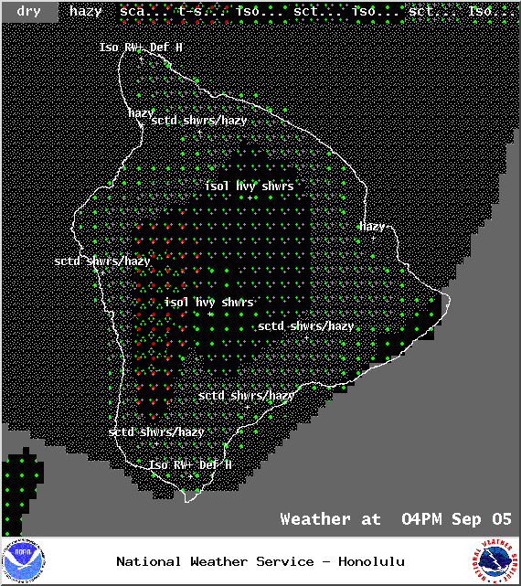
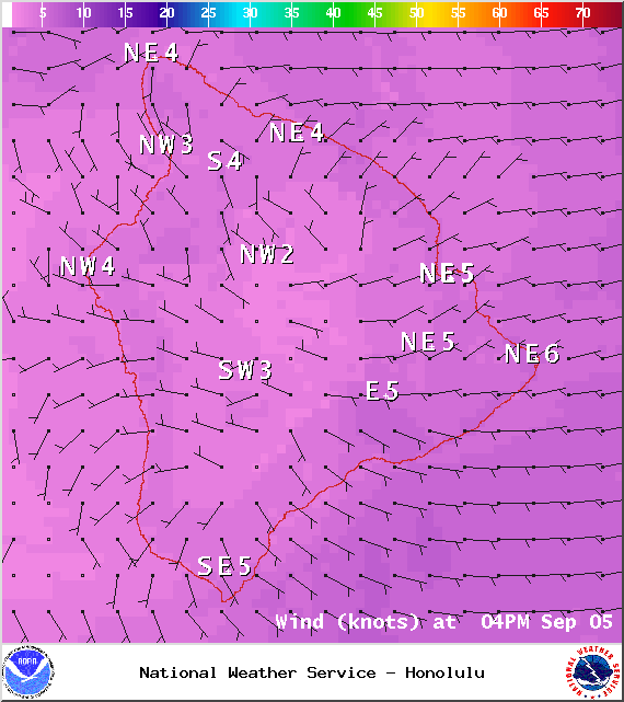
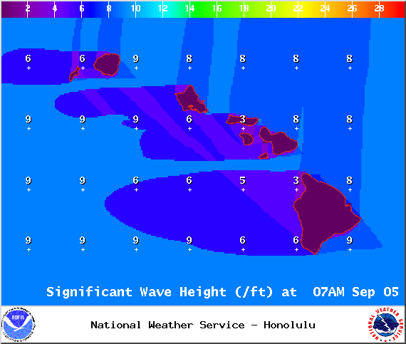
**Click directly on the images below to make them larger. Charts include: Big Island high/low forecasted temperatures, projected winds, chance of cloud cover, projected localized weather conditions, vog/SO2 forecast and expected wave heights.**
+
SWIPE LEFT OR RIGHT
ARTICLE CONTINUES BELOW AD
ARTICLE CONTINUES BELOW AD
Looking Ahead
Pop up heavy showers and thunderstorms are possible through Saturday because of an unstable and moist air mass over the state. Drier weather is expected as this band of moisture moves away. Sea breezes are expected to spawn clouds and showers from late mornings through evening with clearing skies during the late nights and early mornings.
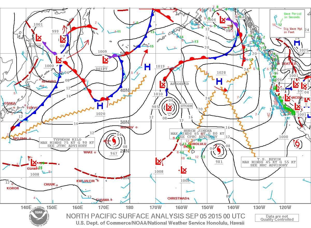
The weather over the main Hawaiian islands by the middle of next week is highly dependent on the track of hurricane Jimena. If the system holds together and passes well northeast of the islands, it could bring more of the light winds and wet weather that have occurred this week. If Jimena tracks closer to the islands we could see more significant impacts. We will keep watching it.
ARTICLE CONTINUES BELOW AD
Today & Sunday
Today we expect partly cloudy skies with scattered windward showers and hazy leeward conditions (see UHSOEST vog model). There is a slight chance of thunderstorms, mainly in the afternoon on Saturday. Locally heavy rainfall is possible in the afternoon as well as clouds build on the Kona side. More stable conditions are expected on Sunday. High temperatures from 85° to 90°. Variable winds up to 15 mph.
UV index at 12 (“extreme” exposure level)
ARTICLE CONTINUES BELOW AD
Tonight & Sunday Night
Variable winds are expected this evening up to 15 mph. Low temperatures from 74° to 79°. Partly to mostly cloudy skies are expected with scattered showers.
This comments section is a public community forum for the purpose of free expression. Although Big Island Now encourages respectful communication only, some content may be considered offensive. Please view at your own discretion. View Comments