A Flash Flood Watch is posted for all islands through the day Friday due to the threat of heavy rain and saturated grounds across the state. Thunderstorms are also possible.
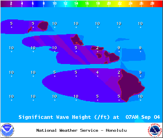
A High Surf Warning is posted for east facing shores of the Big Island through 6 p.m. Saturday with wave heights rising to 12 to 18 foot faces in some spots Tuesday. Expect ocean water occasionally sweeping across portions of beaches, very strong breaking waves and strong longshore and rip currents. Breaking waves may occasionally impact harbors making navigating the harbor channel difficult. Large breaking surf, significant shore break and dangerous currents will make entering the water very hazardous. Boaters should be aware of an increased number of surfers in the water.
A High Surf Advisory is posted for south facing shores from 6:00 a.m. Friday through 6:00 p.m. Saturday. Expect strong breaking waves, shore break and strong longshore and rip currents making swimming difficult and dangerous.
A Small Craft Advisory is posted for Big Island windward and southeastern waters as well as Alenuihaha channel through 6 p.m. Friday for rough seas up to 13 feet. Inexperienced mariners should avoid navigating in these conditions.
ARTICLE CONTINUES BELOW AD
ARTICLE CONTINUES BELOW AD
**Click directly on the images below to make them larger. Charts include: Big Island high/low forecasted temperatures, projected winds, chance of cloud cover, projected localized weather conditions, vog/SO2 forecast and expected wave heights.**
+
SWIPE LEFT OR RIGHT
Looking Ahead
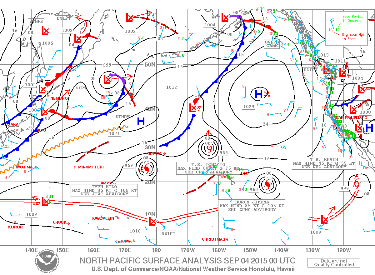
A humid and unstable air mass continues to linger so locally heavy showers and thunderstorms are possible through at least Friday and possibly even into the weekend. Winds are forecasted to remain light and humidity will continue to be high. Hurricane Jimena moves to the northeast of the state next week, and may begin to drift closer to the islands late next week. The system is still too far out to determine what if any affects may result.
ARTICLE CONTINUES BELOW AD
Today
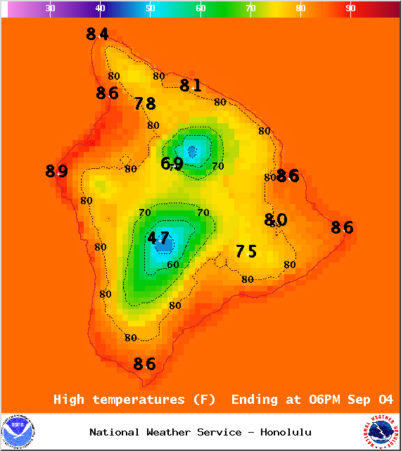
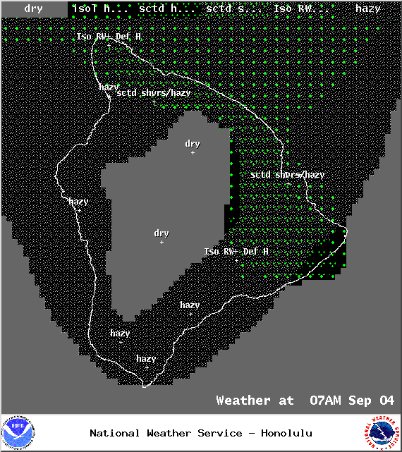
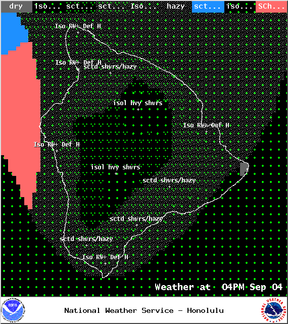
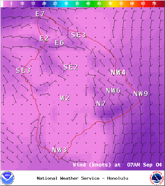
Today we expect partly cloudy skies with scattered windward showers and hazy leeward conditions (see UHSOEST vog model). There is a chance of showers, mainly in the afternoon. Locally heavy rainfall is possible in the afternoon as clouds build on the leeward side. High temperatures from 85° to 90°. North winds up to 15 mph.
UV index at 12 (“extreme” exposure level)
ARTICLE CONTINUES BELOW AD
Tonight
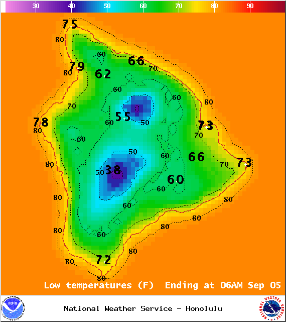
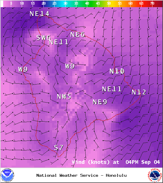
Variable winds are expected this evening up to 10 mph. Low temperatures from 75° to 80°. Partly to mostly cloudy skies are expected with scattered showers.
This comments section is a public community forum for the purpose of free expression. Although Big Island Now encourages respectful communication only, some content may be considered offensive. Please view at your own discretion. View Comments