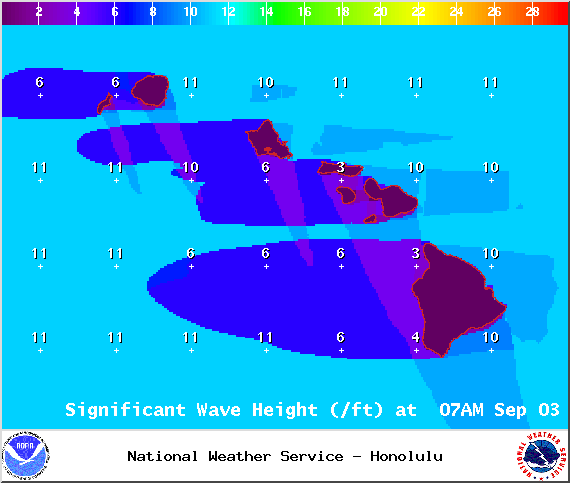
A High Surf Warning is posted for east facing shores of the Big Island through 6 p.m. Thursday with wave heights rising to 10 to 15 foot faces in some spots Tuesday. Expect ocean water occasionally sweeping across portions of beaches, very strong breaking waves and strong longshore and rip currents. Breaking waves may occasionally impact harbors making navigating the harbor channel difficult. Large breaking surf, significant shore break and dangerous currents will make entering the water very hazardous. Boaters should be aware of an increased number of surfers in the water.
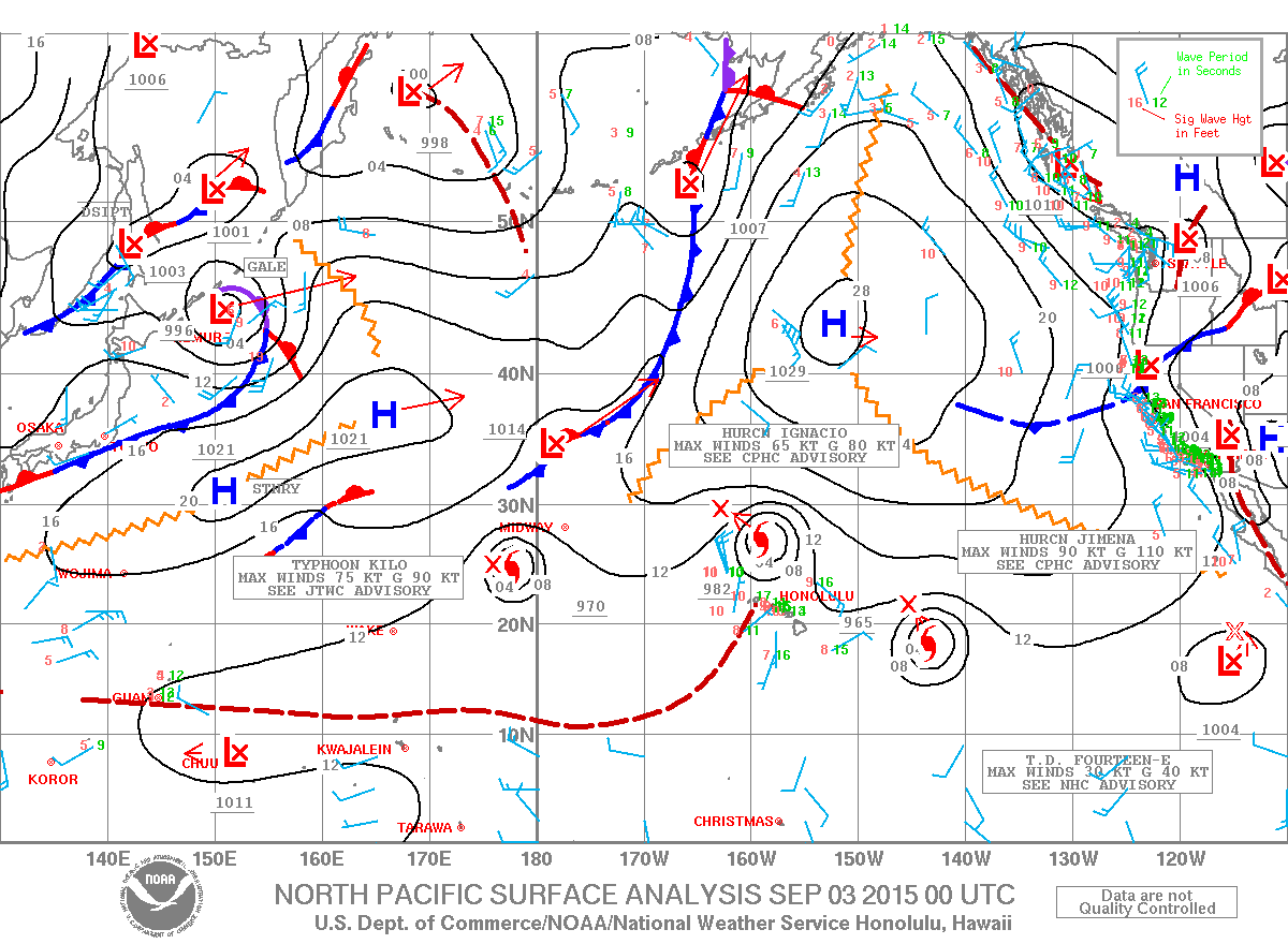
A Small Craft Advisory is posted for Big Island windward and southeastern waters as well as Alenuihaha channel through 6 p.m. Friday for rough seas up to 13 feet. Inexperienced mariners should avoid navigating in these conditions.
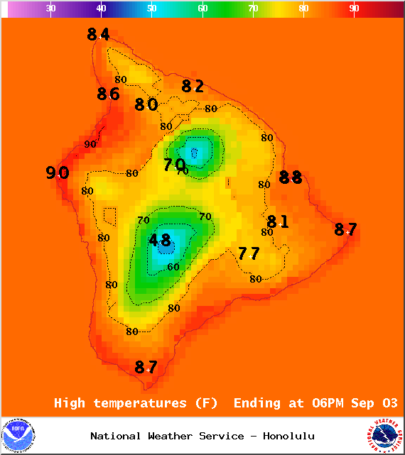
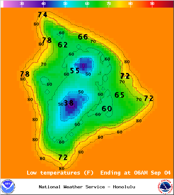
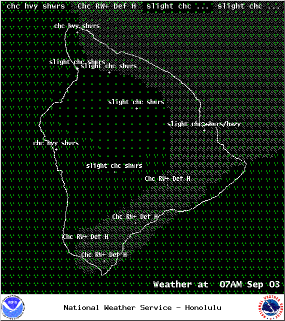
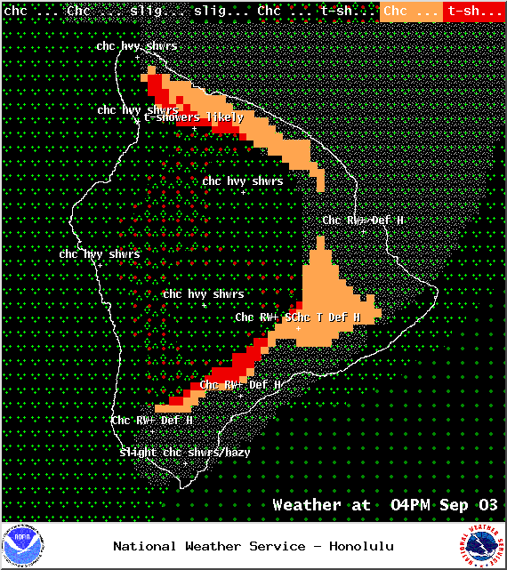
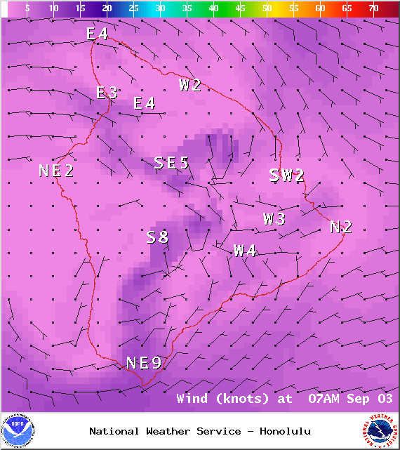
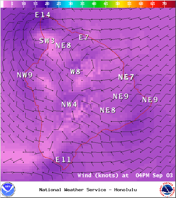
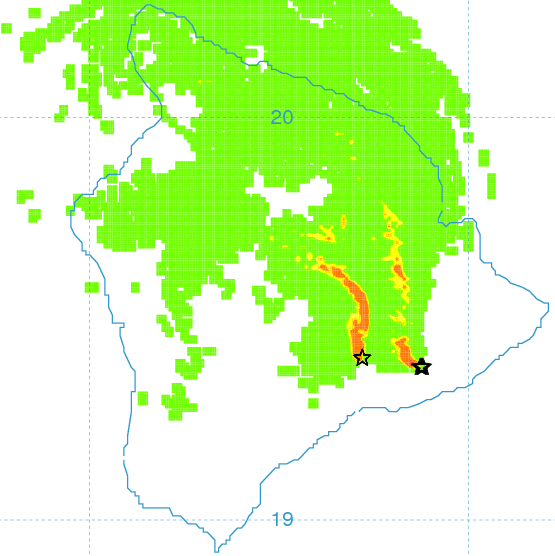
**Click directly on the images below to make them larger. Charts include: Big Island high/low forecasted temperatures, projected winds, chance of cloud cover, projected localized weather conditions, vog/SO2 forecast and expected wave heights.**
+
SWIPE LEFT OR RIGHT
ARTICLE CONTINUES BELOW AD
ARTICLE CONTINUES BELOW AD
Looking Ahead
A moist and somewhat unstable southerly wind flow is expected to produce very humid conditions with spotty heavy showers and a slight chance of a thunderstorms during the next couple of days. Weak trade winds and increasingly stable conditions will gradually fill in on Friday and Saturday but hot and humid weather is expected to continue. Weak trade winds may hold into early next week.
Today
ARTICLE CONTINUES BELOW AD
Today we expect partly to mostly cloudy skies and hazy conditions (see UHSOEST vog model). There is a chance of showers, mainly in the afternoon. Locally heavy rainfall is possible with a slight chance of thunderstorms. High temperatures from 86° to 91°. Variable winds up to 15 mph.
UV index at 12 (“extreme” exposure level)
Tonight
ARTICLE CONTINUES BELOW AD
Variable winds are expected this evening up to 15 mph. Low temperatures from 73° to 78°. Partly to mostly cloudy skies are expected with showers likely and locally heavy rainfall possible.
This comments section is a public community forum for the purpose of free expression. Although Big Island Now encourages respectful communication only, some content may be considered offensive. Please view at your own discretion. View Comments