A High Surf Warning is posted for east facing shores of the Big Island through 6 p.m. Thursday with wave heights rising to 12 to 18 foot faces in some spots Tuesday. Expect ocean water occasionally sweeping across portions of beaches, very strong breaking waves and strong longshore and rip currents. Breaking waves may occasionally impact harbors making navigating the harbor channel difficult. Large breaking surf, significant shore break and dangerous currents will make entering the water very hazardous. Boaters should be aware of an increased number of surfers in the water.
A Small Craft Advisory is posted for Big Island windward and southeastern waters as well as Alenuihaha channel through 6 p.m. Thursday for rough seas up to 12 feet. Inexperienced mariners should avoid navigating in these conditions.
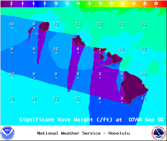
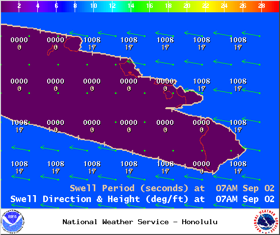
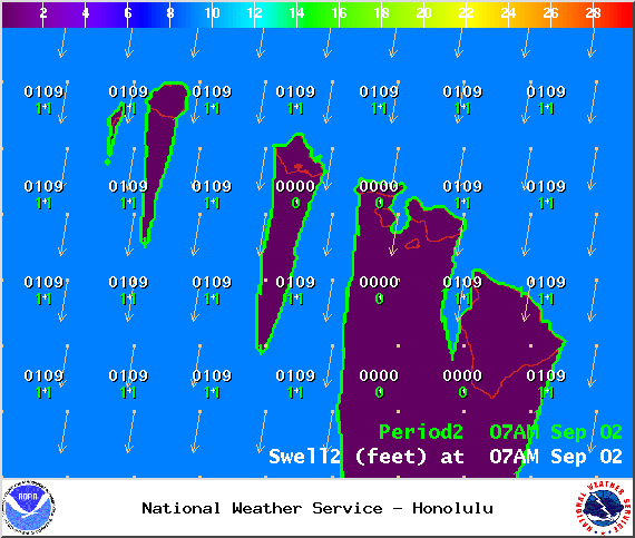
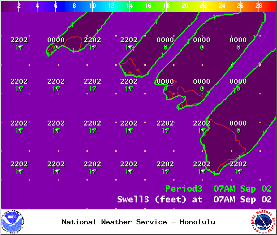
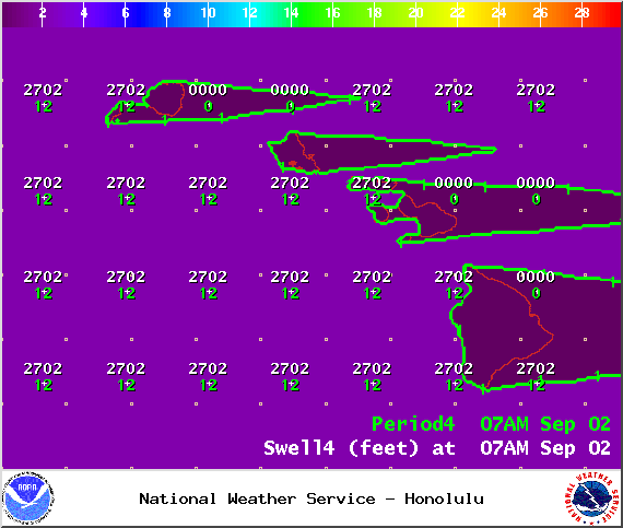
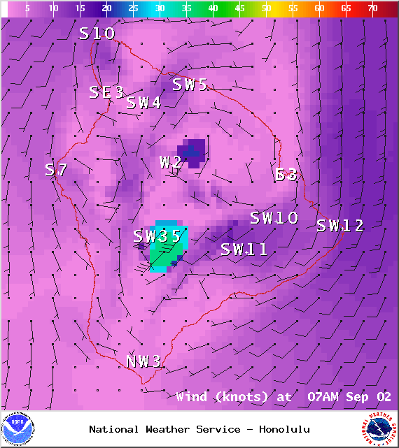
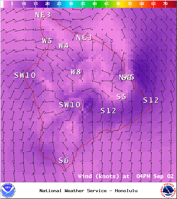
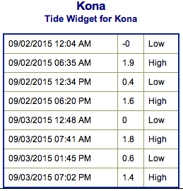
**Click directly on the images below to make them larger. Charts include: Big Island projected winds, tides, swell direction & period and expected wave heights.**
+
SWIPE LEFT OR RIGHT
ARTICLE CONTINUES BELOW AD
ARTICLE CONTINUES BELOW AD
Big Island Surf Forecast
Hilo side: Wave heights are expected overhead to well overhead today. The best breaks could get up to double overhead on the sets.
Kona side: Wave heights waist/chest/shoulder high are expected for the best breaks open to the south-southwest swell.
ARTICLE CONTINUES BELOW AD
South: Spots open to Ignacio swell will be in the overhead to well overhead range at the best breaks. With double overhead waves expected on the sets.
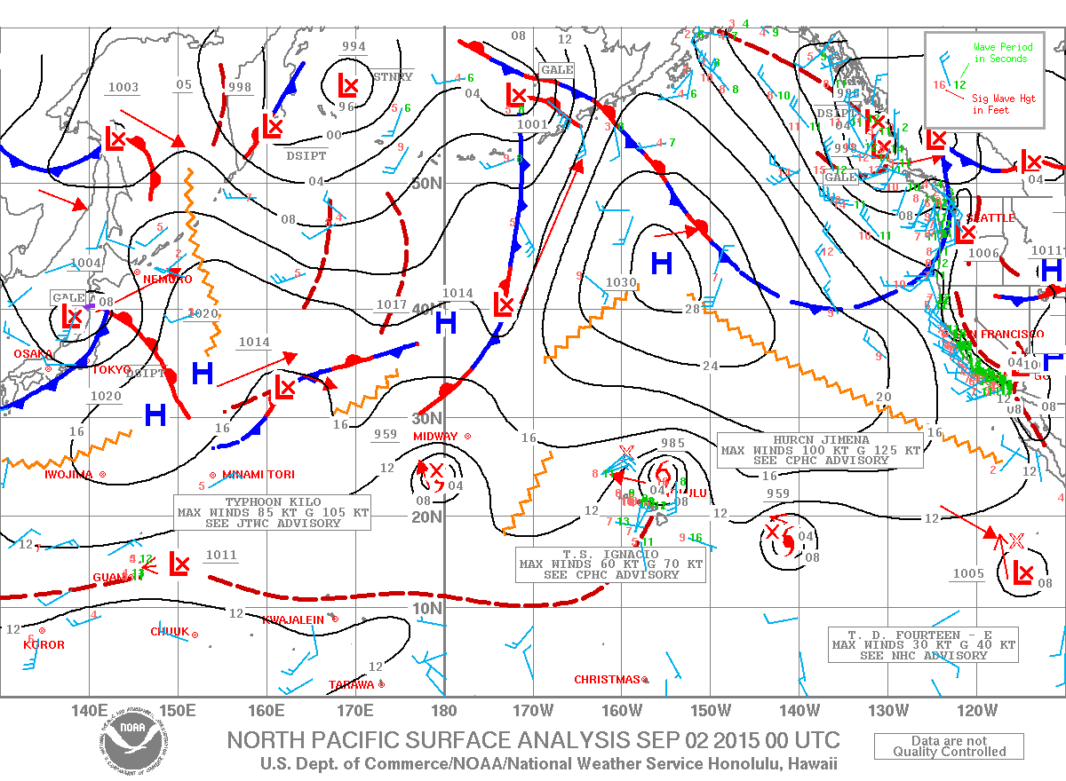
We expect a secondary swell from Ignacio with northeast, shifting north-northwest swell to get pumped out of this system from Wednesday through the work week.
Hurricane Kilo crossed into the west pacific and is therefore now a typhoon. Kilo is expected to generate fun westerly swell to the islands starting Wednesday and peaking Thursday into Friday, then holding through the weekend.
Hurricane Jimena should deliver a solid shot of east-southeast shifting east swell to the islands from Wednesday through the weekend.
ARTICLE CONTINUES BELOW AD
Long-period south-southwest swell is expected to build through Wednesday and Thursday, peak Friday and hold through the weekend.
Keep in mind, surf heights are measured on the face of the wave from trough to crest. Heights vary from beach to beach, and at the same beach, from break to break.
This comments section is a public community forum for the purpose of free expression. Although Big Island Now encourages respectful communication only, some content may be considered offensive. Please view at your own discretion. View Comments


 Big Island Surf Forecast
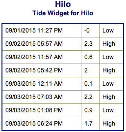 We expect a secondary swell from Ignacio with northeast, shifting north-northwest swell to get pumped out of this system from Wednesday through the work week.