

Flood Watch Posted, One More Day of Unstable Weather
Alerts
A Flood Watch remains in effect until 6 p.m. Wednesday for all islands. An unstable and very moist air mass on the back side of the tropical system is lingering across the state. This moisture interacting with the land is expected to produce periods of heavy rain and slow-moving downpours that could lead to flash flooding. If that occurs a more urgent Flood Advisory (flooding is imminent) or Flood Warning (flooding is occurring) will be posted by the National Weather Service.
**Click directly on the images below to make them larger. Charts include: Big Island high/low forecasted temperatures, projected winds, chance of cloud cover, projected localized weather conditions, vog/SO2 forecast and expected wave heights.**
Looking Ahead
A moist and unstable air mass will keep showers heavier than usual over the islands for the next day or so. Light to moderate trade winds with a slightly drier and more stable air mass will likely return to the islands late in the week and continue over the weekend. Next week’s forecast is based on what tropical cyclone Ignacio, which at this time, is too early to tell, but it looks okay up to Sunday. Should the track of Ignacio pan out, the Big Island would be the first to be affected starting Sunday night.
Today
It’s going to be another muggy day. Today we expect mostly sunny skies in the morning becoming mostly cloudy in the afternoon. Isolated morning showers are expected for windward areas then showers are likely with a slight chance of thunderstorms in the afternoon. For leeward spots the forecast is similar however there is a chance of locally heavy rainfall. High temperatures from 84° to 89° are expected but will likely feel warmer than the thermometer indicates. Variable winds up to 15 mph are forecasted.
UV index at 13 (“extreme” exposure level)
Tonight
Light and variable winds are expected this evening. Low temperatures from 74° to 79° but feeling much warmer. Partly cloudy skies are expected with scattered showers and locally heavy rainfall possible. Clearing is expected as the night goes on.
Our Big Island Now Weather homepage always includes daily: Sunrise | Sunset | Moonrise | Moonset | Moon Phase | Live Weather Cams | 5-day Forecast | Current Temperature & Conditions
**Click here for your detailed Big Island surf report.**
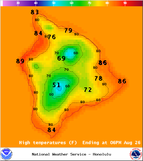
Image: NOAA / NWS
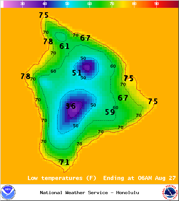
Image: NOAA / NWS
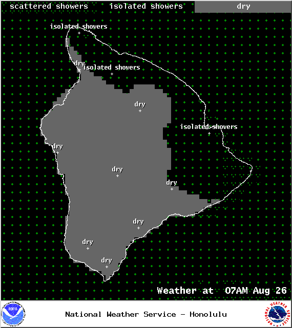
Image: NOAA / NWS

Image: NOAA / NWS
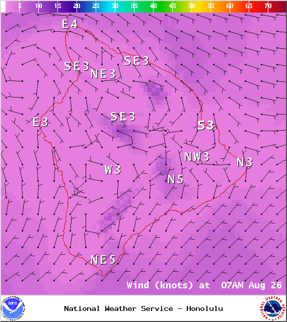
Image: NOAA / NWS
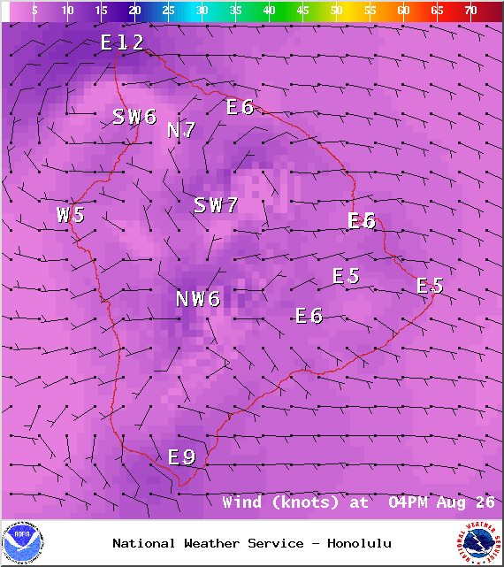
Image: NOAA / NWS
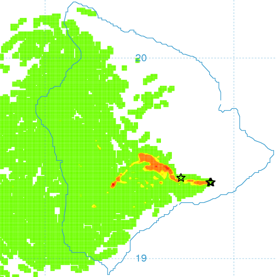
Image: UHSOEST
Image: NOAA / NWS
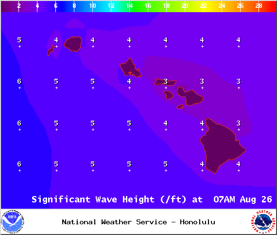
Image: NOAA / NWS
Sponsored Content


