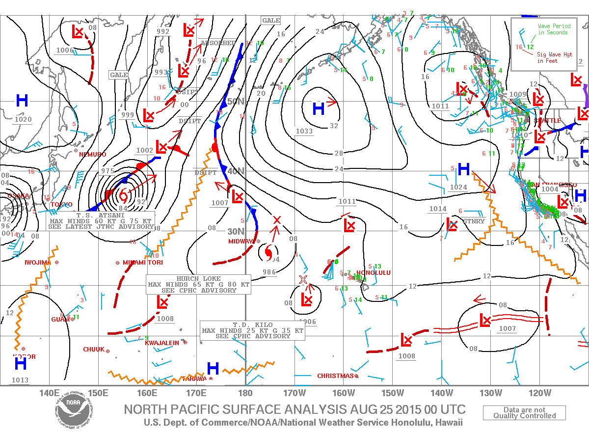
A Flood Watch remains in effect until 6 p.m. Tuesday for all islands. An unstable and very moist air mass on the back side of the tropical system is lingering across the state. This moisture interacting with the land is expected to produce periods of heavy rain and slow-moving downpours that could lead to flash flooding. If that occurs a more urgent Flood Advisory (flooding is imminent) or Flood Warning (flooding is occurring) will be posted by the National Weather Service.
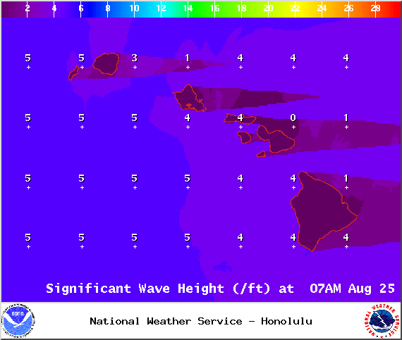
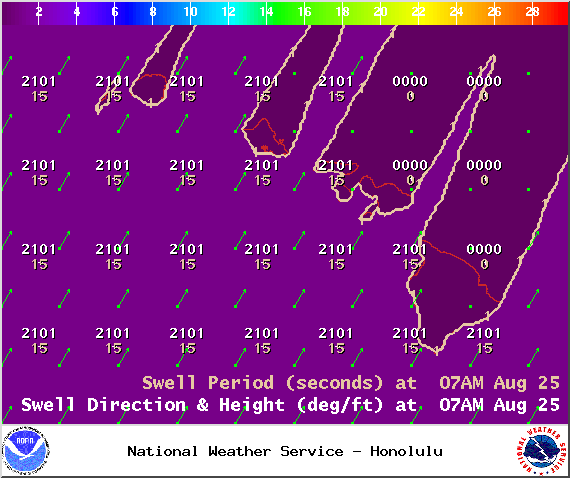
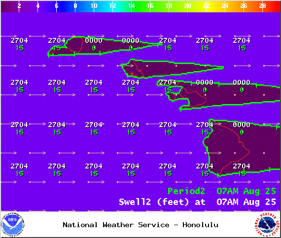
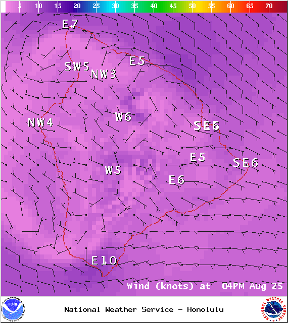
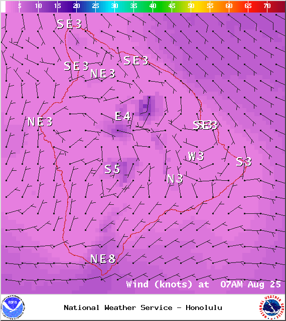
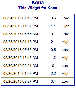
**Click directly on the images below to make them larger. Charts include: Big Island projected winds, tides, swell direction & period and expected wave heights.**
+
SWIPE LEFT OR RIGHT
ARTICLE CONTINUES BELOW AD
ARTICLE CONTINUES BELOW AD
Big Island Surf Forecast
Hilo side: Wave heights are expected to be waist/chest high today. The best breaks open to the swell could get shoulder high on the sets.
ARTICLE CONTINUES BELOW AD
Kona side: Wave heights waist/chest high are expected for the best breaks open to the west swell. Could get up to shoulder high on the sets. Knee/thigh high waves for spots that are catching the southerly swell.
South: Wave heights are expected to be knee/waist high today for the best exposures open to the south swell. Spots open to trade swell could get up to waist/shoulder high. Spots open to the west will show in the waist/tummy high range.
Our current blend of southerly swells will hold through Wednesday. Thursday into the weekend we expect some fun surf to build into the waist/chest high range.
ARTICLE CONTINUES BELOW AD
Kilo and Loke generated swell is expected to be fun size out of the west at about waist high. Atsani is sending some west energy as well which is expected to hold into Tuesday. Models are showing Atsani turning extratropical next week. We are expecting a west-northwest swell from Atsani to build Thursday and possibly peak Friday.
Keep in mind, surf heights are measured on the face of the wave from trough to crest. Heights vary from beach to beach, and at the same beach, from break to break.
This comments section is a public community forum for the purpose of free expression. Although Big Island Now encourages respectful communication only, some content may be considered offensive. Please view at your own discretion. View Comments


 Big Island Surf Forecast
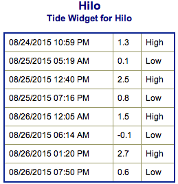 Our current blend of southerly swells will hold through Wednesday. Thursday into the weekend we expect some fun surf to build into the waist/chest high range.