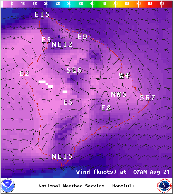
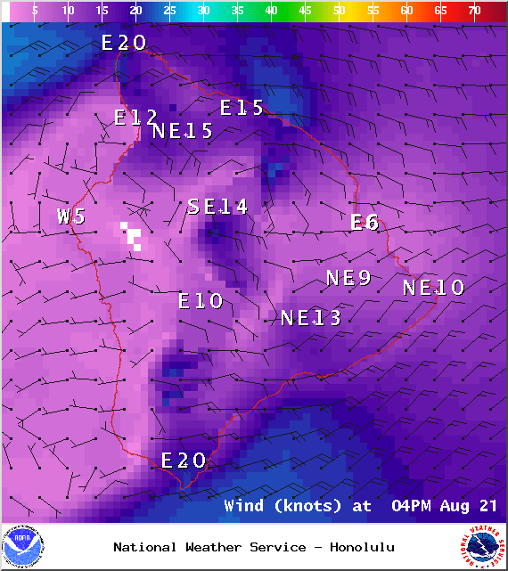
A Small Craft Advisory is in effect for the ʻAlenuihāhā channel, as well as waters to the west and south of the Big Island, through 6:00 a.m. Sunday. East winds are expected up to 25 knots with rough seas from about 8 to 12 feet. Inexperienced mariners should avoid navigating in these conditions.
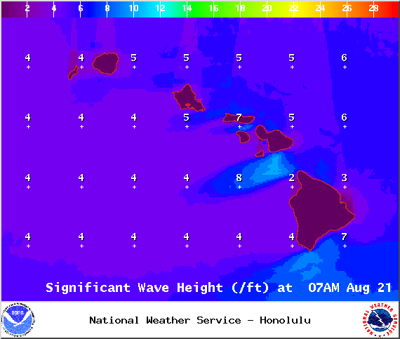
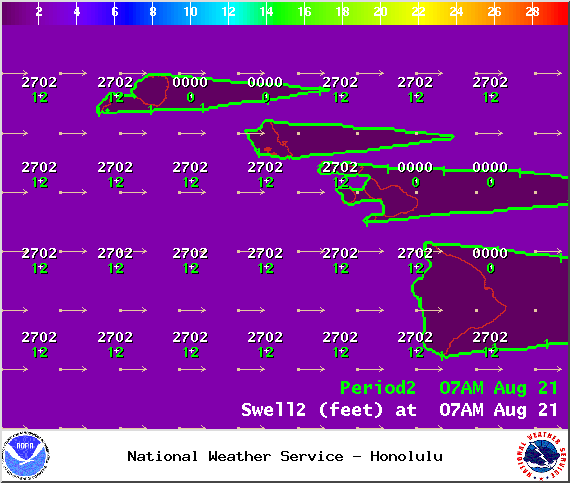
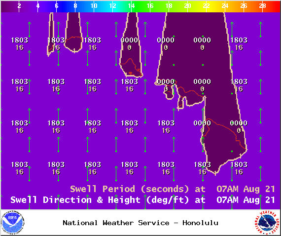
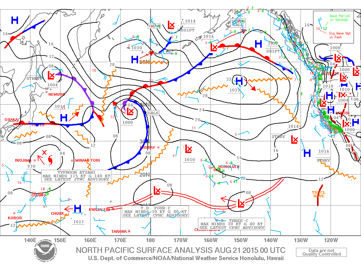
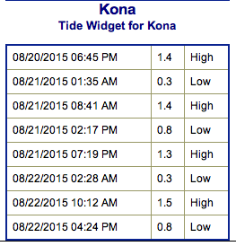
**Click directly on the images below to make them larger. Charts include: Big Island projected winds, tides, swell direction & period and expected wave heights.**
+
SWIPE LEFT OR RIGHT
ARTICLE CONTINUES BELOW AD
ARTICLE CONTINUES BELOW AD
Big Island Surf Forecast
Hilo side: Wave heights are expected to be knee/waist high today to start, picking up to about waist/chest high as the day goes on.
Kona side: Wave heights knee/waist/chest high are expected for the best breaks open to the swell. Ankle/waist high waves for spots that aren’t quite catching it.
South: Wave heights are expected to be waist/chest high today for the best exposures open to the south swell. Spots open to trade swell could get up to waist high or more and building through the day.
ARTICLE CONTINUES BELOW AD
Trade swell is expected to hold today.
Our current south swell is expected to hold through Saturday morning before beginning to fade.
A small west swell generated by Super-Typhoon Atsani is expected to move in on the weekend. This system could go extratropical next week and curve northwest. If so, we could get more swell out of this system.
Tropical Depression Three-C, currently to the southeast of the Hawaiian islands, is expected to strengthen over the next couple of days. If so, we could see some short-period wind swell as early as this weekend and into early next week. Keeping a close eye on this system and will bring you the latest.
ARTICLE CONTINUES BELOW AD
Keep in mind, surf heights are measured on the face of the wave from trough to crest. Heights vary from beach to beach, and at the same beach, from break to break.
This comments section is a public community forum for the purpose of free expression. Although Big Island Now encourages respectful communication only, some content may be considered offensive. Please view at your own discretion. View Comments


 Big Island Surf Forecast
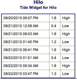 Trade swell is expected to hold today.