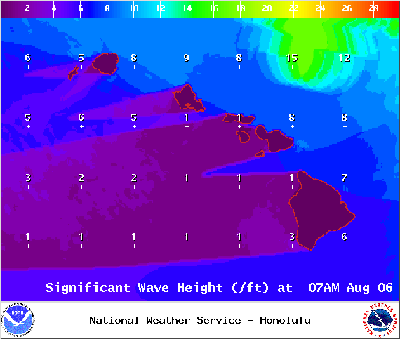
A High Surf Warning has been issued through 6:00 p.m. Thursday for east-facing shores. Wave heights of 10 to 15 foot faces are expected today and tonight. Expect ocean water occasionally sweeping across portions of beaches. Very strong breaking waves and strong longshore rip currents. Breaking waves may occasionally impact harbors making navigating the harbor channel dangerous.
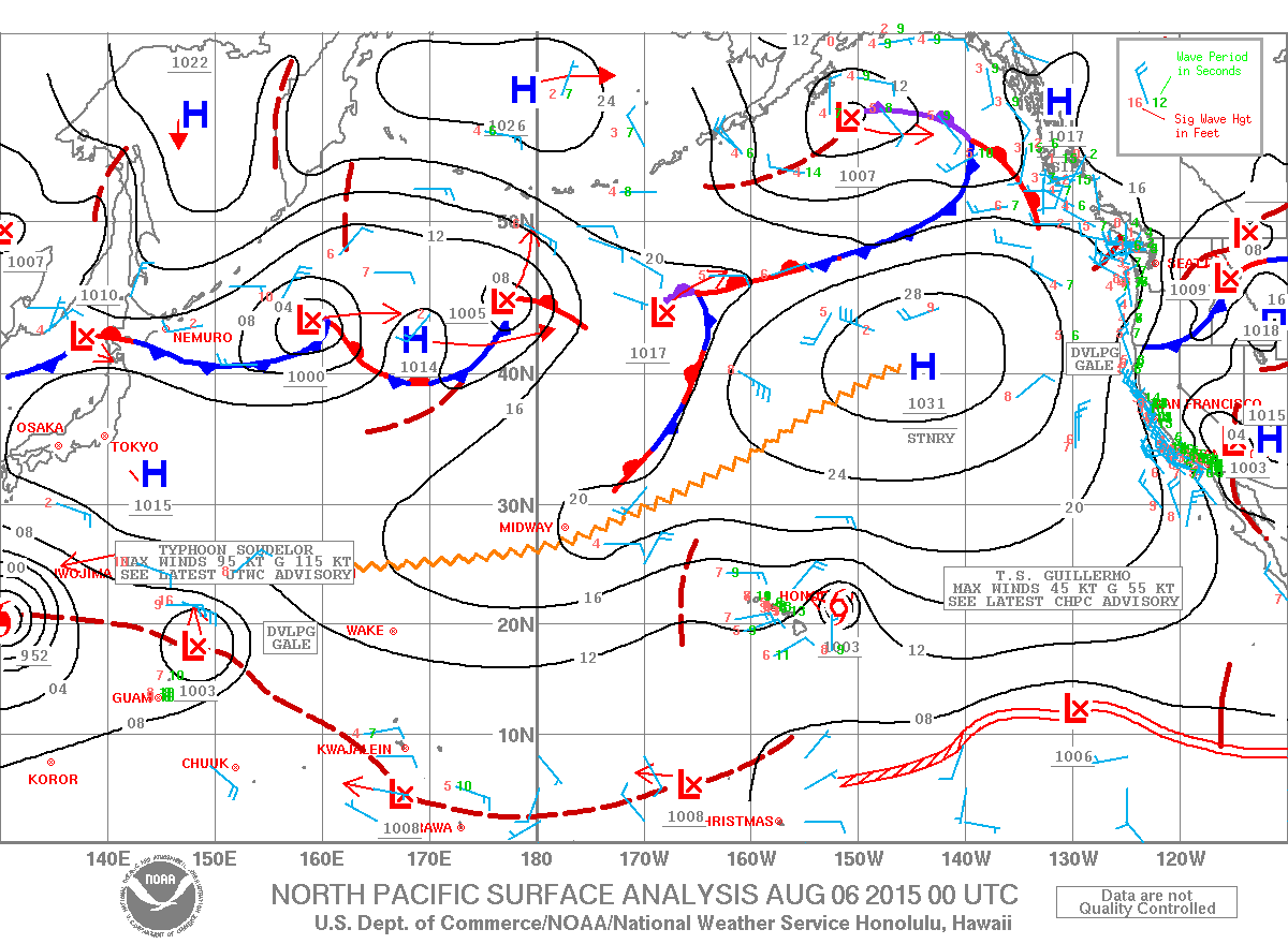
A Tropical Storm Warning is in effect for offshore waters beyond 40 nm and out to 240 nm.
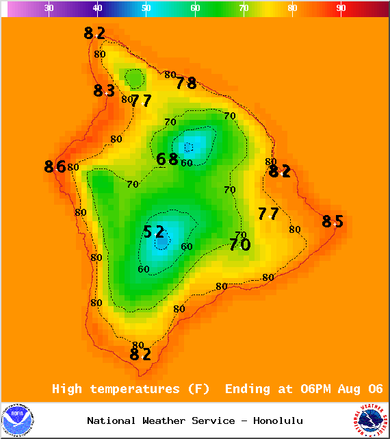
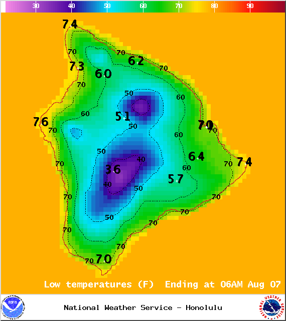
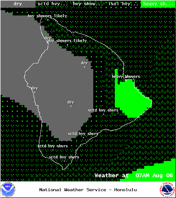
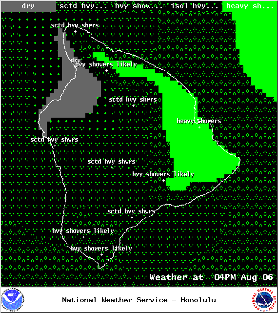
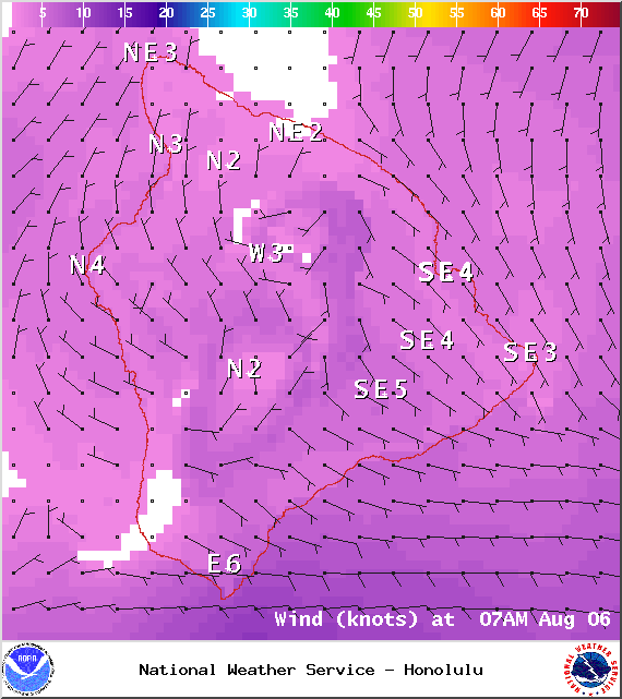
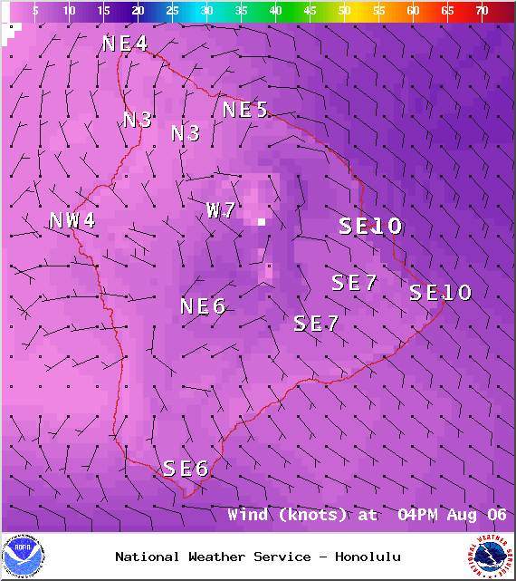
**Click directly on the images below to make them larger. Charts include: Big Island high/low forecasted temperatures, projected winds, chance of cloud cover, projected localized weather conditions, vog/SO2 forecast and expected wave heights.**
+
SWIPE LEFT OR RIGHT
ARTICLE CONTINUES BELOW AD
ARTICLE CONTINUES BELOW AD
Today
We expect high temperatures from 82° to 87°. Variable winds are expected up to 15 mph. Mostly cloudy skies are forecasted with numerous showers. Leeward spots are expected to be partly sunny to start with building cloud cover and afternoon showers. Locally heavy rainfall is possible.
UV index at 12 (“extreme” exposure level)
ARTICLE CONTINUES BELOW AD
Tonight
Mostly cloudy skies are expected with numerous showers for windward spots. Leeward spots should be cloudy then partial clearing is expected overnight. Variable winds are forecasted up to 15 mph. Low temperatures from 71° to 76° are expected.
ARTICLE CONTINUES BELOW AD
Looking Ahead / Guillermo
The cloud area around tropical storm Guillermo will move across the islands through Friday bringing the islands much rainier conditions than normal through Friday. This moisture will fuel locally heavy showers but no widespread heavy rain is expected. The strongest winds and heaviest rain will likely remain north of the islands. Guillermo is forecast to weaken as it passes north of the islands tonight through Friday. Weather around the islands through Friday will depend on the track of the storm. A high remains far northeast of the islands. Once Guillermo moves west of the area, trade winds will return. The trades will push the remnant moisture from Guillermo off to the west of the islands by Saturday afternoon. Trade winds will return to the islands Friday night. Typical summertime weather is expected over the weekend into early next week.
This comments section is a public community forum for the purpose of free expression. Although Big Island Now encourages respectful communication only, some content may be considered offensive. Please view at your own discretion. View Comments