

Guillermo Swell Anticipated
Alerts
A Small Craft Advisory is in effect for the ʻAlenuihāhā channel as well as waters to the west and south of the Big Island through 6:00 a.m. Sunday. East winds up to 25 knots are expected with rough seas up to 11 feet.
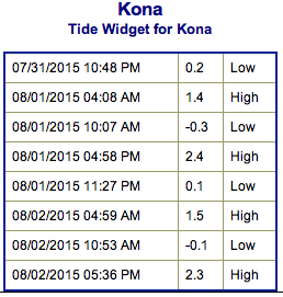
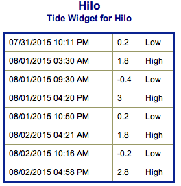
**Click directly on the images below to make them larger. Charts include: Big Island projected winds, tides, swell direction & period and expected wave heights.**
 Big Island Surf Forecast
Hilo side: Waist/head high waves expected today for well exposed trade swell breaks. Best breaks could see sets up to overhead waves from time to time. Messy conditions expected.
Kona side: Wave heights knee/waist high are expected. Spots not exposed to the south will be smaller.
South: Wave heights knee/waist high are expected.
 Small pulses out of the south are expected but nothing super notable. A better angled swell expected the second half of next week with waves possibly up to waist high or more. Otherwise, the SPAC is looking pretty quiet.
Trade swell will push into northeasterly exposures over the next few days. Hurricane Guillermo is located far east southeast of the state moving toward the west northwest. Although the track and intensity of the storm remains uncertain so far in the future, adverse effects for Hawaiian coastal waters next week can not be ruled out. Building east-southeast swell is expected to move in as early as Monday, peaking Wednesday.
Keep in mind, surf heights are measured on the face of the wave from trough to crest. Heights vary from beach to beach, and at the same beach, from break to break.
**Click here for your detailed Big Island weather report.**
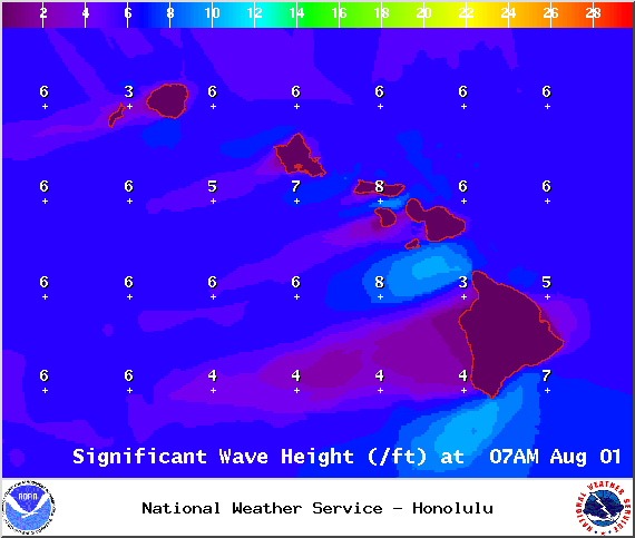
Image: NOAA /NWS

Image: NOAA /NWS
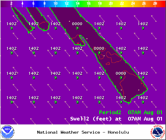
Image: NOAA /NWS
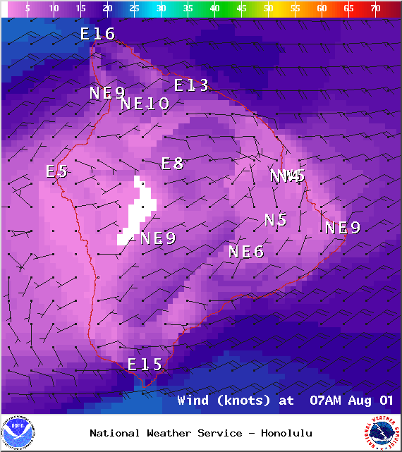
Image: NOAA /NWS
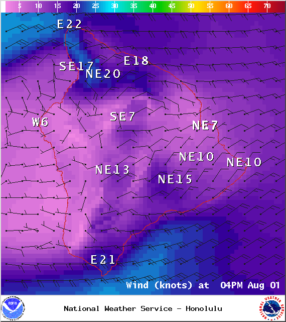
Image: NOAA /NWS
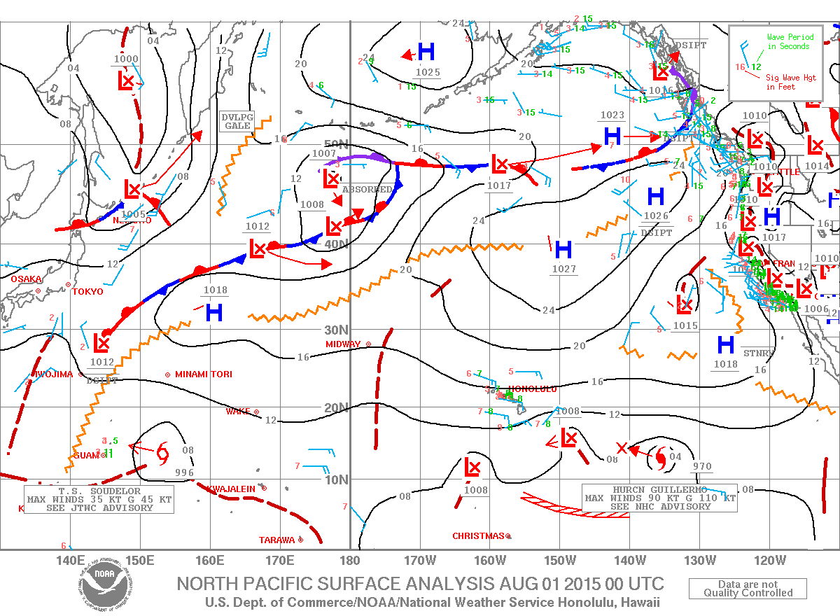
Image: NOAA /NWS
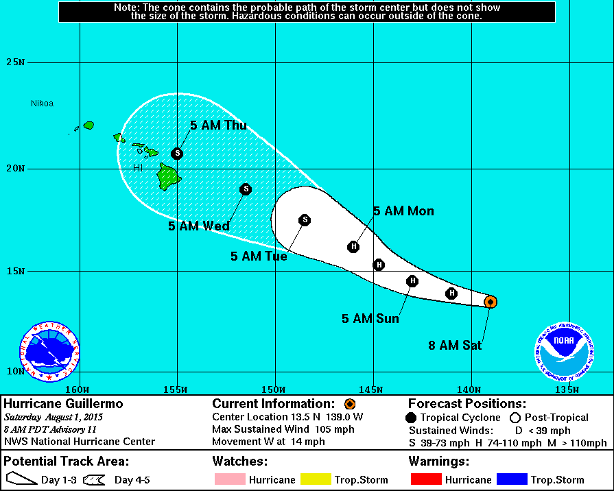
National Hurricane Center image as of 5 a.m. Saturday.


Sponsored Content

