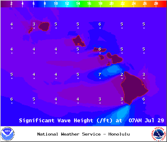
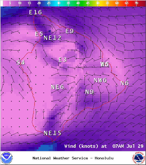
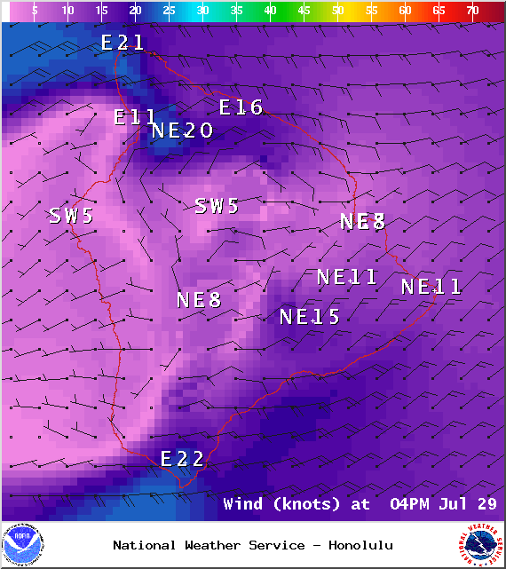
A Small Craft Advisory is in effect for the ʻAlenuihāhā channel as well as waters to the west and south of the Big Island through 6:00 p.m. Thursday. East winds up to 25 knots are expected with rough seas of about 10 feet.
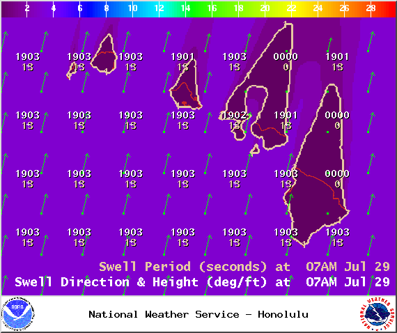
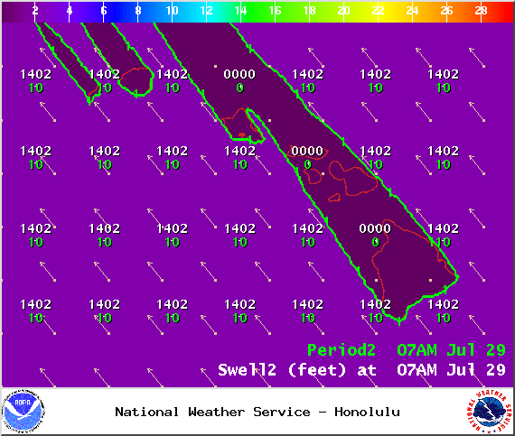
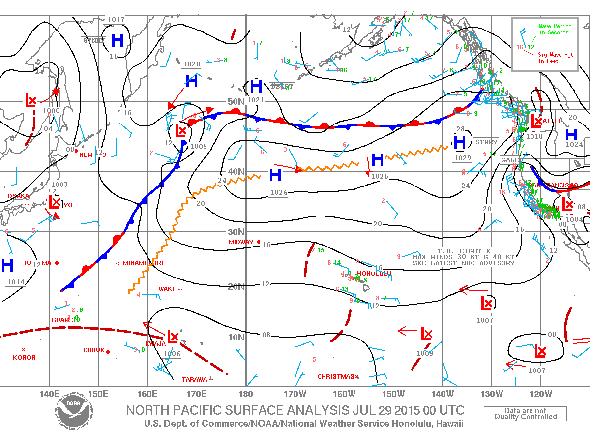
**Click directly on the images below to make them larger. Charts include: Big Island projected winds, tides, swell direction & period and expected wave heights.**
+
SWIPE LEFT OR RIGHT
ARTICLE CONTINUES BELOW AD
ARTICLE CONTINUES BELOW AD
Big Island Surf Forecast
Hilo side: Waist/chest high waves expected today for well exposed trade swell breaks. Best breaks could see sets up to shoulder/head high waves from time to time.
ARTICLE CONTINUES BELOW AD
Kona side: Wave heights waist/shoulder high are expected in the morning with an easing trend through the day.
South: Wave heights waist/shoulder high are expected in the morning with an easing trend through the day.
Our current south-southwest swell is expected to continue to slowly fade through the week, dropping out around Thursday. Small rideable pulses out of the south are expected but nothing super notable. August 3-5th we expect a new knee/thigh high swell with a better angled swell expected the 6-8th with waves possibly up to waist high or more.
ARTICLE CONTINUES BELOW AD
Small trade swell will push into northeasterly exposures. Otherwise, the north Pacific is looking very quiet.
Keep in mind, surf heights are measured on the face of the wave from trough to crest. Heights vary from beach to beach, and at the same beach, from break to break.
This comments section is a public community forum for the purpose of free expression. Although Big Island Now encourages respectful communication only, some content may be considered offensive. Please view at your own discretion. View Comments


 Big Island Surf Forecast
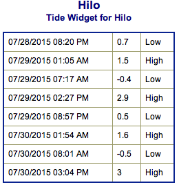 Our current south-southwest swell is expected to continue to slowly fade through the week, dropping out around Thursday. Small rideable pulses out of the south are expected but nothing super notable. August 3-5th we expect a new knee/thigh high swell with a better angled swell expected the 6-8th with waves possibly up to waist high or more.