Slight fluctuations continue to occur at the summit of Kilauea, according to Hawaiian Volcano Observatory’s Monday morning report. The activity follow typical, and expected, Kilauea behavior.
Tilt at Kilauea’s summit switched to deflation on Sunday morning. In addition, the lava lake was measured to be about 130 feet from the Overlook crater’s new rim. HVO noted that lava within the lava lake has consistently declined since the Sunday measurement. Rock-cracking sounds were also heard coming from the Overlook crater.
A swarm of small earthquakes were felt in the upper east rift zone of Kilauea on Sunday. At Puʻu ʻŌʻō, seismicity rates remain at background levels.
According to HVO, when measured on June 19, the sulfur dioxide emission rate from all East Rift Zone vents was about 725 tonnes a day.
ARTICLE CONTINUES BELOW AD
ARTICLE CONTINUES BELOW AD
The June 27 lava flow continues to be monitored through webcam images. Breakouts in the area remain within 5 miles to the northeast of Puʻu ʻŌʻō.
+
SWIPE LEFT OR RIGHT
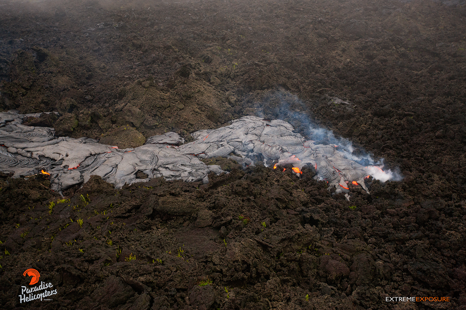
June 18: A lobe of pahoehoe snakes over an old ‘a‘a field. Photo: Extreme Exposure Media/Paradise Helicopters.
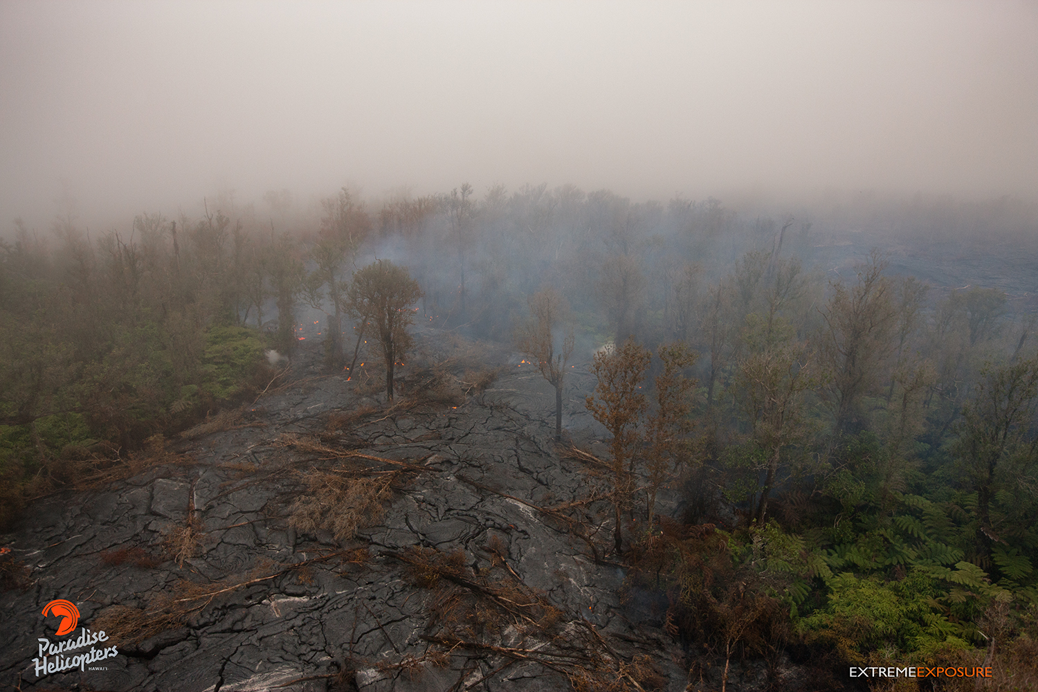
June 18: A lobe of lava entering the forest. Photo: Extreme Exposure Media/Paradise Helicopters.
June 18: A few active lobes were visible, including this one entering a forested area. Photo: Extreme Exposure Media/Paradise Helicopters.
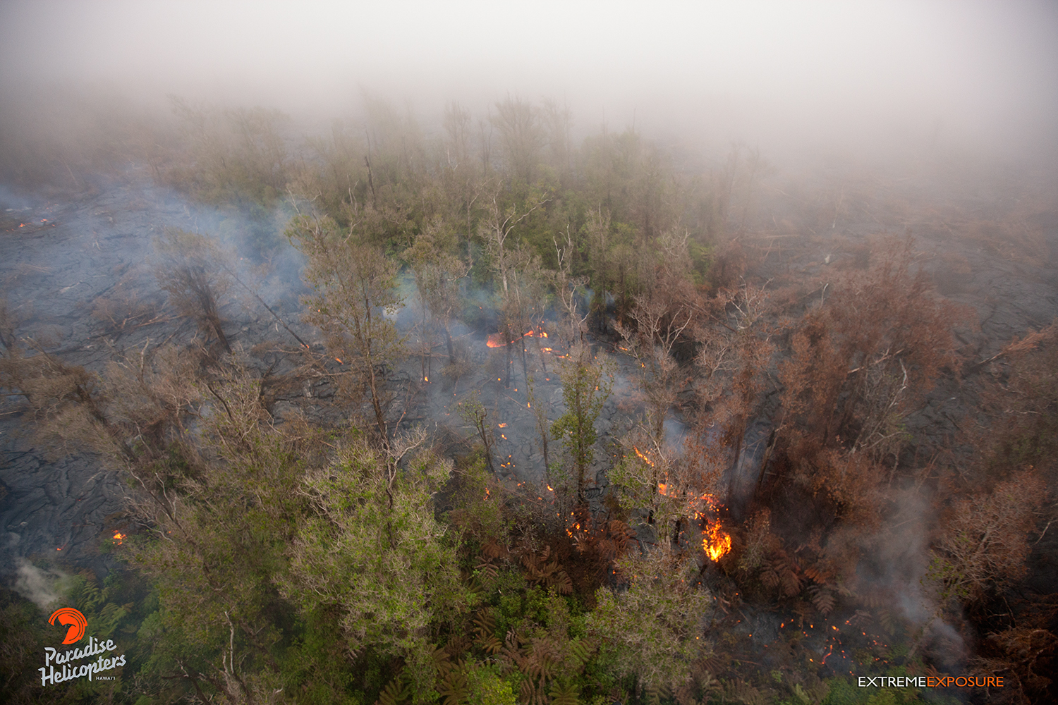
June 18: The perimeter of the flow continues to creep into adjacent areas. Here, a finger burns hap‘u and ohia. Photo: Extreme Exposure Media/Paradise Helicopters.
June 18: Another finger of pahoehoe covers some old ‘a‘a. Photo: Extreme Exposure Media/Paradise Helicopters.
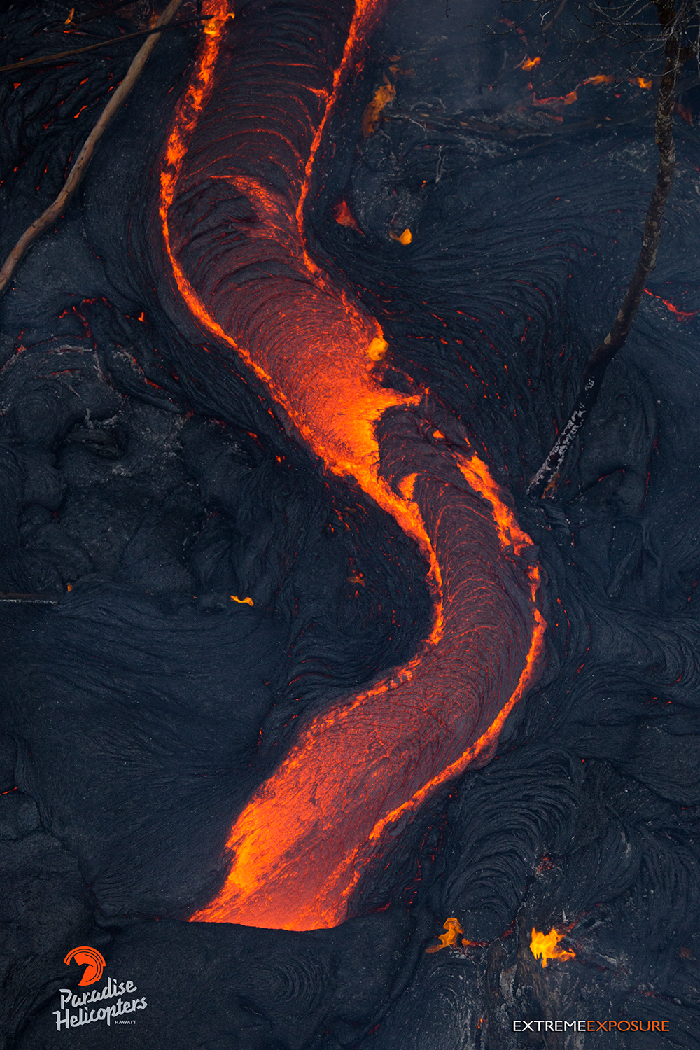
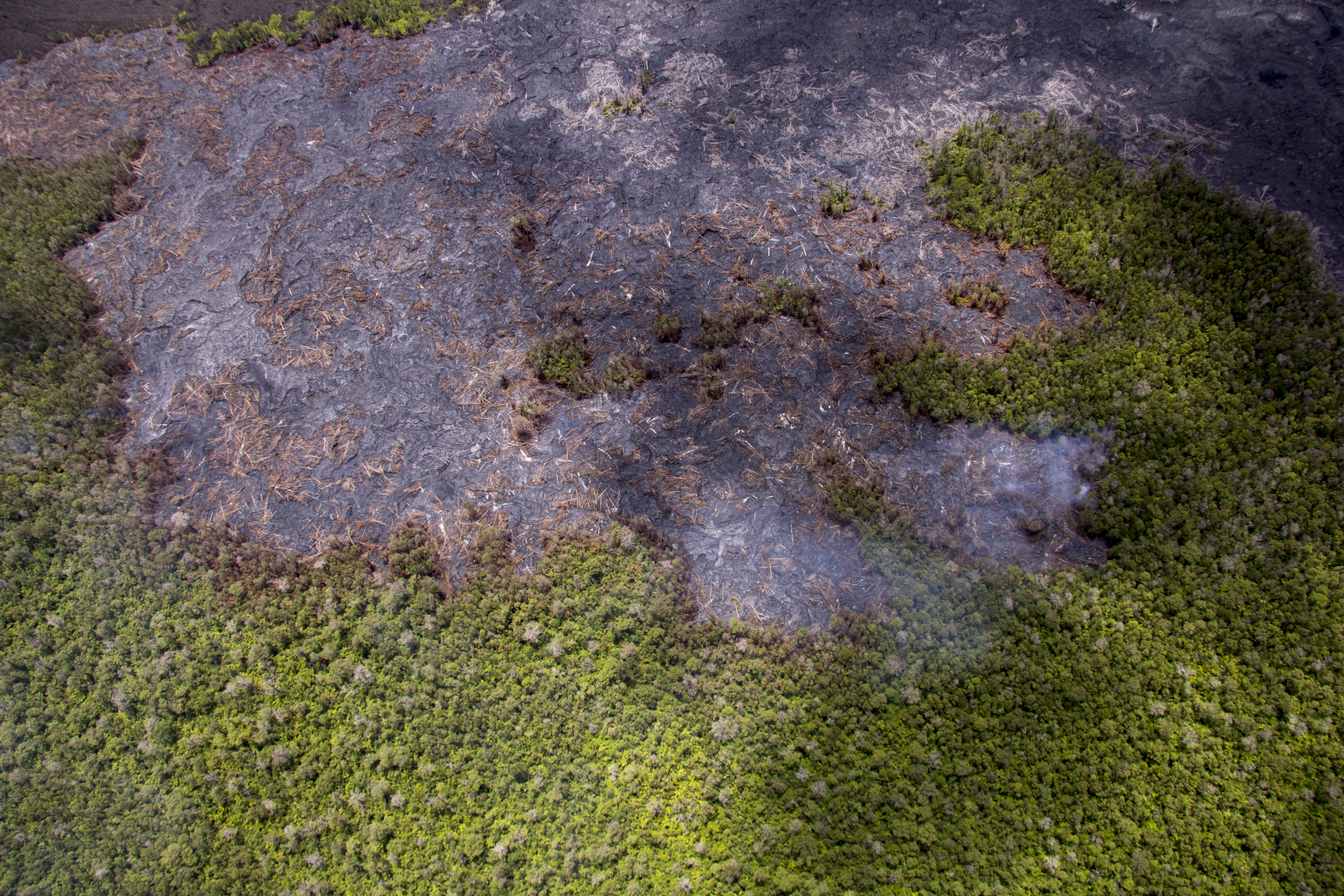
June 18: A river of lava snakes its way through an ohia forest. Photo: Extreme Exposure Media/Paradise Helicopters.
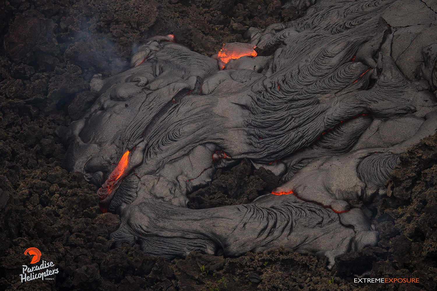
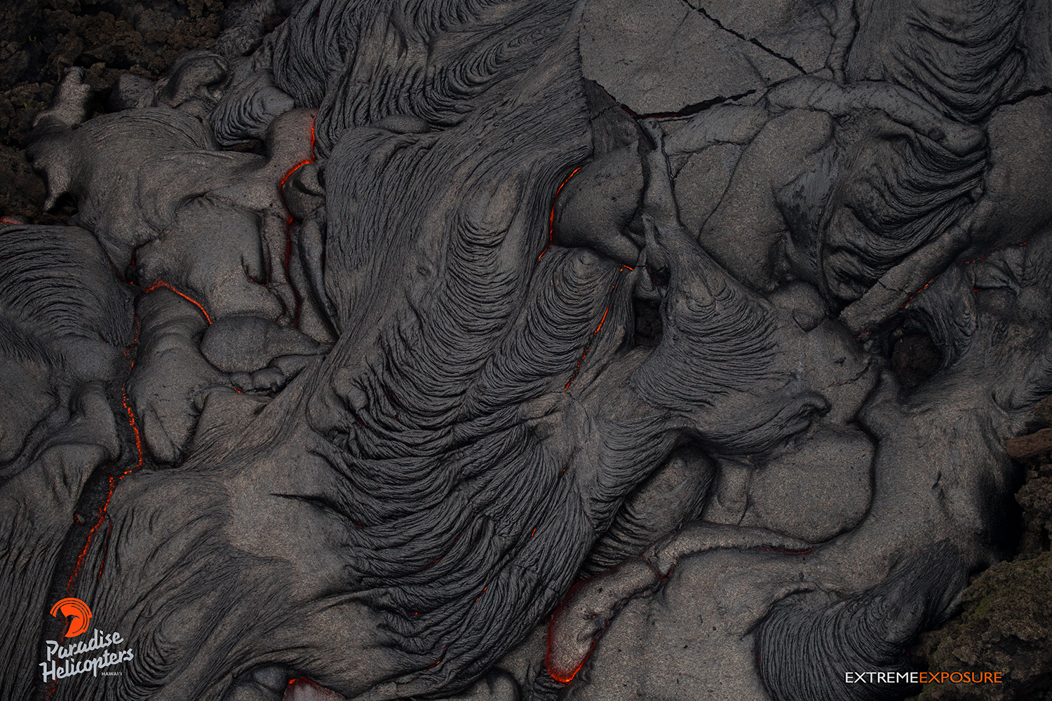
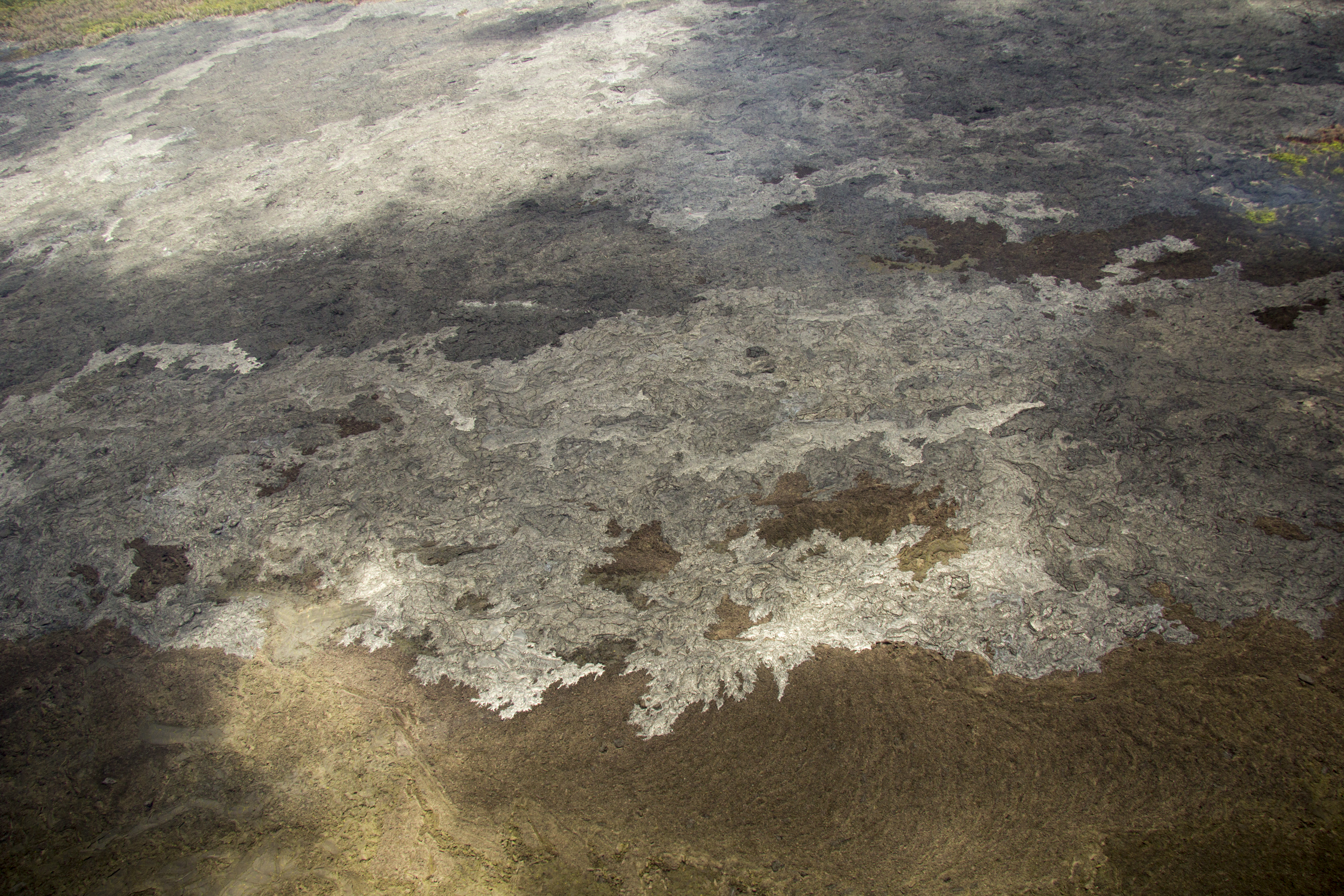
June 18: Glowing cracks indicate the presence of molten lava beneath this silvery black surface. Photo: Extreme Exposure Media/Paradise Helicopters.
June 18: A finger of pahoehoe covers some old ‘a‘a. Photo: Extreme Exposure Media/Paradise Helicopters.
June 18: A finger of pahoehoe creeps over a field of ‘a‘a. Photo: Extreme Exposure Media/Paradise Helicopters.
June 19: Scattered breakouts were active at the margins of the June 27th flow, with only minor expansion of the flow margins over the past two weeks. This photo shows an active breakout on the south margin of the June 27th flow, moving over older ʻaʻā from Puʻu ʻŌʻō. USGS/HVO photo.
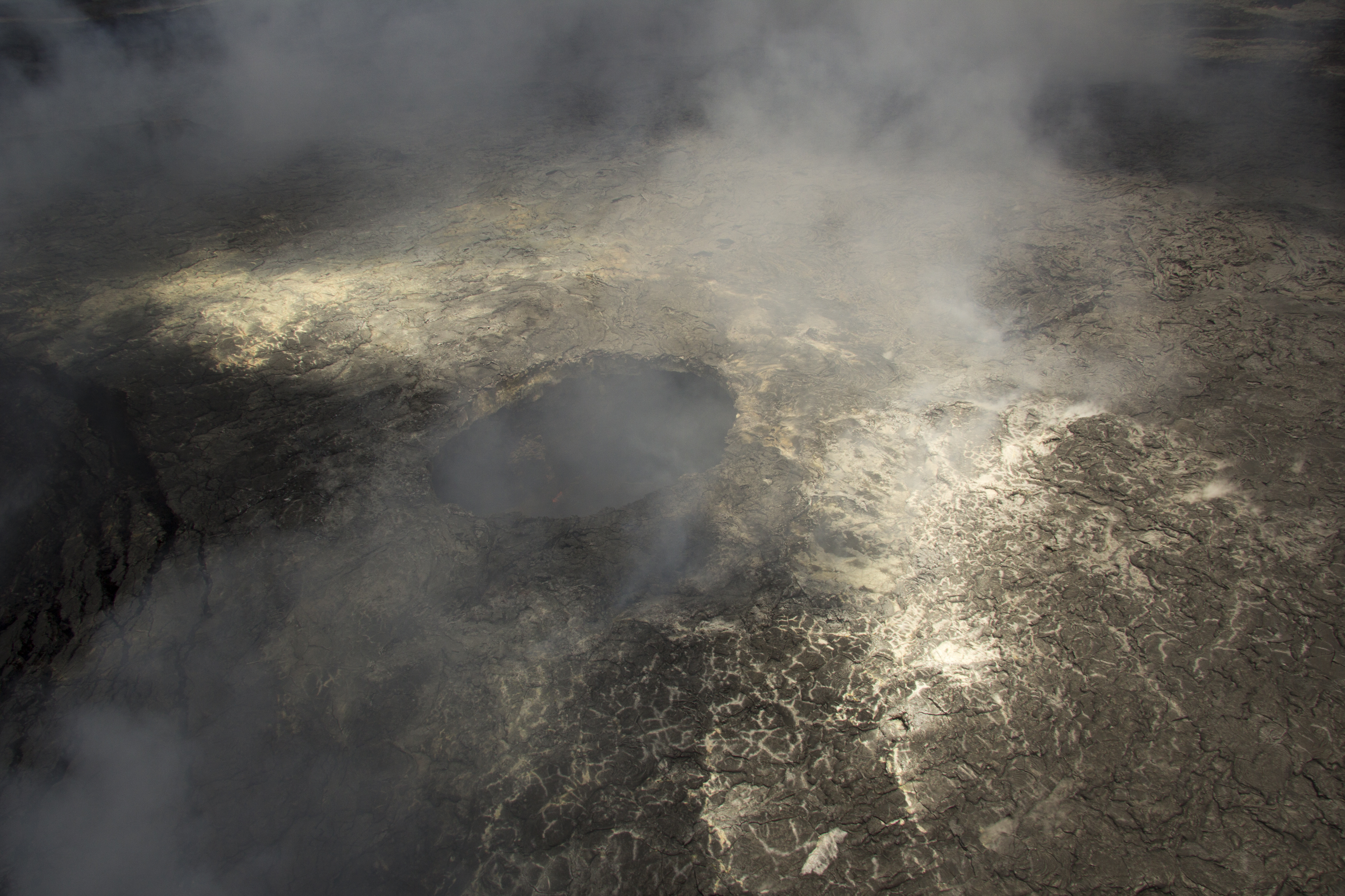
June 19: Little has changed in Puʻu ʻŌʻō over the past month, and a small lava pond still exists within the circular pit in the western portion of the crater. This pit can be seen through the fume in this photo, and a tiny area of incandescence at the edge of the active pond is barely visible. USGS/HVO photo.
June 19: This photograph shows the south margin of the June 27th flow, northeast of Puʻu ʻŌʻō, where many small scattered breakouts were active. The active, and recently active, breakouts are visible at the light gray areas. USGS/HVO photo.
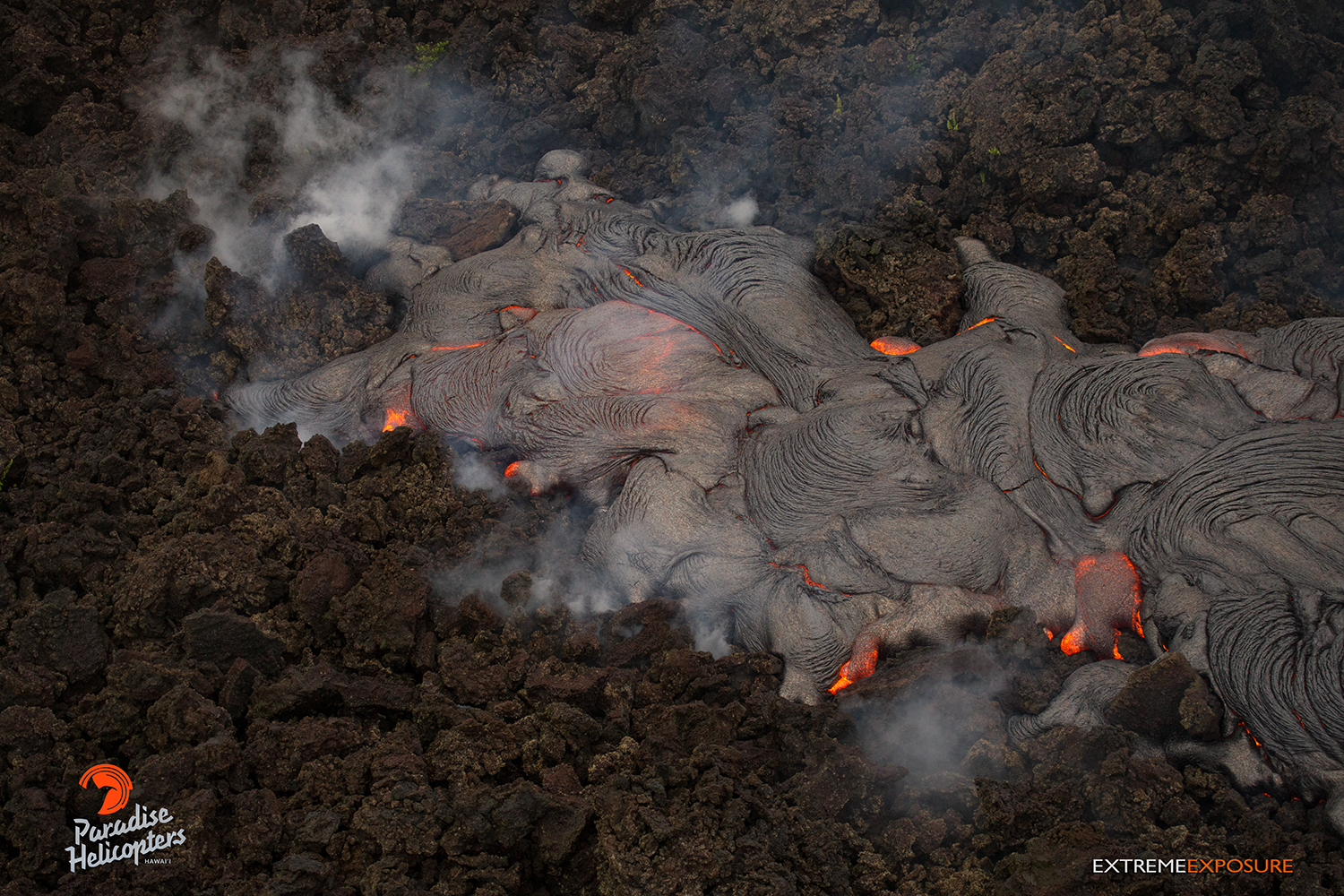
June 19: Scattered breakouts remain active northeast of Puʻu ʻŌʻō on the June 27th lava flow, but have not advanced significantly over the past month. This photo shows the farthest reach of active lava on the flow field, which was about 8 km (5 miles) northeast of the vent on Puʻu ʻŌʻō. Minor brush fires were active where lava was entering forest. USGS/HVO photo.
This comments section is a public community forum for the purpose of free expression. Although Big Island Now encourages respectful communication only, some content may be considered offensive. Please view at your own discretion. View Comments