Volcanic activity at the summit of Kilauea has slightly increased over the past day with two lava lake overflows occurring within the past 12 hours. Hawaiian Volcano Observatory reported Thursday morning that a slight inflationary tilt has been observed since Wednesday morning.
In addition to the increase in tilt, the Overlook crater lava lake has once again overflowed onto the floor of the Halema’uma’u Crater. The first spill-over occurred a little after 10 p.m. Wednesday night and again at about 4:30 a.m. Thursday morning. According to HVO, the early morning overflow was still occurring, as of 7:40 a.m.
Prior to the overflows in the past 12 hours, lava remained at or just below the rim of the Overlook crater for most of the past two days. Between Tuesday and Wednesday, no spill-over occurred.
HVO officials say the overflows have built up the rim of the Overlook crater by several yards above the Halema’uma’u Crater floor.
ARTICLE CONTINUES BELOW AD
ARTICLE CONTINUES BELOW AD
Below Kilauea’s summit and upper East and Southwest Rift Zones, seismicity remains elevated.
Deflationary tilt continues to be recorded by the tiltmeter on the north flank of Puʻu ʻŌʻō. HVO scientists have reported lava eruptions on the Puʻu ʻŌʻō crater floor in several small pulses over the past couple of days.
The June 27 lava flow is being observed through webcam imagery, according to HVO. Incandescence and daytime smoke indicate that surface flows remain active northeast of Puʻu ʻŌʻō. HVO’s most recent mapping of the area, conducted on May 5, show the most distant flow is about 5 miles northeast of the crater. According to officials, the majority of the surface flows were being fed from a breakout that began on Feb. 21, in proximity to the north rim of Puʻu ʻŌʻō. These flows are less than 2 miles away.
+
SWIPE LEFT OR RIGHT
A breakout from an opening along the eastern wall (bright spot), spilled lava onto the crater’s floor on the morning of May 6. Photo credit: Extreme Exposure Media/Paradise Helicopters.
This photo, take May 6, shows the steamy floor of Pu‘u ‘O‘o . Molten lava was visible in several collapse pits and skylights in the crater’s floor. Photo credit: Extreme Exposure Media/Paradise Helicopters.
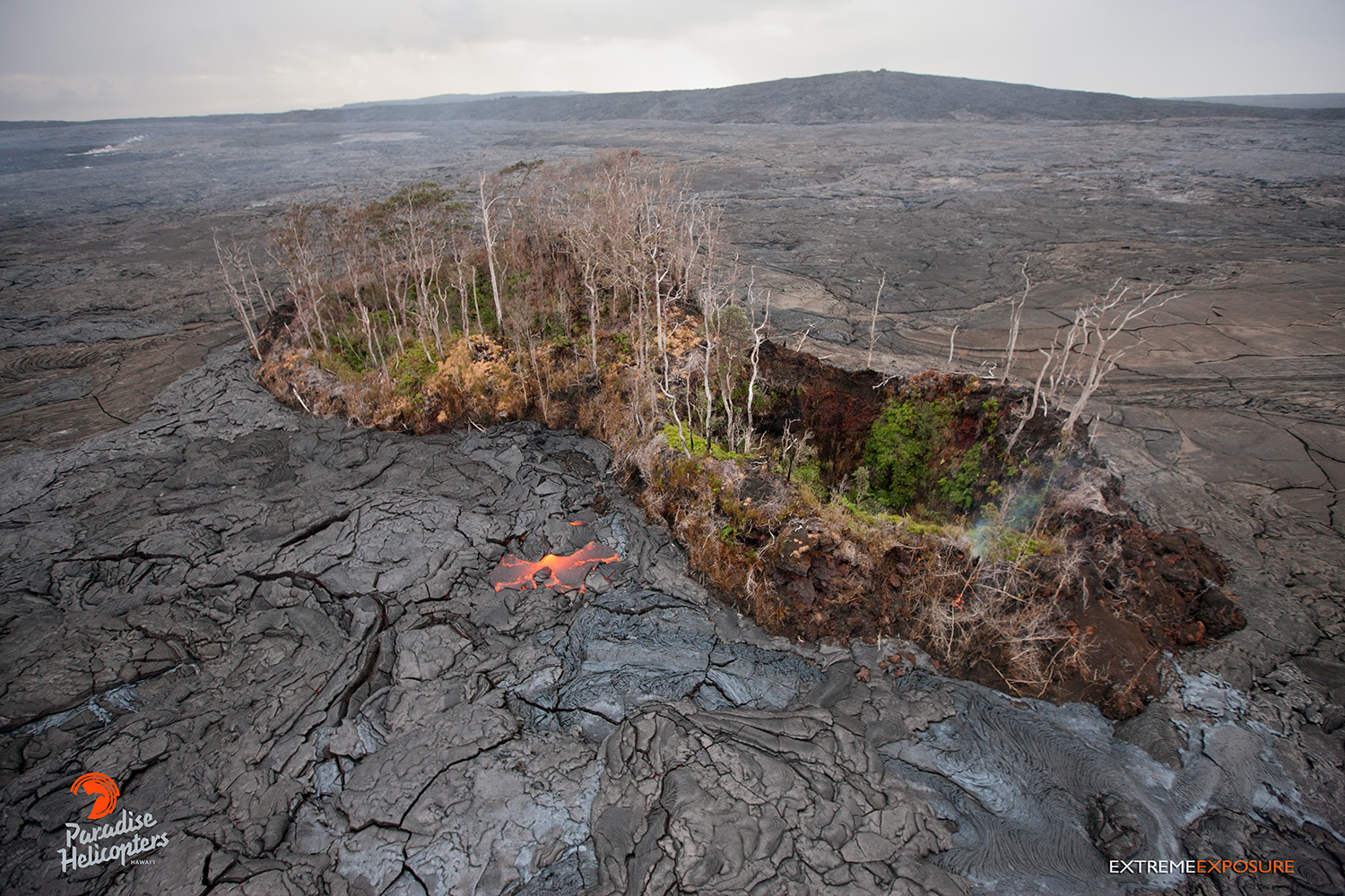
Pu‘u Kahauale‘a continues to be surrounded by lava flows. Photo credit: Extreme Exposure Media/Paradise Helicopters.
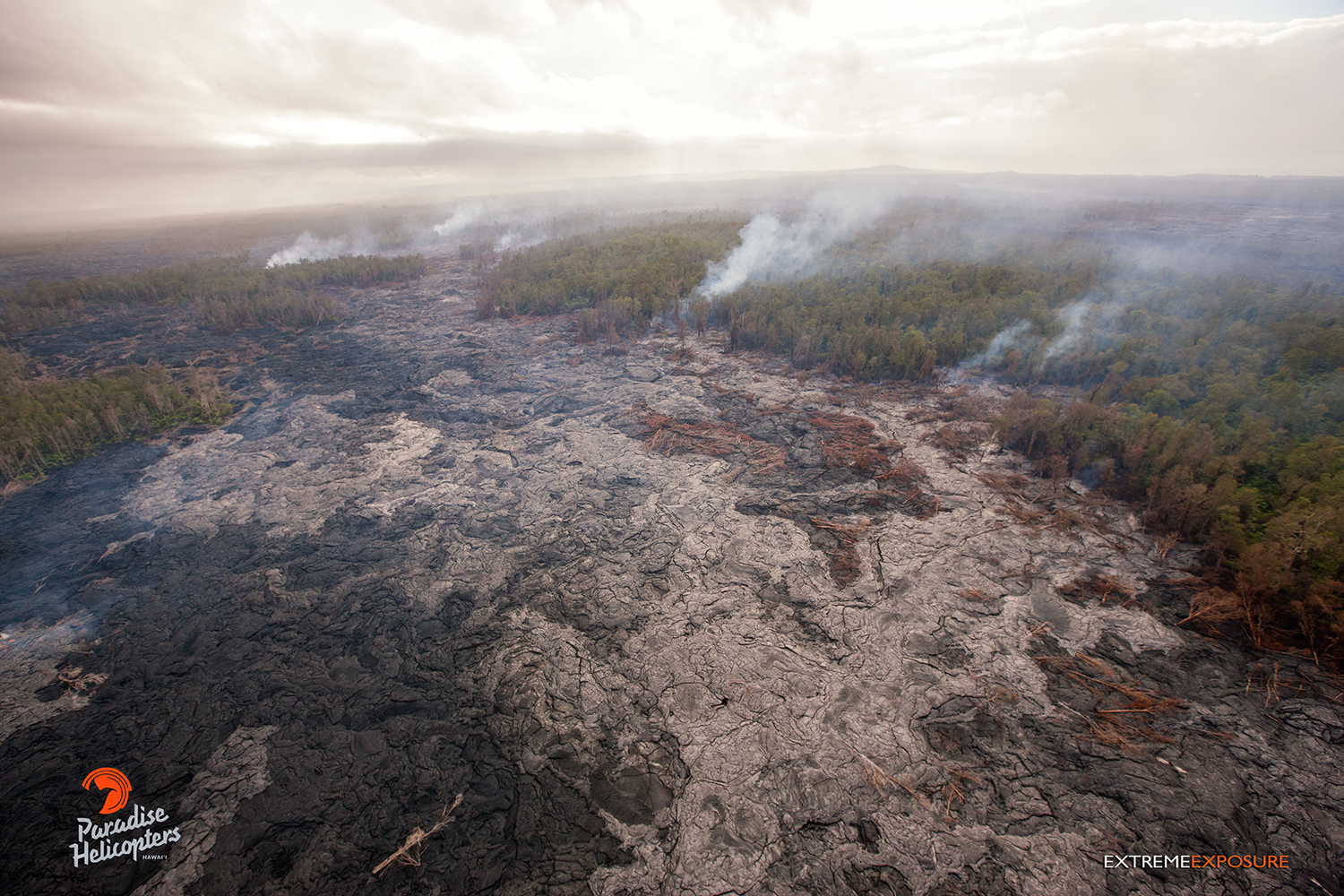
This photo, taken on May 6, shows a view of the distal tip of the June 27 lava flow, approximately 5 miles downslope from Pu‘u ‘O‘o, and 8 miles upslope of Pahoa. The haze in this photo is rain. Photo credit: Extreme Exposure Media/Paradise Helicopters.
This photo, taken May 6, shows a view of the distal tip of the June 27 lava flow from the reverse angle. Photo credit: Extreme Exposure Media/Paradise Helicopters.
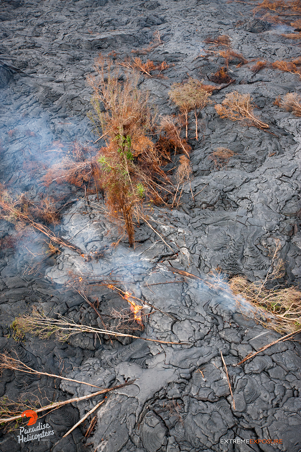
In this photo, taken on May 6, a breakout surrounds trees, eventually toppling them as their trunks get charred from the lava’s heat. Photo credit: Extreme Exposure Media/Paradise Helicopters.
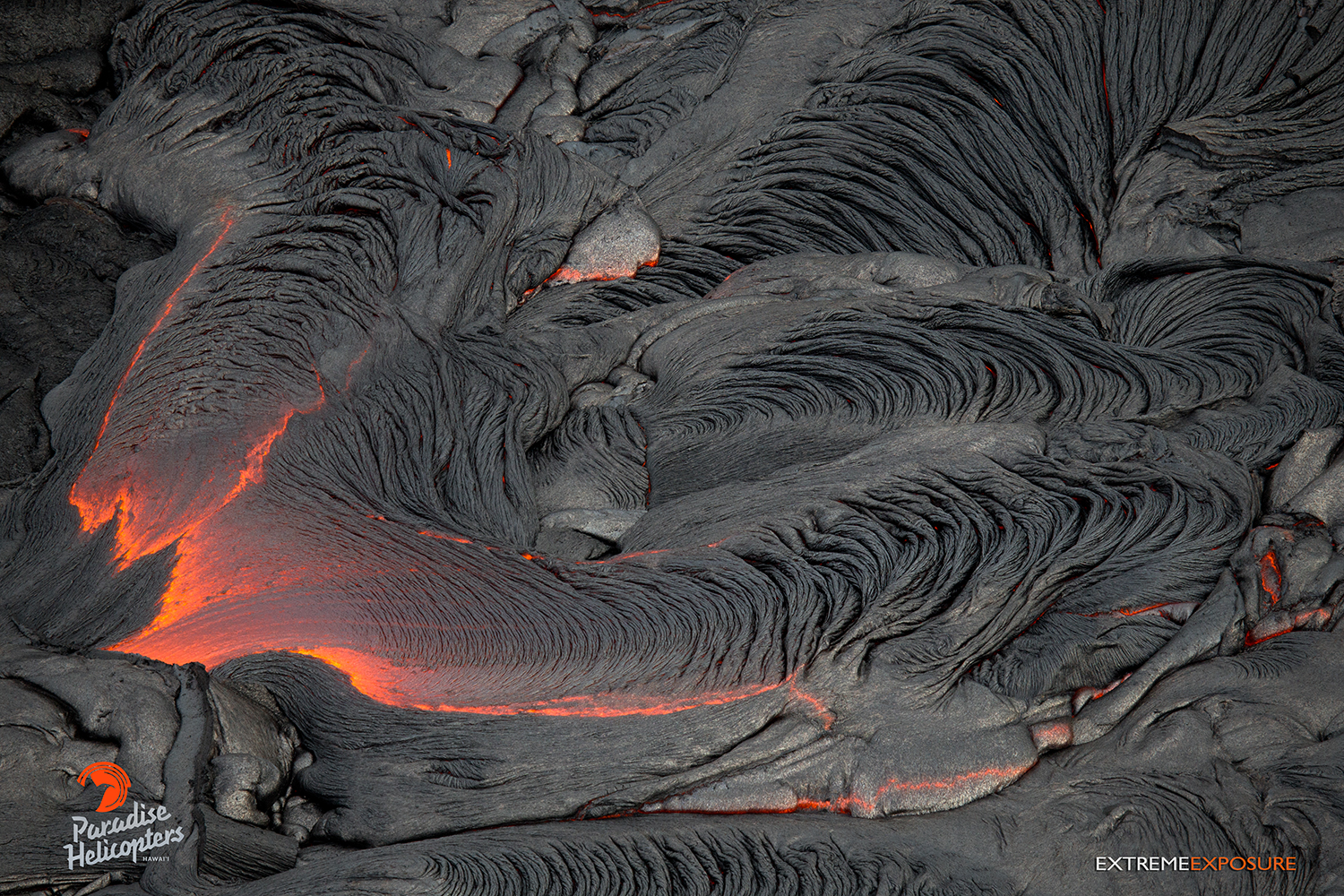
This photo, take on May 6, shows a breakout in the middle of the flow field, approximately 4 miles from the Pu‘u ‘O‘o vent. Photo credit: Extreme Exposure Media/Paradise Helicopters.
This photo, taken on May 6, shows a spatter cone on the floor of Pu‘u ‘O‘o crater. Photo credit: Extreme Exposure Media/Paradise Helicopters.
In this photo, taken on May 6, an opening along the eastern wall of Pu‘u ‘O‘o occasionally tossed lava into the air. Photo credit: Extreme Exposure Media/Paradise Helicopters.
In this photo, taken on May 6, this particular breakout was encroaching upon Pu‘u Kahauale‘a. Photo credit: Extreme Exposure Media/Paradise Helicopters.
This comments section is a public community forum for the purpose of free expression. Although Big Island Now encourages respectful communication only, some content may be considered offensive. Please view at your own discretion. View Comments