Kilauea’s summit has remain relatively steady since Tuesday morning. According to Hawaiian Volcano Observatory, the area saw no significant change in tilt at the summit and the lava lake has either been at or near the Overlook crater rim.
No overflows onto the Halema’uma’u Crater floor were reported by HVO during the past day. HVO officials say that the area in which the overflows during the past week spilled over onto the Halema’uma’u Crater floor is about 28 acres.
Beneath Kilauea’s summit and the upper East and Southwest Rift Zones, seismicity continues to be high.
At Puʻu ʻŌʻō, the tiltmeter along the north flank recorded deflationary tilt. In addition, HVO scientists say a small lava flow began to speak on the Puʻu ʻŌʻō crater floor early Wednesday morning.
ARTICLE CONTINUES BELOW AD
ARTICLE CONTINUES BELOW AD
June 27 lava flow activity is still going, according to HVO observations. Tthe most distant breakout is still about 5 miles northeast of the Puʻu ʻŌʻō crater. Additional surface flows, which experts say are being fed from the breakout that began on Feb. 21, are located about 2 miles from the northeast area of Puʻu ʻŌʻō.
+
SWIPE LEFT OR RIGHT
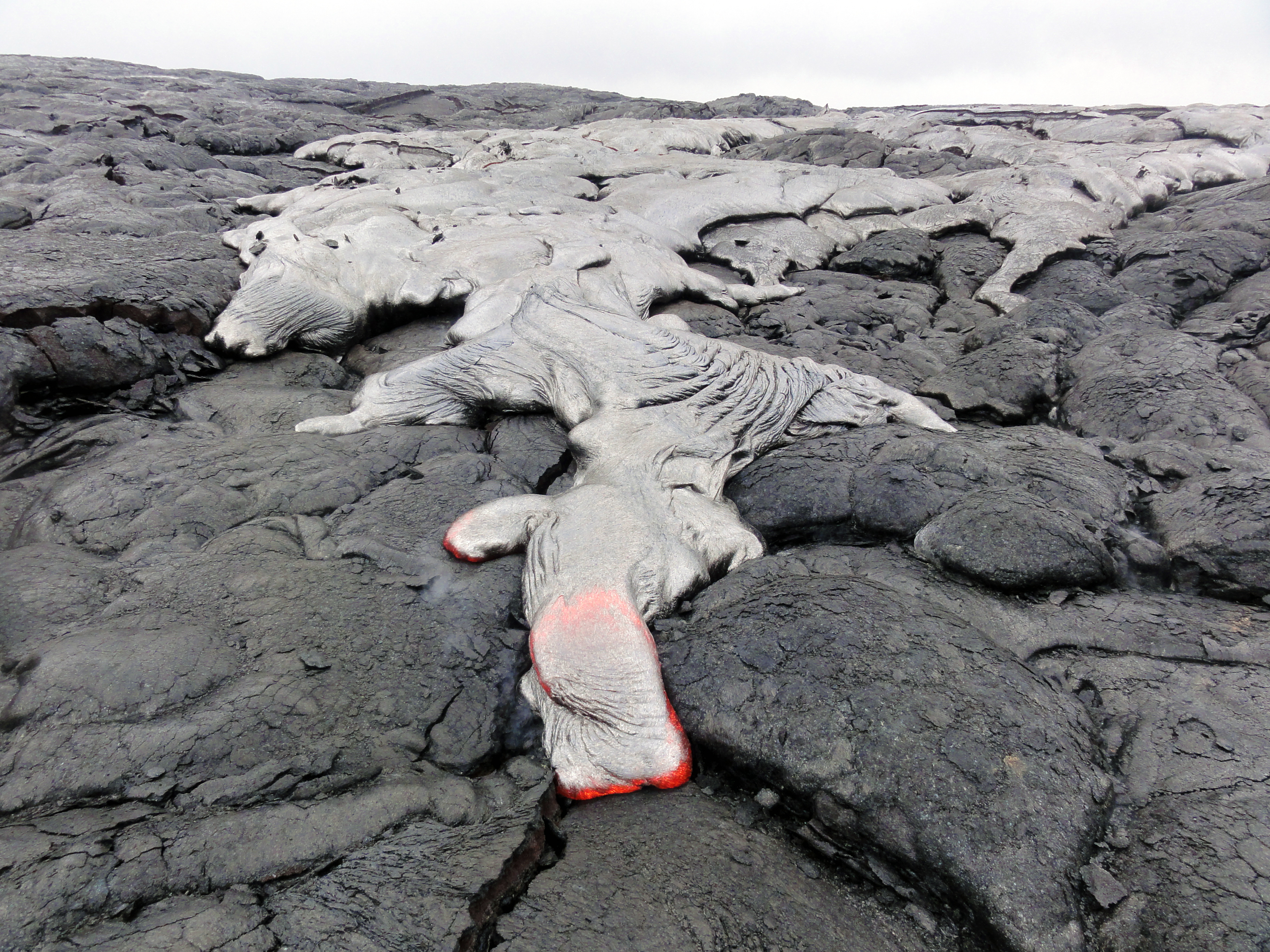
This photograph, take May 5, shows one of the June 17 lava flow’s active breakouts closer to Puʻu ʻŌʻō. USGS/HVO photo.
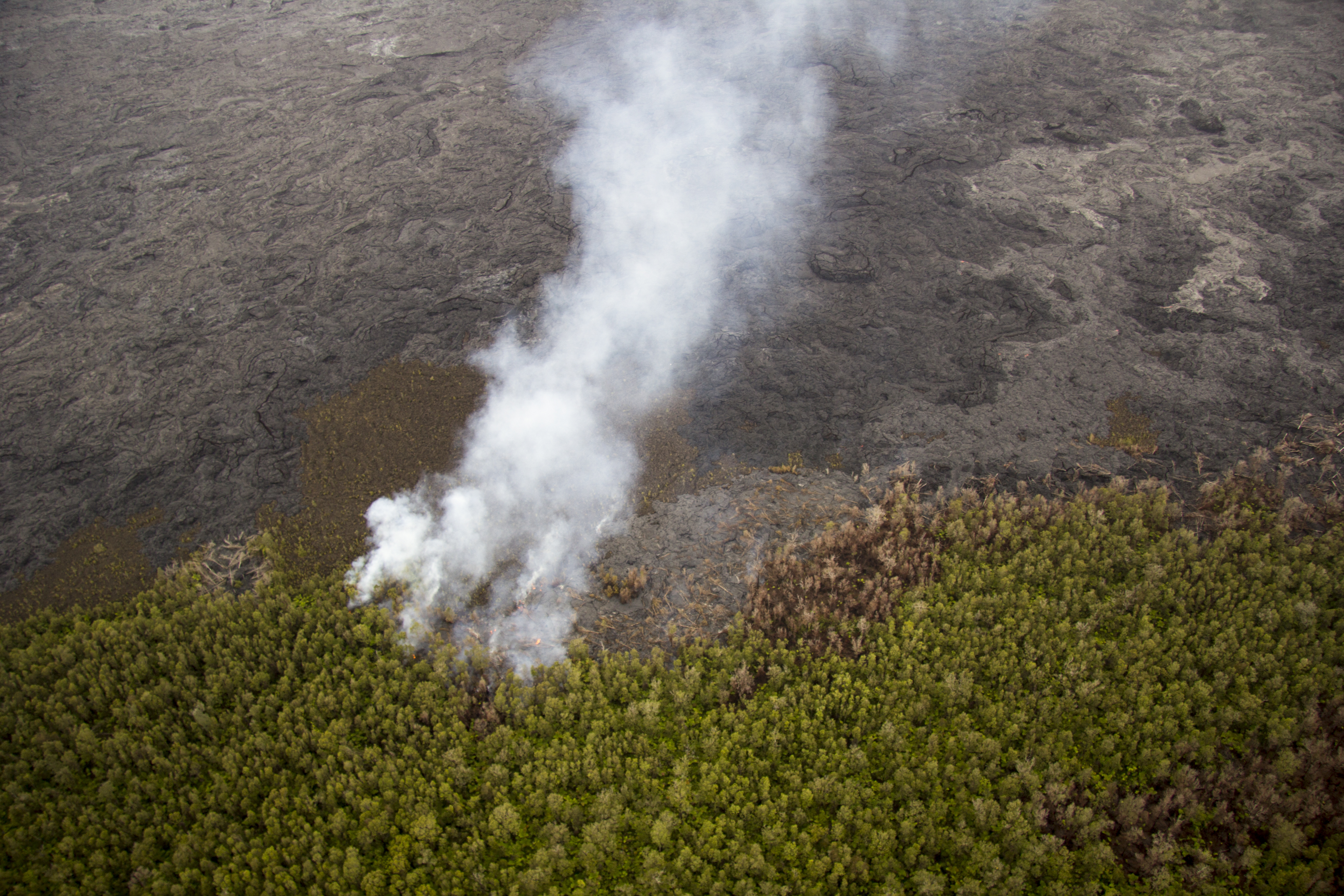
One of several lobes on the June 27 lava flow that was at the forest boundary May 5, burning vegetation northeast of Puʻu ʻŌʻō. USGS/HVO photo.
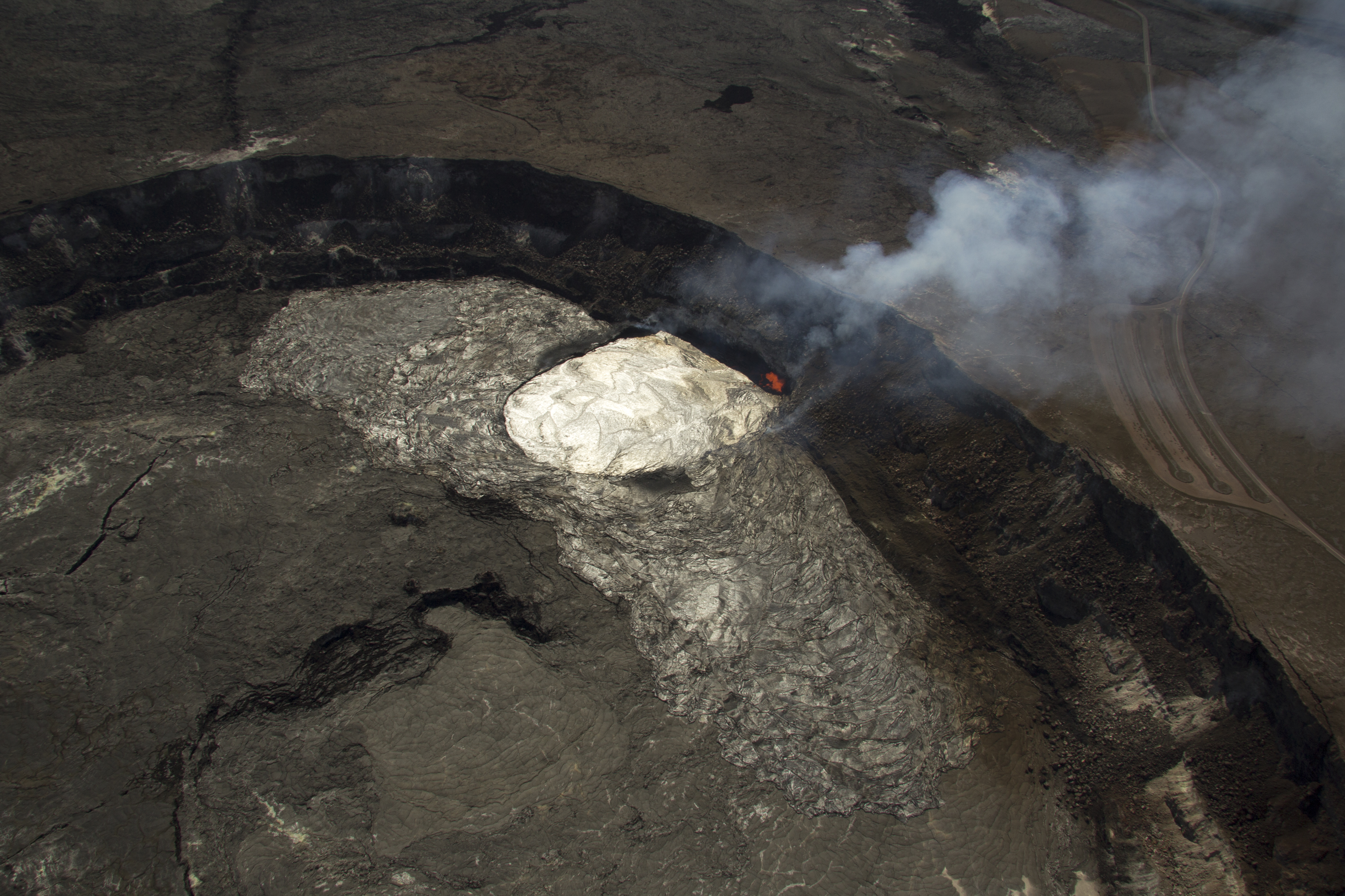
A closer look at the lava lake and overflows on the floor of Halemaʻumaʻu Crater. The outline of the Overlook crater, and the active lake, is easier to distinguish in this view. USGS/HVO photo.
In this photo, the extent of the lava lake within the Overlook crater is much easier to distinguish from the surrounding overflows. The closed Halemaʻumaʻu parking lot is in the right side of the photograph. USGS/HVO photo.
This comments section is a public community forum for the purpose of free expression. Although Big Island Now encourages respectful communication only, some content may be considered offensive. Please view at your own discretion. View Comments