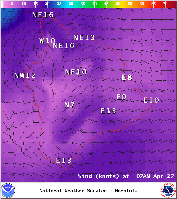
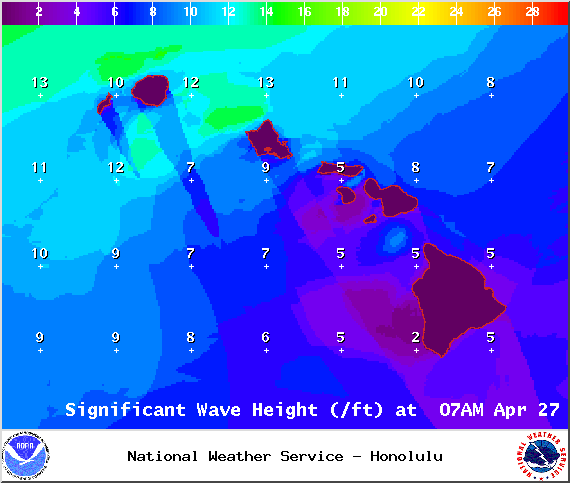
A Small Craft Advisory is posted for the Alenuihaha Channel through 6:00 a.m. Tuesday. Northeast winds up to 25 knots are forecasted along with rough seas of 8 to 15 feet. Inexperienced mariners should avoid navigating in these conditions.
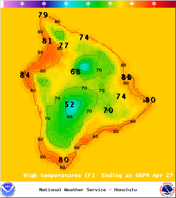
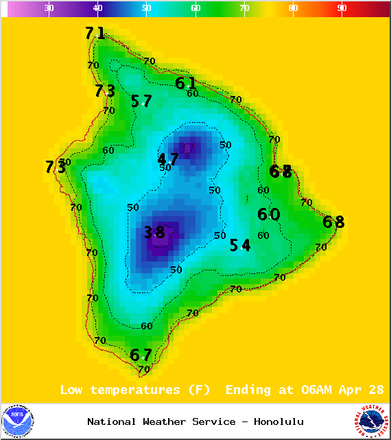
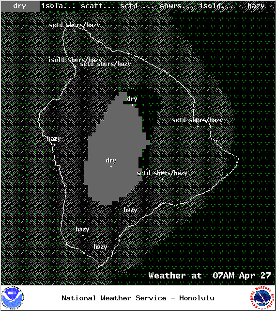
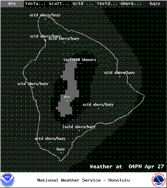
**Click directly on the images below to make them larger. Charts include: Big Island high/low forecasted temperatures, projected winds, chance of cloud cover, projected localized weather conditions, vog/SO2 forecast and expected wave heights.**
+
SWIPE LEFT OR RIGHT
Today
ARTICLE CONTINUES BELOW AD
ARTICLE CONTINUES BELOW AD
Partly sunny skies are expected this morning with scattered showers for windward and mauka areas. Leeward spots are expected to be mostly sunny with isolated showers through the day. Hazy skies are in the forecast (see UHSOEST vog model above). Northeast winds are forecasted around 15 mph with higher gusts. High temperatures from 81° to 86°.
UV index at 12 (“extreme” exposure level)
Tonight
ARTICLE CONTINUES BELOW AD
Mostly cloudy skies are expected tonight with scattered windward showers. Partly cloudy for leeward spots with isolated showers. Hazy skies will stick around. Northeast winds are forecasted from 15 to 25 mph. Low temperatures from 69° to 74° are expected.
Looking Ahead
A slow-moving front is spreading modest rain from the Kaiwi Channel to the Big Island through Monday night. Light southerly winds ahead of the front are forecasted to turn into breezy trade winds behind it. As the frontal cloud band falls apart, much of the moisture is expected to get caught in the trade winds. The winds in turn are expected to carry this moist air mass over the state again, bringing rainfall over windward slopes. Lee areas should experience some drying by mid-week, but a few showers will continue to drift leeward before dissipating. Conditions are expected to remain on the wet side of usual through the forecast period.
This comments section is a public community forum for the purpose of free expression. Although Big Island Now encourages respectful communication only, some content may be considered offensive. Please view at your own discretion. View Comments