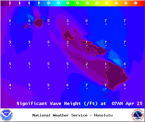
A Small Craft Advisory is posted for Big Island windward waters through 6 p.m. Saturday for east to southeast winds up to to 25 knots and rough seas up to 11 feet. Inexperienced mariners should avoid navigating in these conditions.
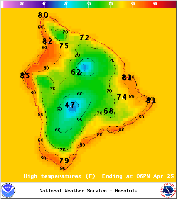
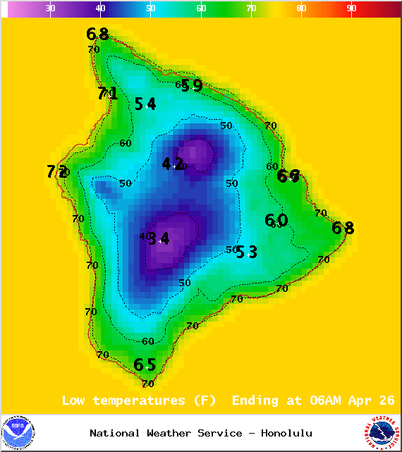
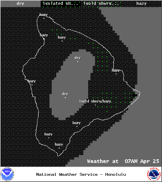
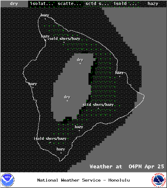
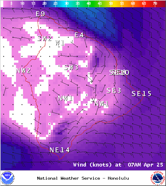
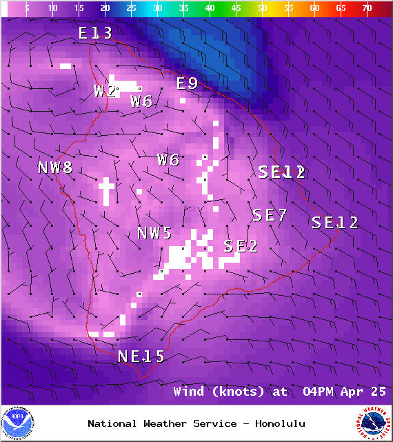
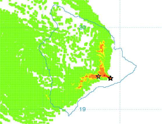
**Click directly on the images below to make them larger. Charts include: Big Island high/low forecasted temperatures, projected winds, chance of cloud cover, projected localized weather conditions, vog/SO2 forecast and expected wave heights.**
+
SWIPE LEFT OR RIGHT
Today
Mostly sunny skies are expected this morning with clouds expected to build in the afternoon with scattered showers. Hazy skies are in the forecast (see UHSOEST vog model above). Southeast winds are forecasted around 15 mph with localized sea breezes developing in some spots. High temperatures from 81° to 86°.
ARTICLE CONTINUES BELOW AD
ARTICLE CONTINUES BELOW AD
UV index at 12 (“extreme” exposure level)
Tonight
Mostly cloudy skies are expected tonight with isolated evening showers. Clearing to partly cloudy skies is expected as the night goes on. Hazy skies will stick around. Variable winds are forecasted around 15 mph. Low temperatures from 67° to 72° are expected.
ARTICLE CONTINUES BELOW AD
Sunday
Partly cloudy skies are expected with scattered showers for windward locations and isolated afternoon leeward showers. Hazy skies are expected for the Kona side. Winds are forecasted out of the east around 15 mph. High temperatures from 81° to 86° and low temperatures from 67° to 72°.
Looking Ahead
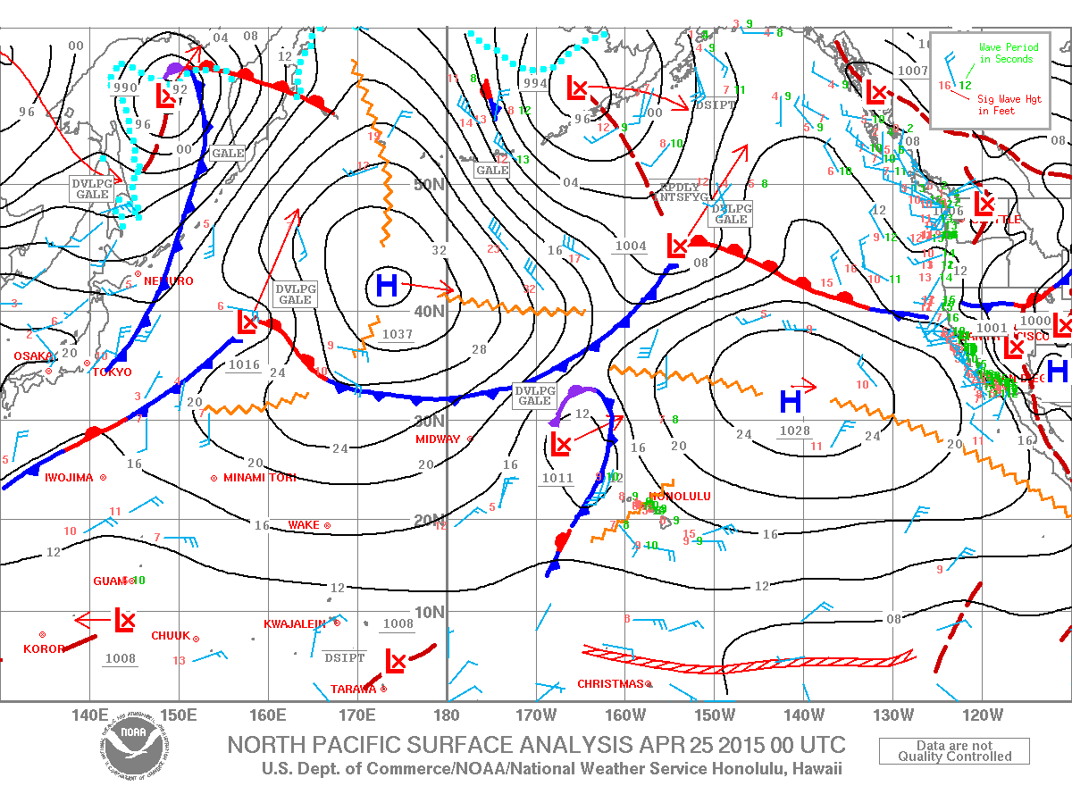
A front is approaching from the northwest. Locally breezy southeast winds ahead of the front will focus showers over southeast areas of the islands and carry volcanic haze north toward the other islands. There will also be afternoon clouds and showers over interior areas Saturday afternoon. A band of showers along the front is expected to reach Kauai Saturday evening, then stall and weaken over the central islands by Sunday night. Behind the front, breezy trade winds and showery weather is expected for windward areas through much of next week.
This comments section is a public community forum for the purpose of free expression. Although Big Island Now encourages respectful communication only, some content may be considered offensive. Please view at your own discretion. View Comments