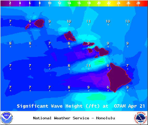
A High Surf Advisory is posted for the north and east facing shores of the Big Island through 6:00 a.m. Wednesday. Surf of 6 to 10 feet is expected. Expect strong breaking waves, shore break and strong longshore and rip currents making swimming difficult and dangerous.
A Small Craft Advisory is posted for all Big Island waters through 6 a.m. Tuesday for northeast winds up to to 30 knots and rough seas up to 15 feet. Inexperienced mariners should avoid navigating in these conditions.
A Gale Warning is posted through Tuesday morning at 6:00 a.m. for the ʻAlenuihāhā Channel. East winds up to 35 knots and rough seas up to 18 feet are forecasted. Mariners without the proper vessel and experience should remain in port until gale conditions end.
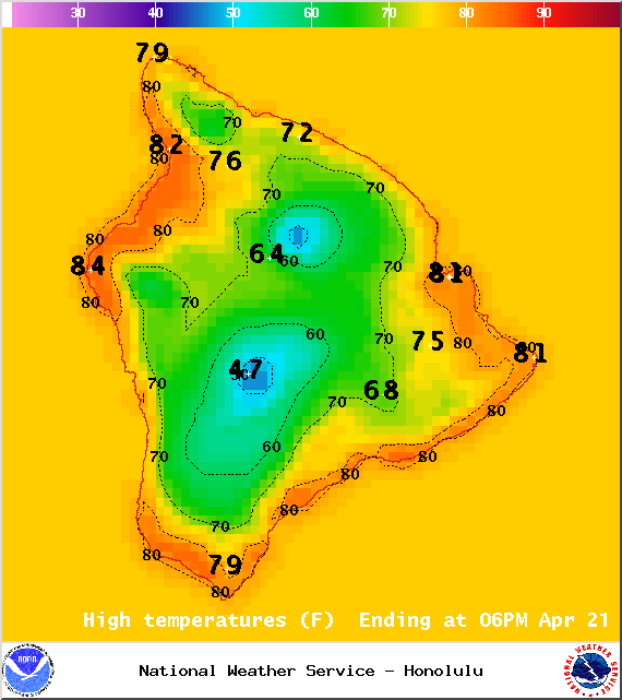
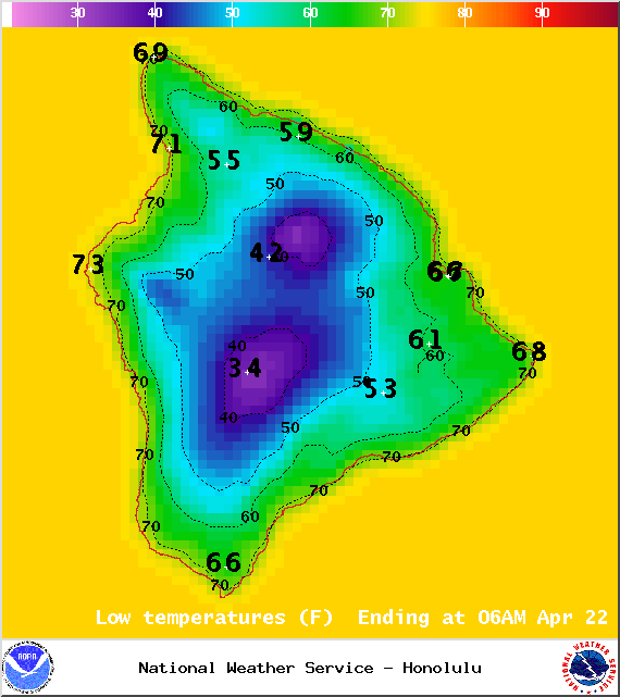
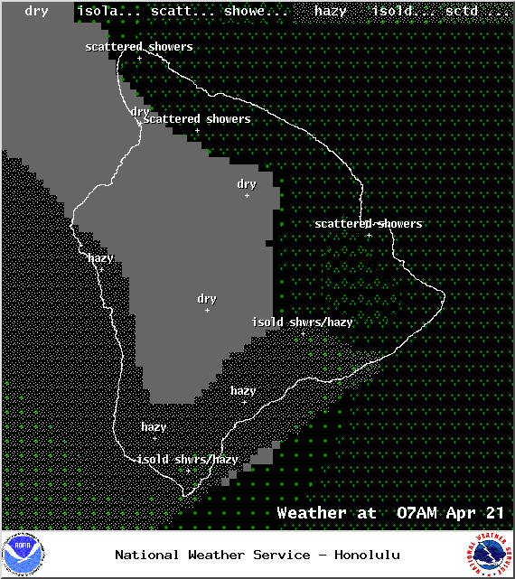
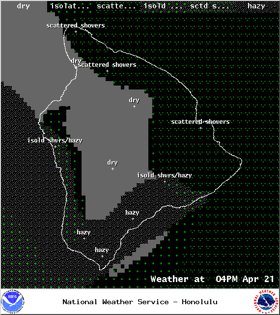
**Click directly on the images below to make them larger. Charts include: Big Island high/low forecasted temperatures, projected winds, chance of cloud cover, projected localized weather conditions, vog/SO2 forecast and expected wave heights.**
+
SWIPE LEFT OR RIGHT
ARTICLE CONTINUES BELOW AD
ARTICLE CONTINUES BELOW AD
Today
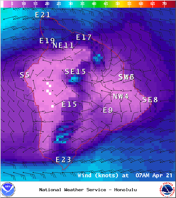
Mostly cloudy skies are expected for the Hilo side with windward showers in the morning. Kona side should get sunshine in the morning with building cloud cover in the afternoon and isolated showers. East winds are forecasted from 15 to 25 mph, gusting to 40 mph. High temperatures from 80° to 85°.
UV index at 11 (“extreme” exposure level)
ARTICLE CONTINUES BELOW AD
Tonight
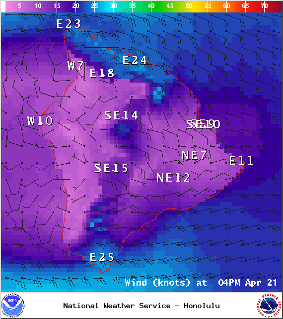
Windward and southeastern facing slopes are expected to get numerous showers tonight. Leeward spots are forecasted to be partly cloudy. East/southeast winds are forecasted around 15 mph. Low temperatures from 69° to 74° are expected.
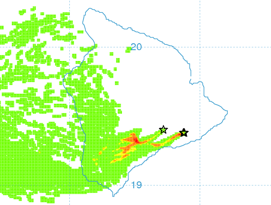
Moderate to strong trade winds are expected to weaken and become more southeasterly through mid-week and change little into the weekend. Most clouds and rain will occur over slopes facing into the wind, but showers will be more likely to drift leeward later in the week, especially at night. Southeast winds also may bring volcanic haze from Kilauea to the islands by the weekend.
This comments section is a public community forum for the purpose of free expression. Although Big Island Now encourages respectful communication only, some content may be considered offensive. Please view at your own discretion. View Comments