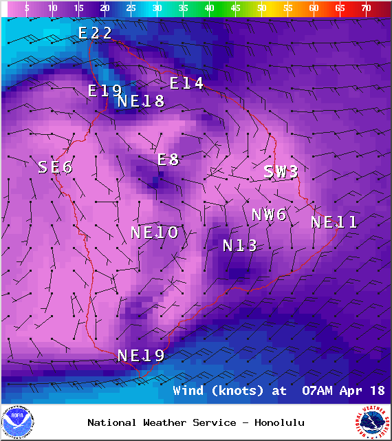
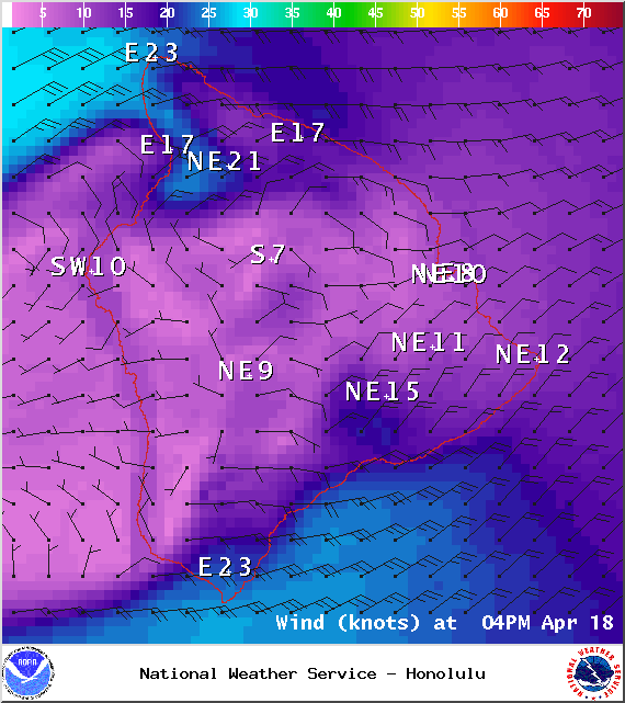
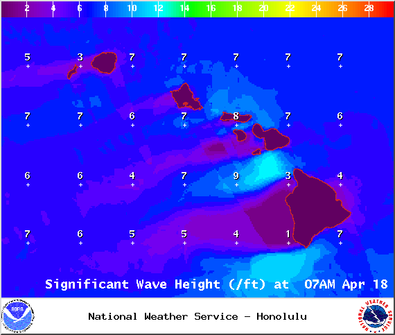
A Small Craft Advisory is posted for Big Island southeast and leeward waters as well as the Alenuihaha channel through 6 p.m. Sunday for east winds up to to 30 knots and rough seas up to 15 feet. Inexperienced mariners should avoid navigating in these conditions.
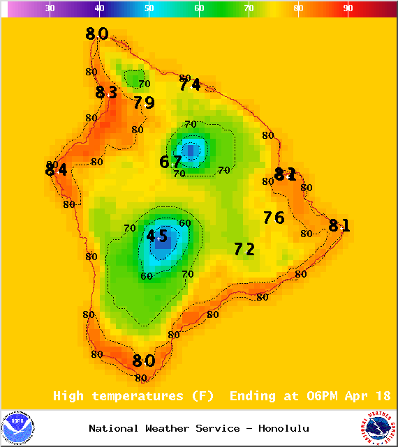
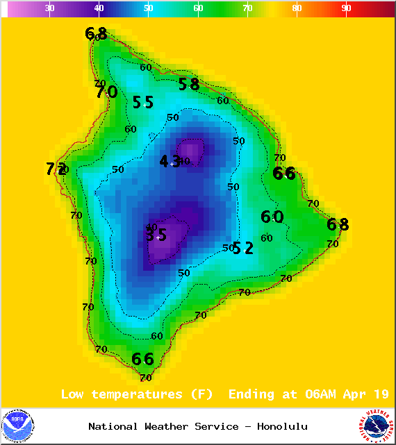
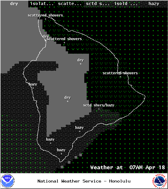
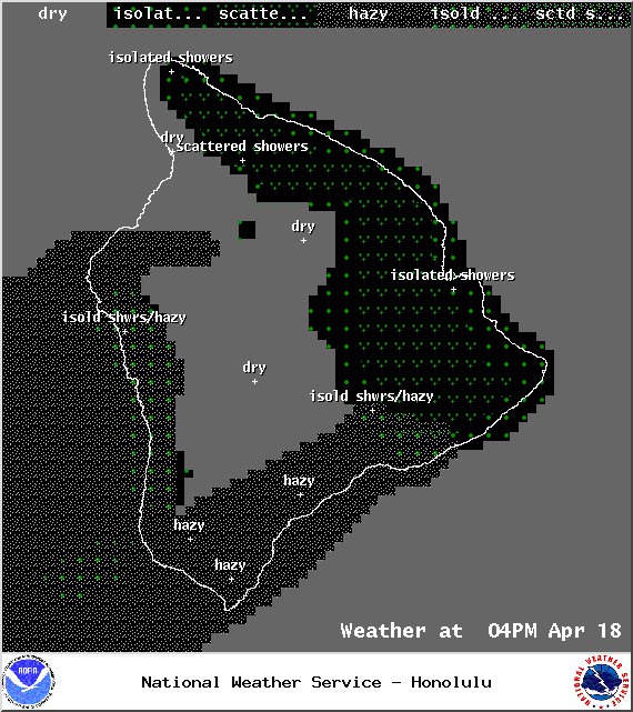
**Click directly on the images below to make them larger. Charts include: Big Island high/low forecasted temperatures, projected winds, chance of cloud cover, projected localized weather conditions, vog/SO2 forecast and expected wave heights.**
+
SWIPE LEFT OR RIGHT
Today
Partly cloudy skies are expected for the Hilo side with scattered windward showers. Kona side should get sunshine in the morning with building cloud cover in the afternoon and isolated showers. Trade winds are forecasted from 15 to 25 mph. The strongest winds will be at Upolu Point and South Point. High temperatures from 82° to 87°.
ARTICLE CONTINUES BELOW AD
ARTICLE CONTINUES BELOW AD
UV index at 11 (“extreme” exposure level)
Tonight
Scattered showers are expected for windward and mauka areas tonight. Leeward spots are forecasted to be partly cloudy with isolated showers in the evening, then clearing as the night goes on. Trade winds are forecasted from 15 to 25 mph. Low temperatures from 67° to 72° are expected.
ARTICLE CONTINUES BELOW AD
Sunday
Partly cloudy skies are expected with scattered showers for windward and mauka locations, mainly in the morning and evening hours. The Kona side will have mostly sunny skies with isolated afternoon showers. Winds are forecasted out of the northeast from 15 to 25 mph strongest near Upolu Point and South Point. High temperatures from 81° to 86° and low temperatures from 67° to 72°.
Looking Ahead
Fresh to locally strong trade winds are expected into the middle of next week. The trade winds will focus clouds and showers over windward slopes and coasts, but the atmosphere will become increasingly stable over the next couple of days. Therefore shower coverage should decrease this weekend, and remain minimal into early next week. Southeast winds may bring a wetter pattern toward the the second half of next week.
This comments section is a public community forum for the purpose of free expression. Although Big Island Now encourages respectful communication only, some content may be considered offensive. Please view at your own discretion. View Comments