A Small Craft Advisory is posted for the Alenuihaha channel and Big Island leeward and southeast waters through 6:00 a.m. Wednesday for east winds up to to 25 knots and rough seas up to 10 feet. Inexperienced mariners should avoid navigating in these conditions.
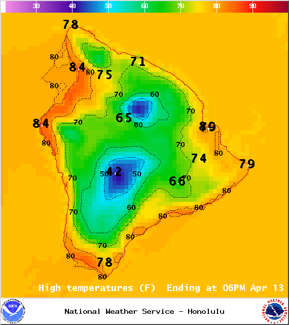
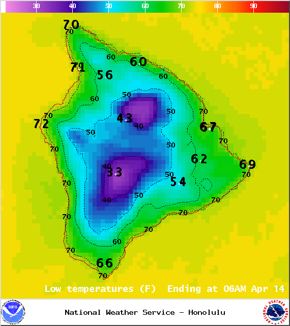
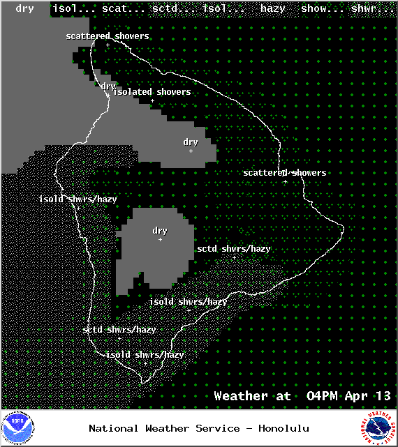
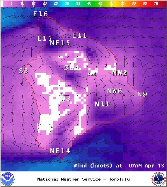
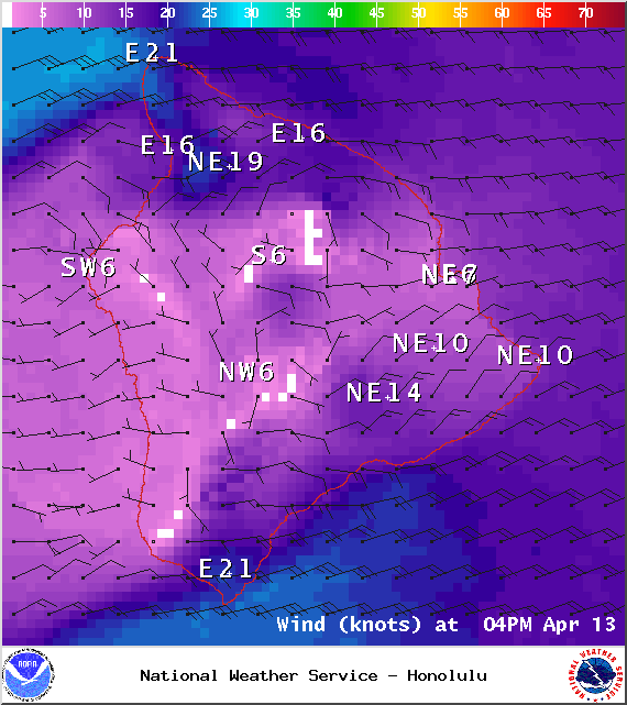
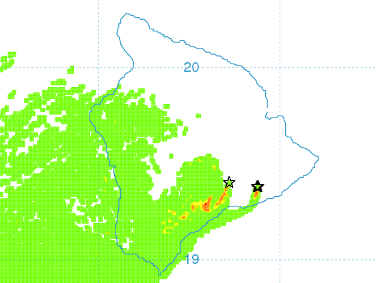
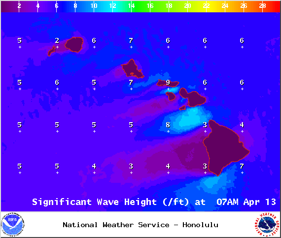
**Click directly on the images below to make them larger. Charts include: Big Island high/low forecasted temperatures, projected winds, chance of cloud cover, projected localized weather conditions, vog/SO2 forecast and expected wave heights.**
+
SWIPE LEFT OR RIGHT
Today
ARTICLE CONTINUES BELOW AD
ARTICLE CONTINUES BELOW AD
Mostly cloudy skies are in the forecast with windward showers likely during the day. Mostly sunny skies are expected for leeward areas in the morning with building cloud cover and scattered showers in the afternoon. Trade winds are forecasted from 15 to 20 mph with higher gusts. High temperatures from 81° to 86°.
UV index at 11 (“extreme” exposure level)
Tonight
ARTICLE CONTINUES BELOW AD
Showers are likely in windward and mauka areas tonight. Leeward spots are expected to have mostly cloudy skies and scattered showers in the evening, then clearing should take place. Trade winds are forecasted from 15 to 20 mph. Low temperatures from 67° to 72° are expected.
Looking Ahead
Locally breezy trade winds are expected to continue through Tuesday. The trades should continue to transport clouds and showers mainly over windward and mauka sections of the island chain, with a few showers affecting some leeward areas at times. High clouds are forecasted to begin streaming over the state on Tuesday. A disturbance high in the atmosphere combined with enhanced moisture is forecast to produce unstable conditions with wet weather expected across most of the state starting Wednesday or Wednesday night. There is the potential for locally heavy rainfall to occur Wednesday night and Thursday.
This comments section is a public community forum for the purpose of free expression. Although Big Island Now encourages respectful communication only, some content may be considered offensive. Please view at your own discretion. View Comments