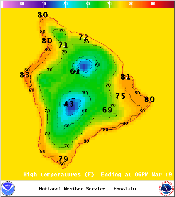
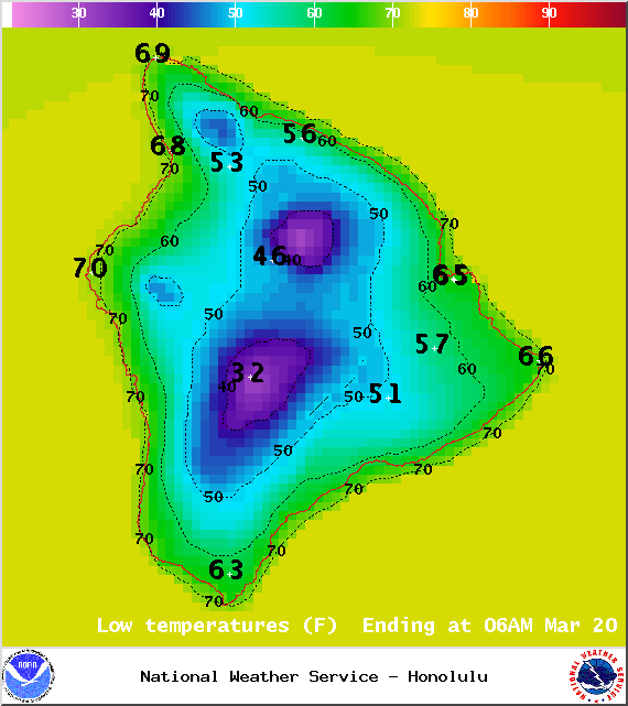
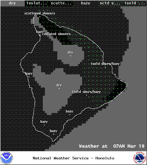
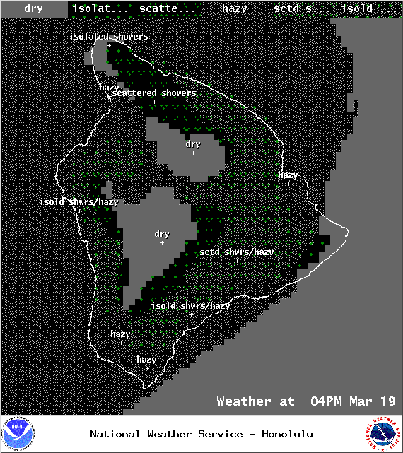
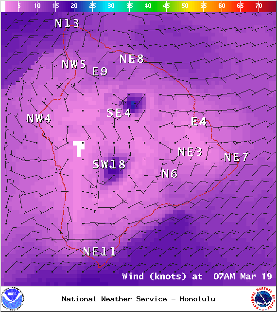
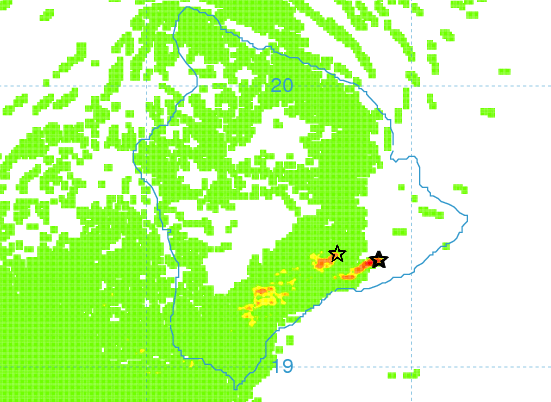
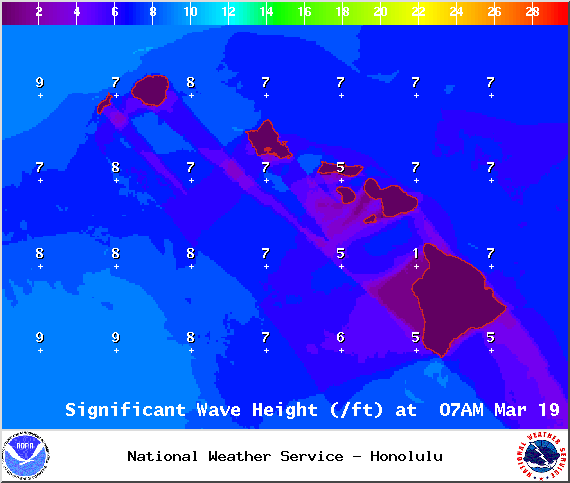
**Click directly on the images below to make them larger. Charts include: Big Island high/low forecasted temperatures, projected winds, chance of cloud cover, projected localized weather conditions, vog/SO2 forecast and expected wave heights.**
+
SWIPE LEFT OR RIGHT
Today
ARTICLE CONTINUES BELOW AD
ARTICLE CONTINUES BELOW AD
Mostly cloudy skies are expected for windward spots with scattered showers. Leeward spots should be relatively clear in the morning with building cloud cover in the afternoon and isolated showers. Hazy skies are in the forecast (see UHSOEST vog model above). Northeast winds are forecasted from 15 to 20 mph. High temperatures from 78° to 85°.
UV index at 11 (“extreme” exposure level)
Tonight
ARTICLE CONTINUES BELOW AD
The windward side is forecasted to get mostly cloudy skies and showers are likely. Leeward spots are cloudy to start and clearing is expected. Northeast winds are forecasted from 15 to 20 mph. Low temperatures from 67° to 73° are expected.
Looking Ahead
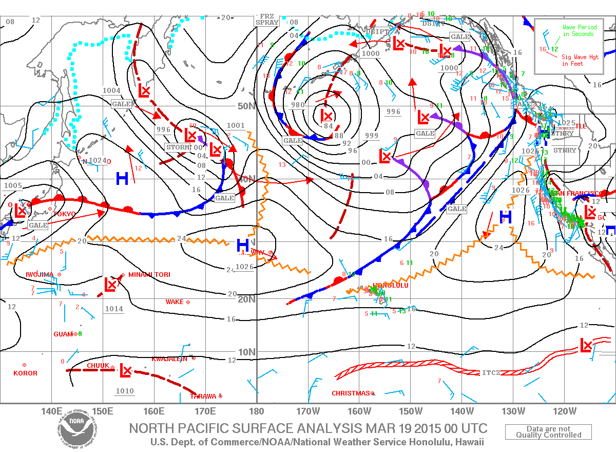
A weakening front northwest of Kauai is expected to reach the islands on Thursday as it dissipates and loses steam. Behind this front a return to trade winds is forecasted, which is expected to continue through early next week. Lingering moisture will enhance windward showers through the weekend.
This comments section is a public community forum for the purpose of free expression. Although Big Island Now encourages respectful communication only, some content may be considered offensive. Please view at your own discretion. View Comments