As another work week begins, the June 27 lava flow continues to show very minimal activity in its lower portions, according to Hawai’i County Civil Defense following its morning overflight assessment.
Breakouts that have been reported as small continue to be seen in the upslope regions of the flow, about 8 miles up near the summit area.
Hawaiian Volcano Observatory noted Monday morning that northeast of Puʻu ʻŌʻō, at least three breakouts continue. A breakout along the northern flank of Puʻu ʻŌʻō has spread out at the northeastern base. In addition, HVO said that the breakout near Kahauale’a has reached the forest that is at the edge of the flow field to the northeast of Puʻu ʻŌʻō. The third breakout that has been monitored has been noted to be about 3-4 miles northeast of Puʻu ʻŌʻō, and compared to the other two breakouts, is relatively small.
Officials say that none of the activity at the current time is posing any threat to communities in the area. Civil Defense, along with HVO, will continue to monitor changes in the flow and keep the public informed.
ARTICLE CONTINUES BELOW AD
ARTICLE CONTINUES BELOW AD
Very light smoke conditions were observed as a light northeast wind was blowing smoke in a southwest direction. Burning in the active areas of the flow is limited to the flow pad and is mainly composed of smoldering trees and vegetation. As usual, smoke conditions have the possibility of changing. Those are sensitive should take necessary precautions.
+
SWIPE LEFT OR RIGHT
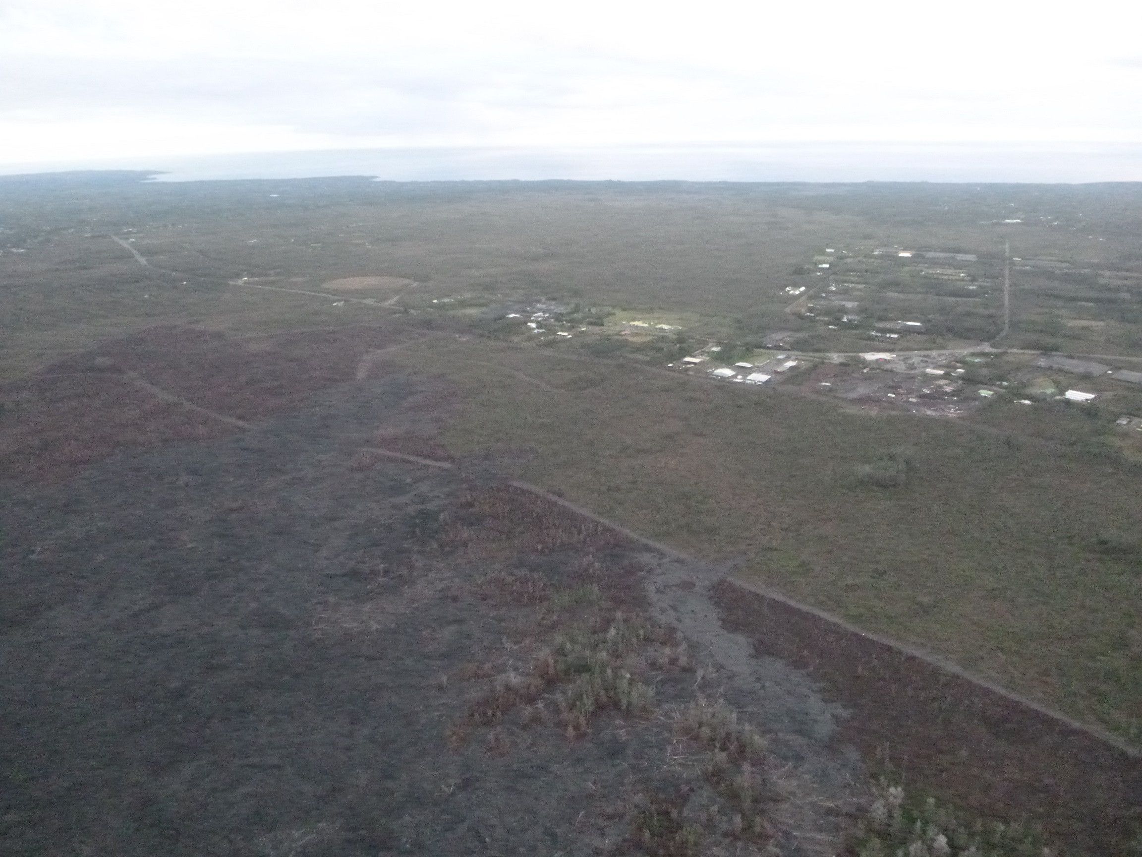
This photo, taken March 16, shows s view from the south flow margin, looking downslope towards Highway 130 and Pahoa Marketplace. Hawai’i County Civil Defense photo.
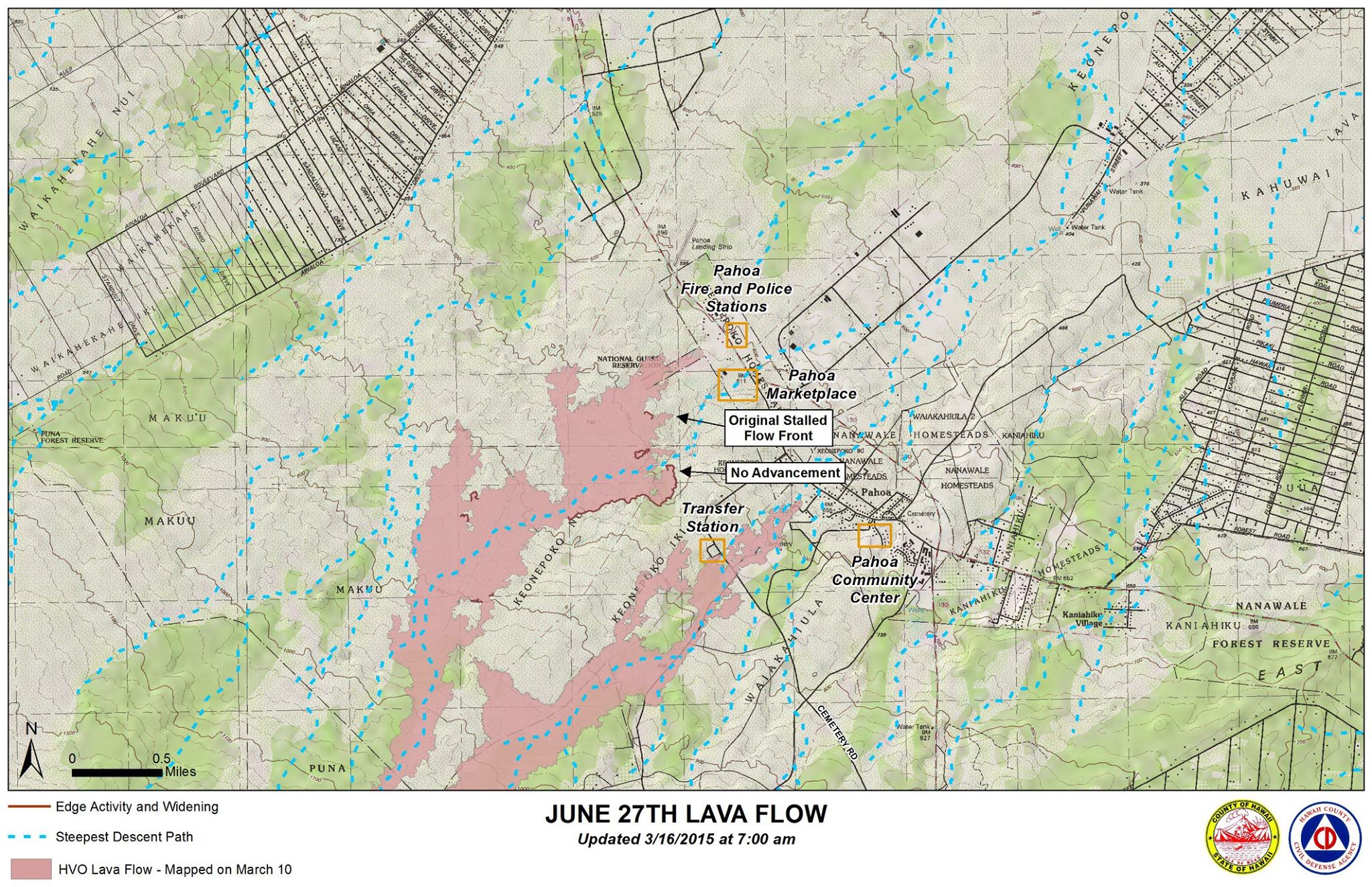
Hawai’i County Civil Defense lava flow map, as of March 16 at 7 a.m. Civil Defense image.
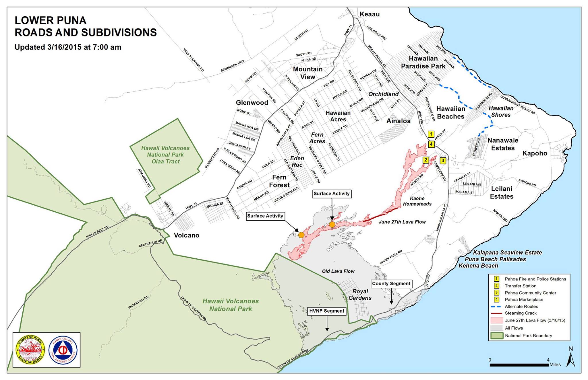
Hawai’i County Civil Defense lava flow map, as of March 16 at 7 a.m. Civil Defense image.
Hawai’i County Civil Defense lava flow map, as of March 16 at 7 a.m. Civil Defense image.
This comments section is a public community forum for the purpose of free expression. Although Big Island Now encourages respectful communication only, some content may be considered offensive. Please view at your own discretion. View Comments