A High Surf Advisory is posted through Friday at 6 p.m. Surf heights from 12 to 16 feet are expected. Expect strong breaking waves, shore break and strong longshore and rip currents making swimming difficult and dangerous.
A Small Craft Advisory is posted for all island waters through 6 p.m. Friday. North winds up to 25 knots are expected along with rough seas of 9 to 16 feet. Inexperienced mariners should avoid navigating in these conditions.
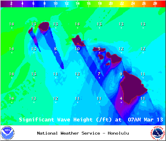
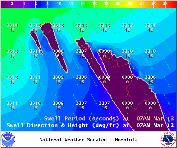
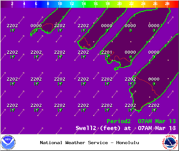
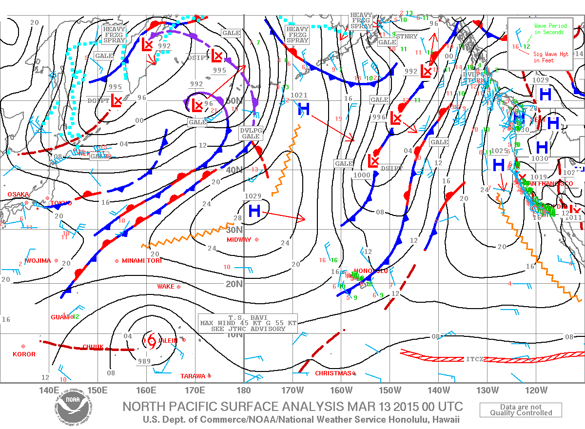
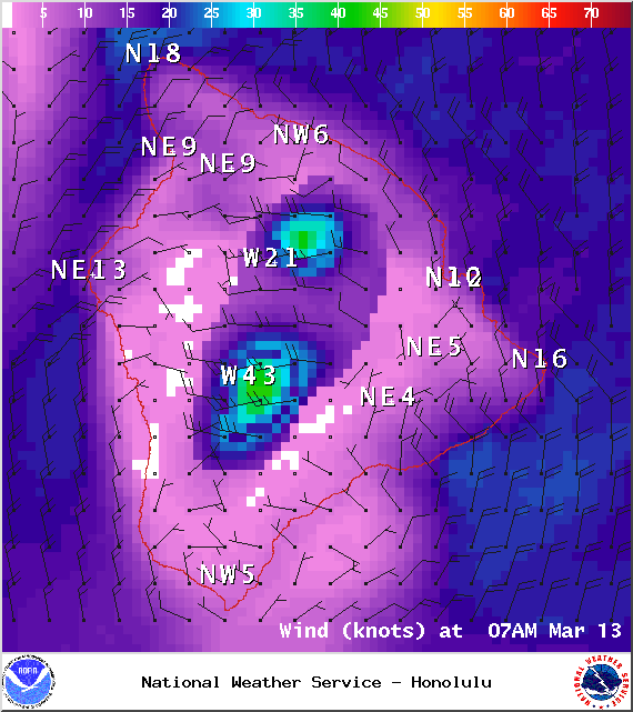
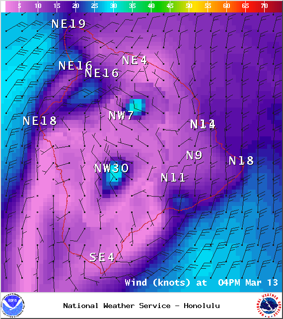
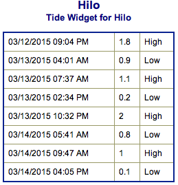
**Click directly on the images below to make them larger. Charts include: Big Island projected winds, tides, swell direction & period and expected wave heights.**
+
SWIPE LEFT OR RIGHT
ARTICLE CONTINUES BELOW AD
ARTICLE CONTINUES BELOW AD
Big Island Surf Forecast
Hilo side: Well overhead waves are expected to start the day. Size is expected to get up to double overhead or more by the afternoon, the best breaks could be slightly bigger.
Kona side: Wave heights from knee to waist high are expected. The best spots could get chest high waves on the sets.
ARTICLE CONTINUES BELOW AD
South: Wave heights of knee to waist high are expected. Standout spots could get up to chest high on the sets.
Our current north swell is expected to continue to slowly fade.
A strong storm over the Aleutians is expected to bring a solid north-northwest swell building through the morning Friday peaking in the afternoon. Most of the size will show for the northeast or Hilo coastline while the Kona side will be heavily shadowed from this swell.
A northwest pulse is expected late this weekend. A storm near Japan is expected to bring us a west-northwest swell early next week. Will keep an eye on these.
ARTICLE CONTINUES BELOW AD
A slightly bigger swell is expected to continue to build Friday morning and peak late in the day. This swell was generated by a storm in the Tasman Sea.
Keep in mind, surf heights are measured on the face of the wave from trough to crest. Heights vary from beach to beach, and at the same beach, from break to break.
This comments section is a public community forum for the purpose of free expression. Although Big Island Now encourages respectful communication only, some content may be considered offensive. Please view at your own discretion. View Comments


 Big Island Surf Forecast
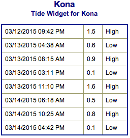 Our current north swell is expected to continue to slowly fade.