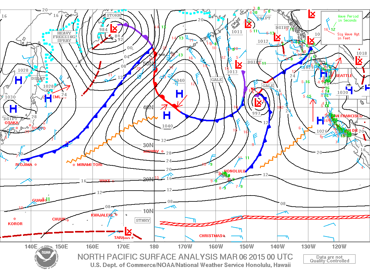
A Small Craft Advisory is posted for the ʻAlenuihāhā channel as well as waters to the south and west of the Big Island. The advisory is through 6:00 a.m. Saturday for north winds from 20 to 25 knots and rough seas of 7 to 12 feet. Inexperienced mariners should avoid navigating in these conditions.
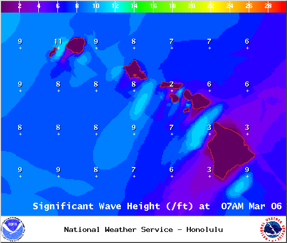
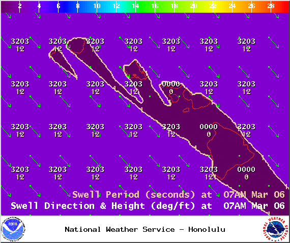
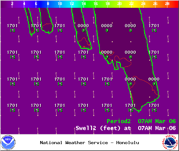
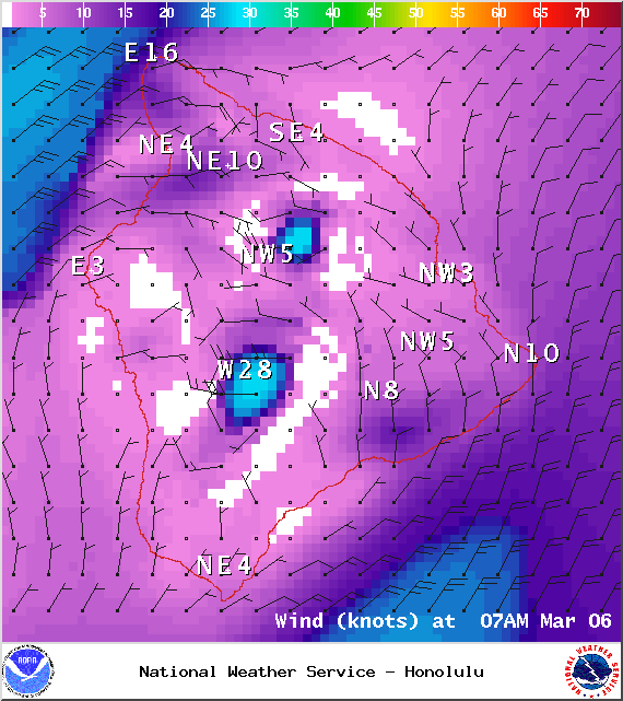
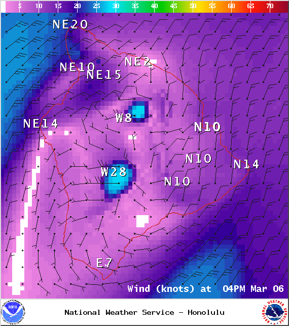
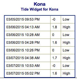
**Click directly on the images below to make them larger. Charts include: Big Island projected winds, tides, swell direction & period and expected wave heights.**
+
SWIPE LEFT OR RIGHT
ARTICLE CONTINUES BELOW AD
ARTICLE CONTINUES BELOW AD
Big Island Surf Forecast
Hilo side: Wave heights from waist to head high are expected, the best breaks could be bigger on the sets.
Kona side: Wave heights from knee to thigh high are expected. The best spots could get waist high waves on the sets.
South: Wave heights of knee to waist high are expected. Standout spots could get bigger waves on the sets.
ARTICLE CONTINUES BELOW AD
A mix of short to mid period north-northwest swell energy and northeast trade swell is expected to linger the next few days for the northeast coast. Onshore winds will make conditions messy.
A shadowed west-northwest is expected to slowly fade out Friday with just leftovers for the weekend.
Looking farther out, a northwest swell generated by a storm off of Japan is expected to bring a shot of surf energy Saturday, peaking Sunday. Another developing storm north of the state could bring a pulse late on Sunday through about Tuesday. Another storm expected to develop near the Aleutians could bring a solid swell around the 14th. Will keep an eye on it.
South shores are expected to go quiet from Friday through the first part of next week. We may get some energy headed our way around the 13th.
ARTICLE CONTINUES BELOW AD
Keep in mind, surf heights are measured on the face of the wave from trough to crest. Heights vary from beach to beach, and at the same beach, from break to break.
This comments section is a public community forum for the purpose of free expression. Although Big Island Now encourages respectful communication only, some content may be considered offensive. Please view at your own discretion. View Comments


 Big Island Surf Forecast
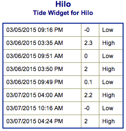 A mix of short to mid period north-northwest swell energy and northeast trade swell is expected to linger the next few days for the northeast coast. Onshore winds will make conditions messy.