Light smoke conditions were reported following Hawai’i County Civil Defense’s Friday morning overflight assessment of the June 27 lava flow. The smoke was blowing in a southeast direction.
Civil Defense reported little change in the downslope areas of the lava flow, in addition to advancement.
Breakouts continue to be observed both on the flow pad and along each of the flow margins. Officials say that breakout activity begins just upslope from the stalled downslope areas and continues all the way up to the summit area.
Hawaiian Volcano Observatory noted on Friday morning that the lava flow continues to widen in many of the downslope areas, but that none of the breakouts or leading edge of the flow has advanced towards Highway 11 in over a week.
ARTICLE CONTINUES BELOW AD
ARTICLE CONTINUES BELOW AD
These numerous breakouts indicate that the area is still active. Civil Defense says that the breakouts show that the tube system remains active as lava continues to be supplied from the source and traveling downslope.
None of the current lava activity is posing a threat to communities in the area. Civil Defense, along with HVO, will continue to monitor conditions and keep the public informed.
+
SWIPE LEFT OR RIGHT
This photo, taken March 6, shows a view from the north flow margin, looking down slope towards Highway 130 and Pahoa Marketplace. Hawai’i County Civil Defense photo.
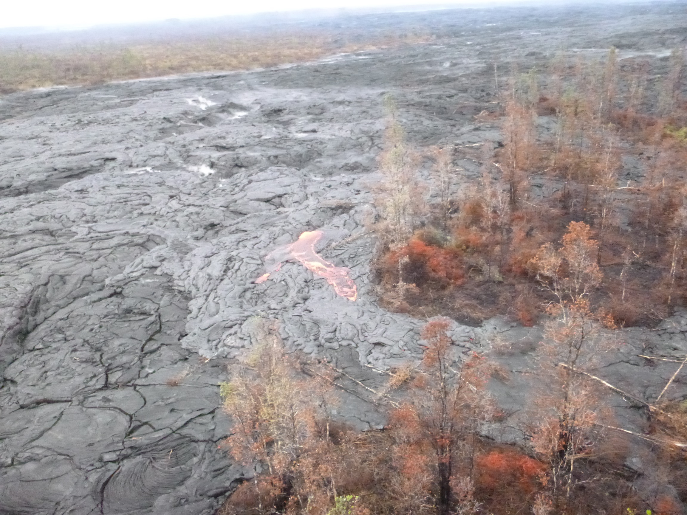
This photo, taken March 6, shows a view of the upslope surface activity. Hawai’i County Civil Defense photo.
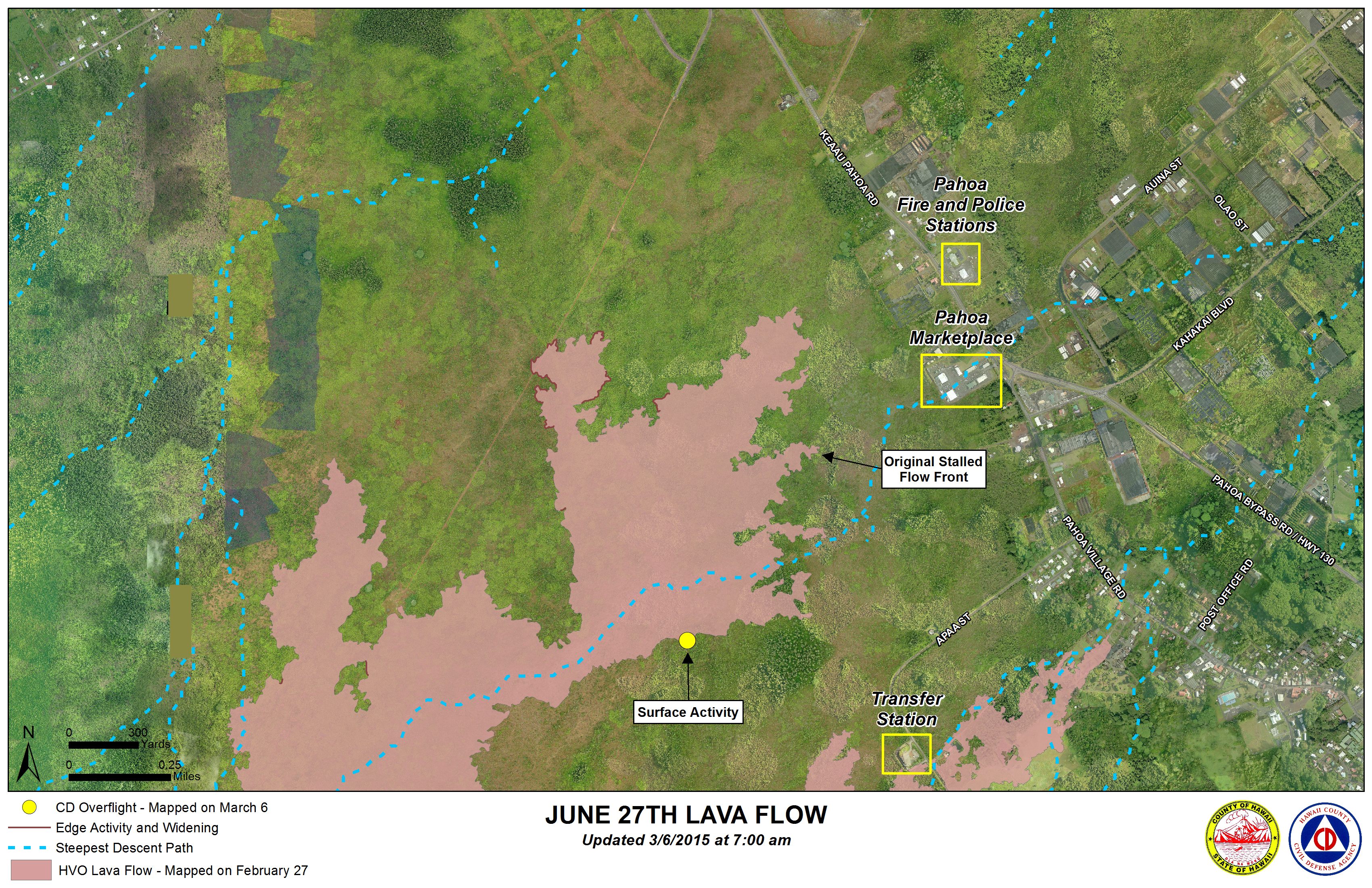
Hawai’i County Civil Defense lava flow map, as of March 6 at 7 a.m. Civil Defense image.
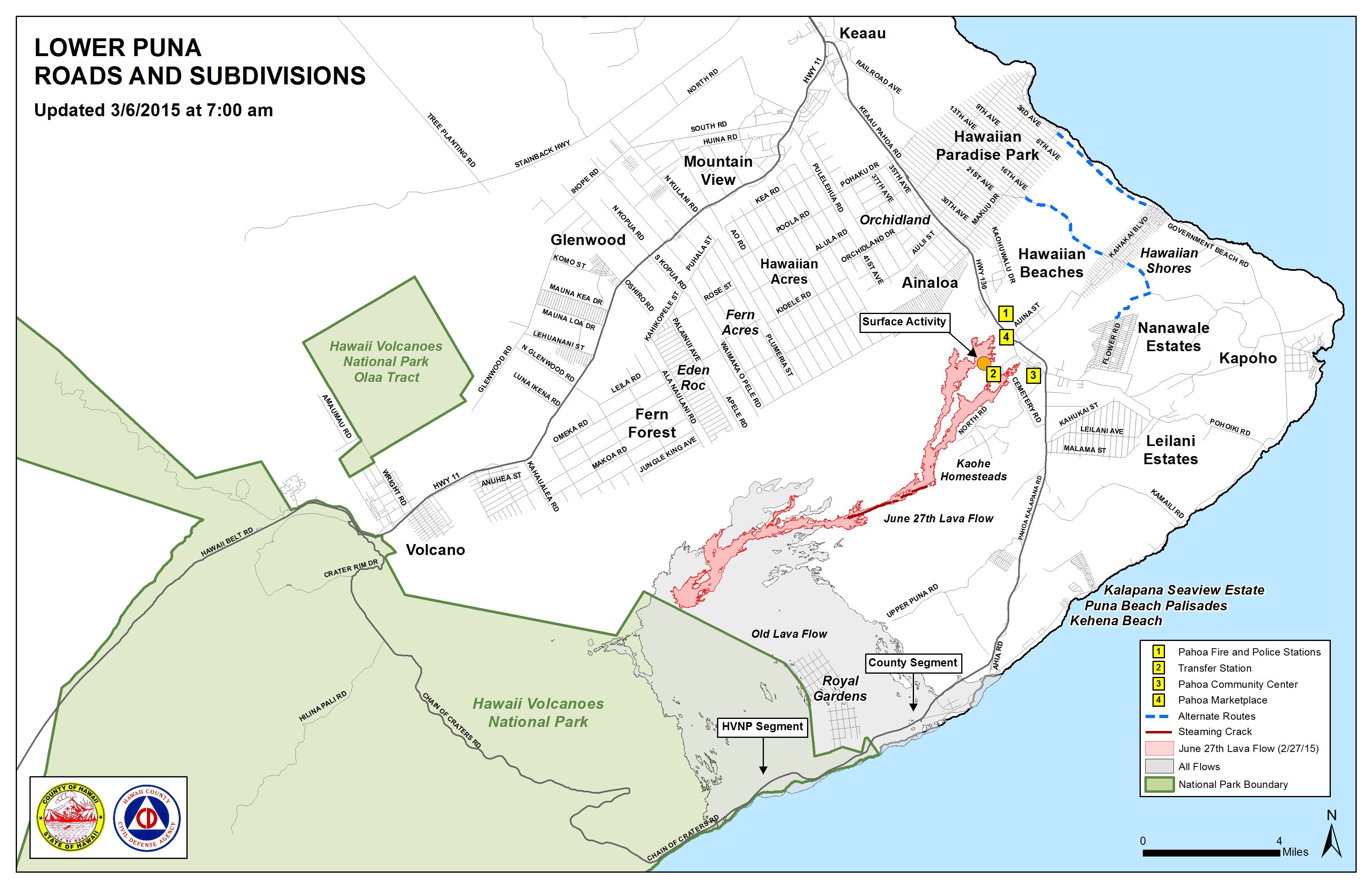
Hawai’i County Civil Defense lava flow map, as of March 6 at 7 a.m. Civil Defense image.
This comments section is a public community forum for the purpose of free expression. Although Big Island Now encourages respectful communication only, some content may be considered offensive. Please view at your own discretion. View Comments