The National Weather Service has issued a Flash Flood Watch for the Big Island through 6:00 a.m. Thursday. An area of instability is expected to push moisture up toward the island that could potential cause flooding and thunderstorms through Wednesday night. The rainfall will mainly focus over windward areas. Excessive runoff could result in rock and mudslides in steep terrain. Fast-moving waters could create life-threatening conditions.
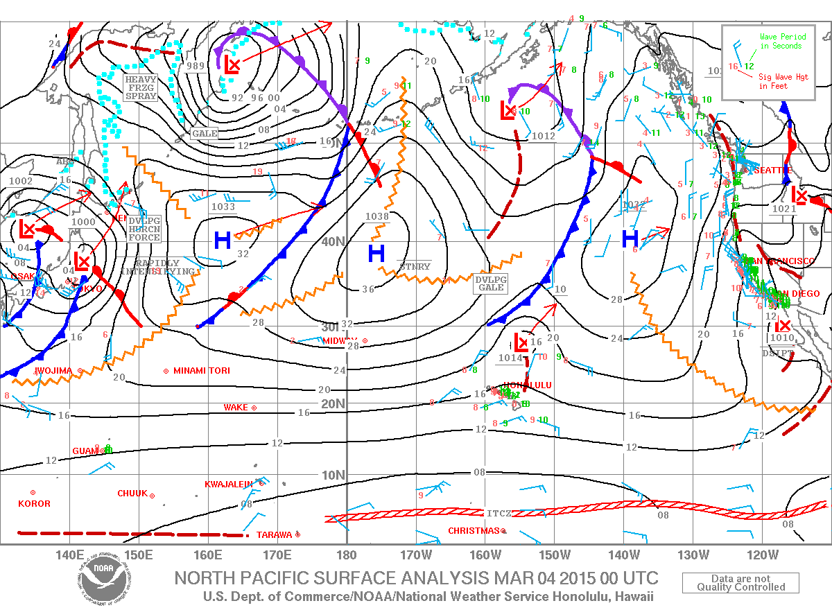
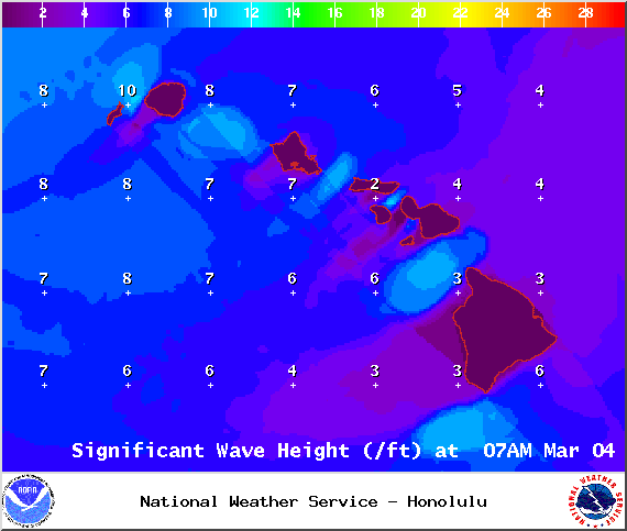
A Small Craft Advisory is posted for the ʻAlenuihāhā channel as well as waters to the south and west of the Big Island. The advisory is posted from 6:00 a.m. Wednesday through 6:00 a.m. Friday for north winds from 25 to 30 knots and rough seas of 8 to 12 feet. Inexperienced mariners should avoid navigating in these conditions.
A Winter Storm Warning is posted for the summits of Mauna Kea and Mauna Loa for heavy snow accumulation of 12 to 18 inches, southwest winds from 10 to 20 mph and temperatures in the upper 20s. This may make travel very hazardous or impossible. The warning is posted through 6:00 a.m. Thursday.
**Click directly on the images below to make them larger. Charts include: Big Island high/low forecasted temperatures, projected winds, chance of cloud cover, projected localized weather conditions, vog/SO2 forecast and expected wave heights.**
+
SWIPE LEFT OR RIGHT
ARTICLE CONTINUES BELOW AD
ARTICLE CONTINUES BELOW AD
Today
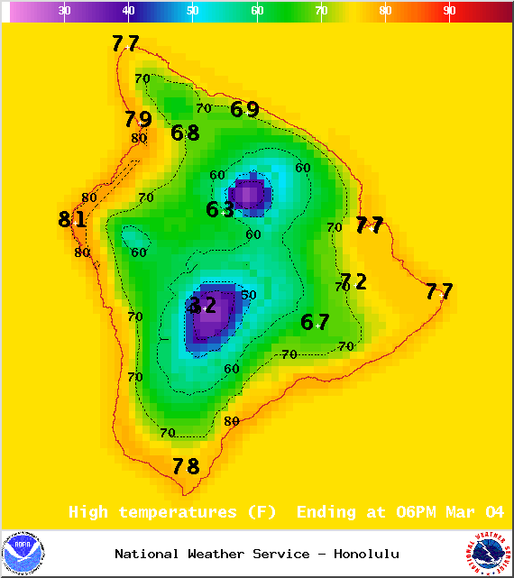
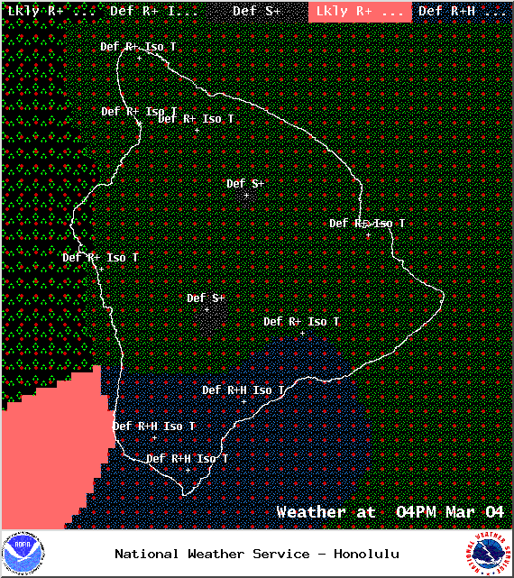
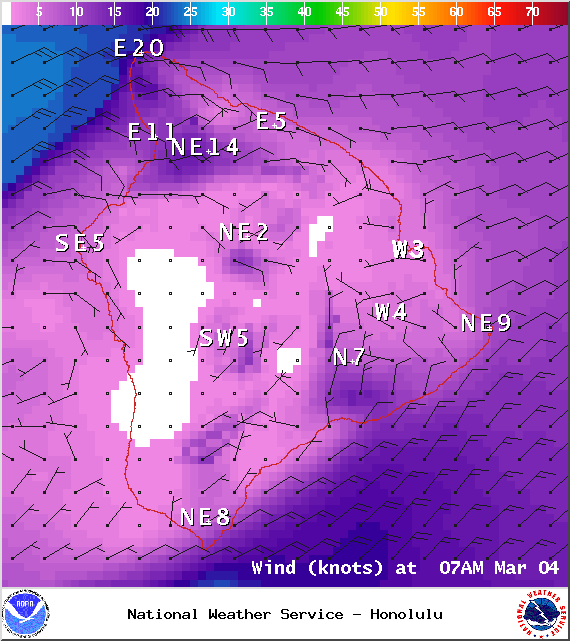
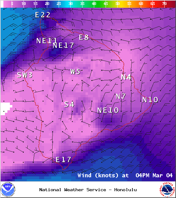
Cloudy skies are expected today. Heavy rain and thunderstorms are expected today, especially for the windward side of the Big Island and along windward slopes. Northeast winds are forecasted from 15 to 20 mph. High temperatures from 76° to 81°.
UV index at 5 (“moderate” exposure level)
Tonight
ARTICLE CONTINUES BELOW AD
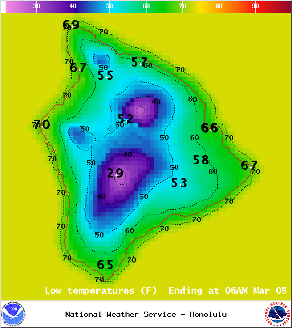
Mostly cloudy skies are expected with showers likely for windward spots and the possibility of heavy rain and thunderstorms, especially on windward slopes. Northeast winds are forecasted from 15 to 20 mph. Low temperatures from 66° to 71° are expected.
Next Full Moon: 8:06 a.m. on Mar. 5
Looking Ahead
Trade winds are expected to become stronger through Friday. An area of instability near the state will result in heavy rain and thunderstorms on the Big Island and Maui through Thursday. Trade winds will focus rainfall over the windward slopes, with some showers carrying over to leeward areas. The weekend could bring another round of heavy rain and thunderstorms over the eastern half of the state. We will continue to watch the models and bring you the latest.
This comments section is a public community forum for the purpose of free expression. Although Big Island Now encourages respectful communication only, some content may be considered offensive. Please view at your own discretion. View Comments