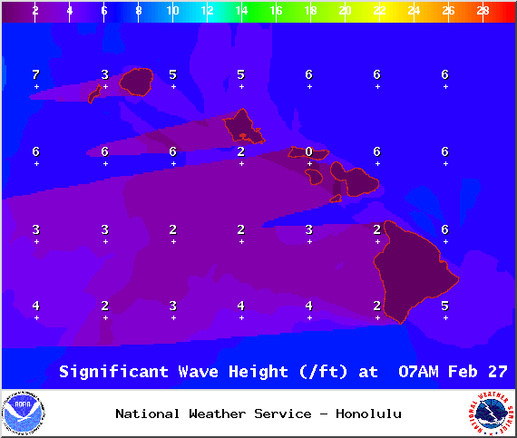
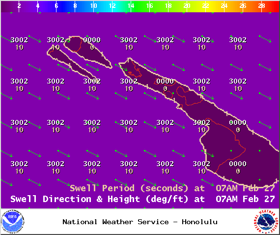
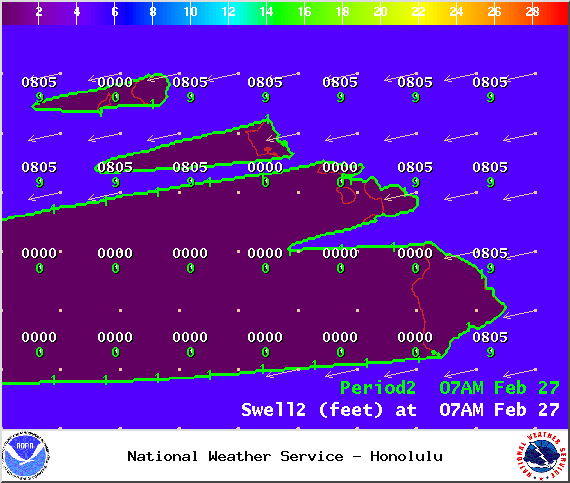
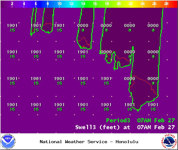
**Click directly on the images below to make them larger. Charts include: Big Island projected winds, tides, swell direction & period and expected wave heights.**
+
SWIPE LEFT OR RIGHT
ARTICLE CONTINUES BELOW AD
ARTICLE CONTINUES BELOW AD
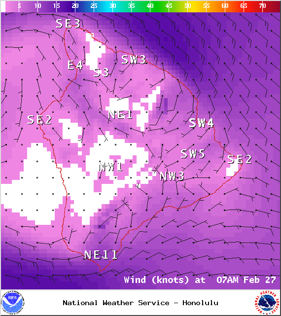
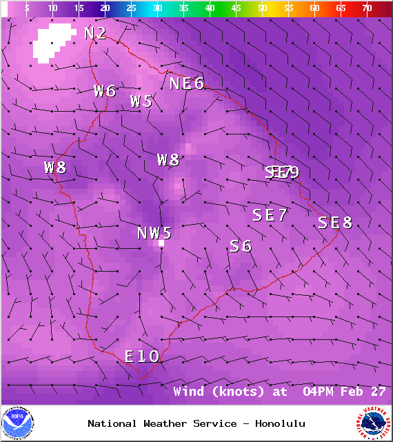
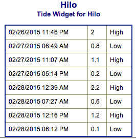
Big Island Surf Forecast
Hilo side: Wave heights from waist to shoulder high are expected.
ARTICLE CONTINUES BELOW AD
Kona side: Wave heights from knee to waist high are expected.
South: Wave heights of knee to waist high are expected.
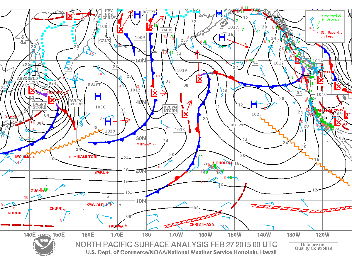
Our current shadowed west-northwest swell fades out further Friday. Short-period northwest shifting swell brings a reinforcement late Friday, holding Saturday before fading out Sunday.
ARTICLE CONTINUES BELOW AD
A northwest swell is expected for first few days of March, peaking late Monday.
Our current south swell is expected to slowly fade through the weekend. Another round is expected for the first week of March but will be inconsistent.
Keep in mind, surf heights are measured on the face of the wave from trough to crest. Heights vary from beach to beach, and at the same beach, from break to break.
This comments section is a public community forum for the purpose of free expression. Although Big Island Now encourages respectful communication only, some content may be considered offensive. Please view at your own discretion. View Comments


 Big Island Surf Forecast
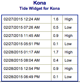 A northwest swell is expected for first few days of March, peaking late Monday.