Hawai’i County Civil Defense reported Wednesday morning that advancement in the downslope areas of the June 27 lava flow continues to show no change.
During its morning overflight assessment, Civil Defense noted that the north margin breakout continues to remain sluggish and widen.
Officials say that “no advancement was noted since Monday morning.” The flow remains about one mile west of Highway 130.
Although the main portions of the flow continue to remain stalled, Civil Defense says that surface breakouts and breakouts along the north and south margins of the flow lead officials to believe that lava is being supplied to the tube system from the source.
ARTICLE CONTINUES BELOW AD
ARTICLE CONTINUES BELOW AD
None of the current lava activity is posing an immediate threat to area communities. Civil Defense, along with Hawaiian Volcano Observatory, will continue to monitor activity and inform the public of any changes.
Light smoke conditions were reported Wednesday morning as a light north wind was blowing smoke in a southeast direction. As usual, these conditions have the possibility of increasing. Those who are sensitive or have a history of respiratory problems should necessary precautions.
+
SWIPE LEFT OR RIGHT
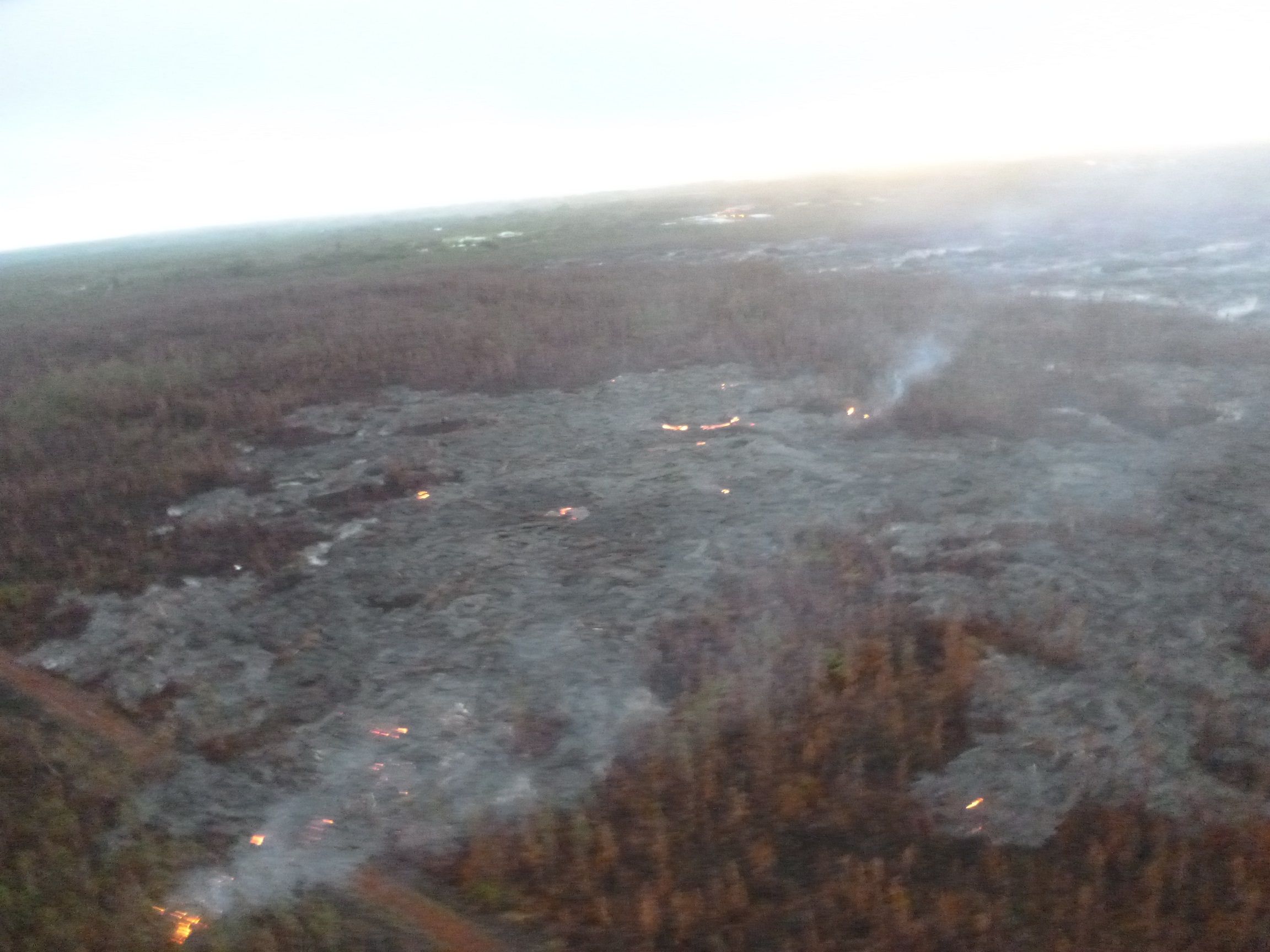
This photo, taken on Feb. 25 at 7 a.m., shows the breakout along north margin, looking down slope towards Highway 130. Hawai’i County Civil Defense photo.
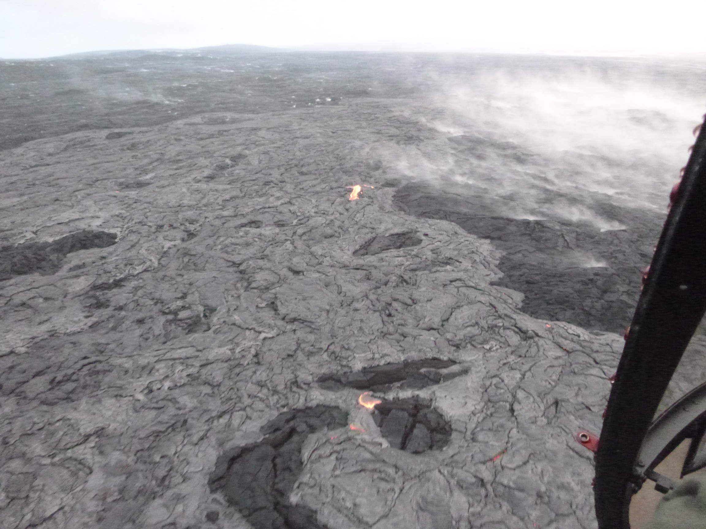
This photo, taken on Feb. 25 at 7 a.m., shows an upslope breakout near vent. Hawai’i County Civil Defense photo.
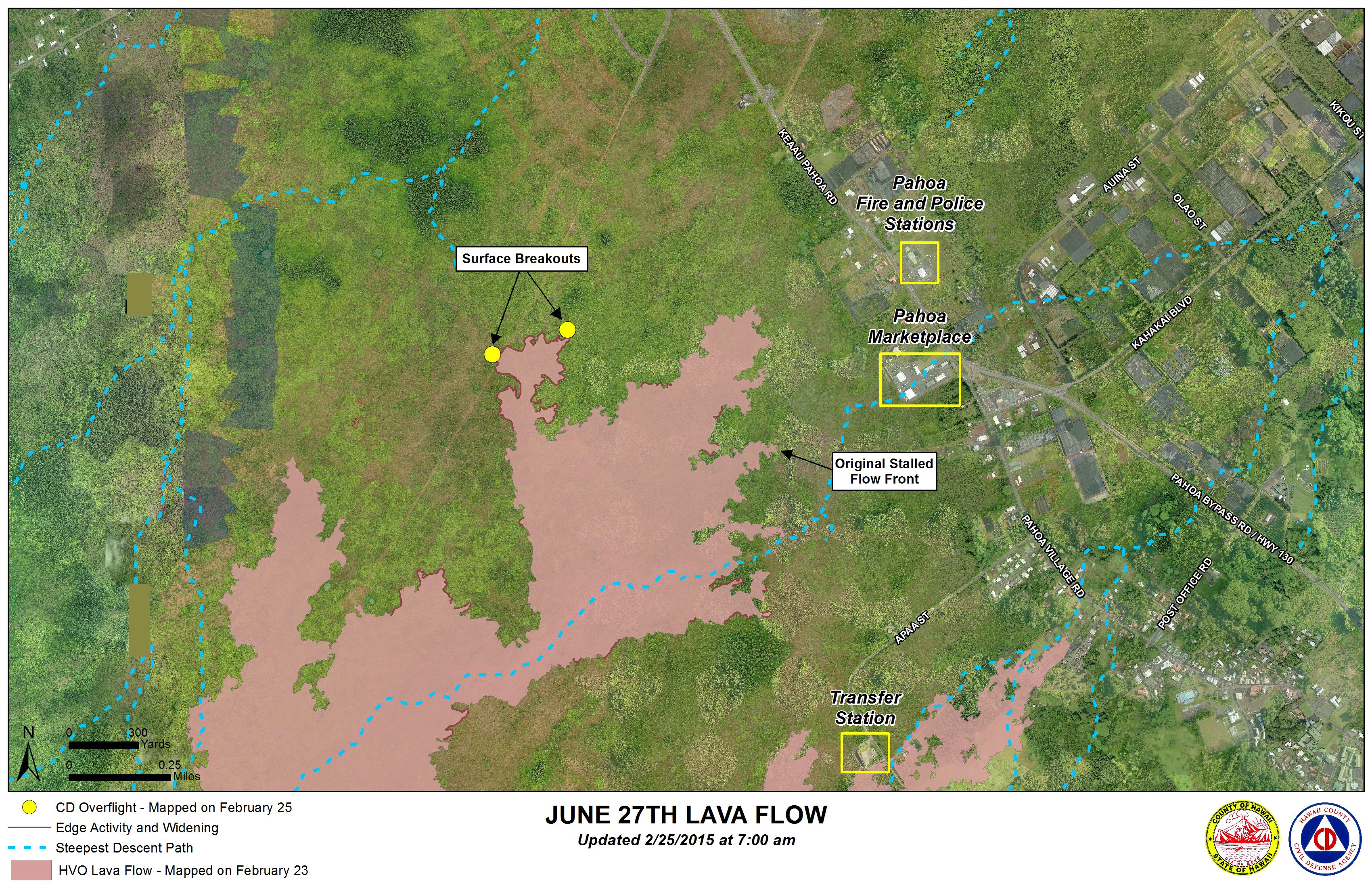
Hawai’i County Civil Defense lava flow map, as of Feb. 25 at 7 a.m. Civil Defense image.
Hawai’i County Civil Defense lava flow map, as of Feb. 25 at 7 a.m. Civil Defense image.
This comments section is a public community forum for the purpose of free expression. Although Big Island Now encourages respectful communication only, some content may be considered offensive. Please view at your own discretion. View Comments