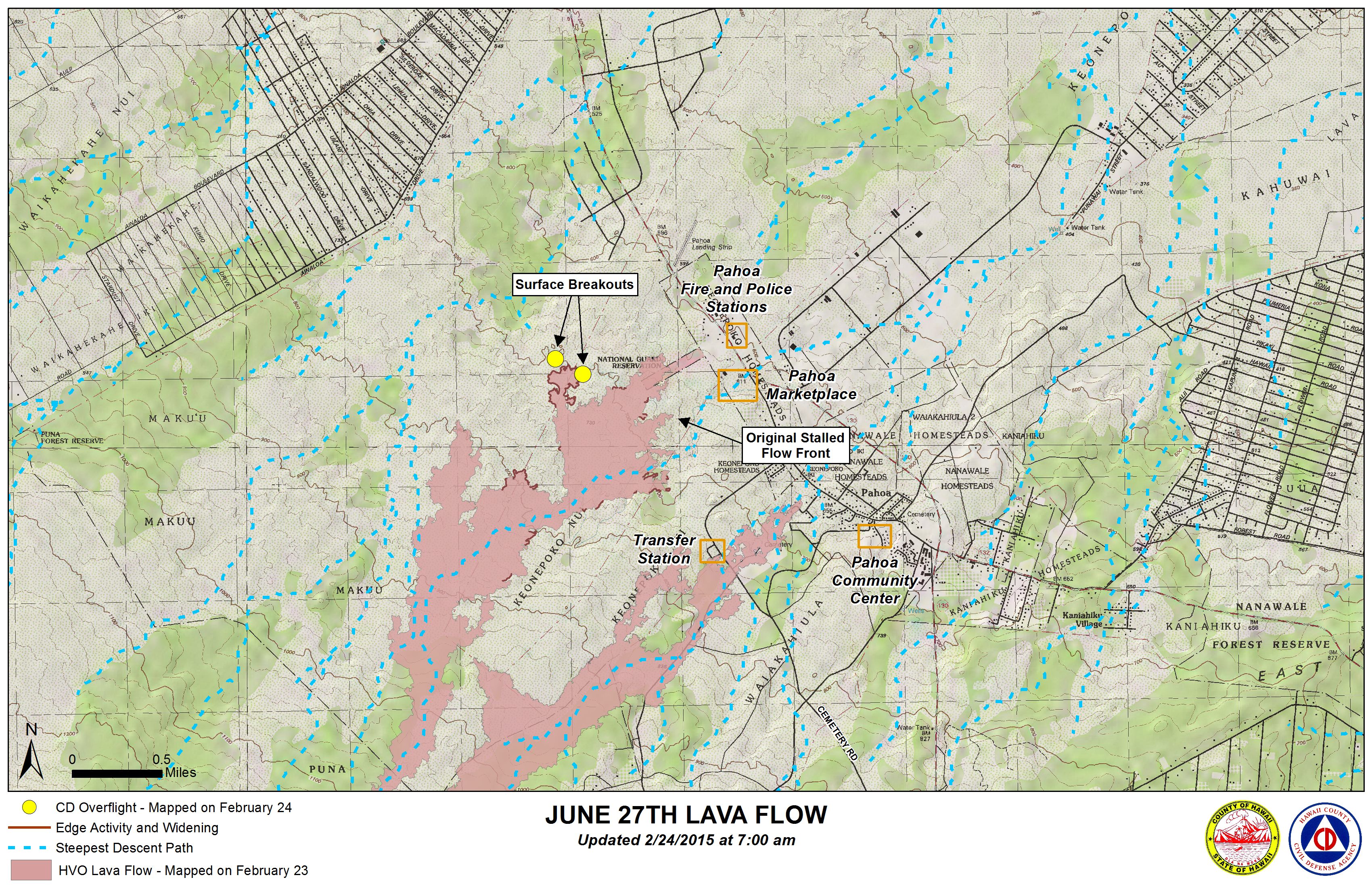
Hawai’i County Civil Defense reported Tuesday morning following its overflight assessment of the June 27 lava flow that no changes have occurred in the downslope areas of the flow.
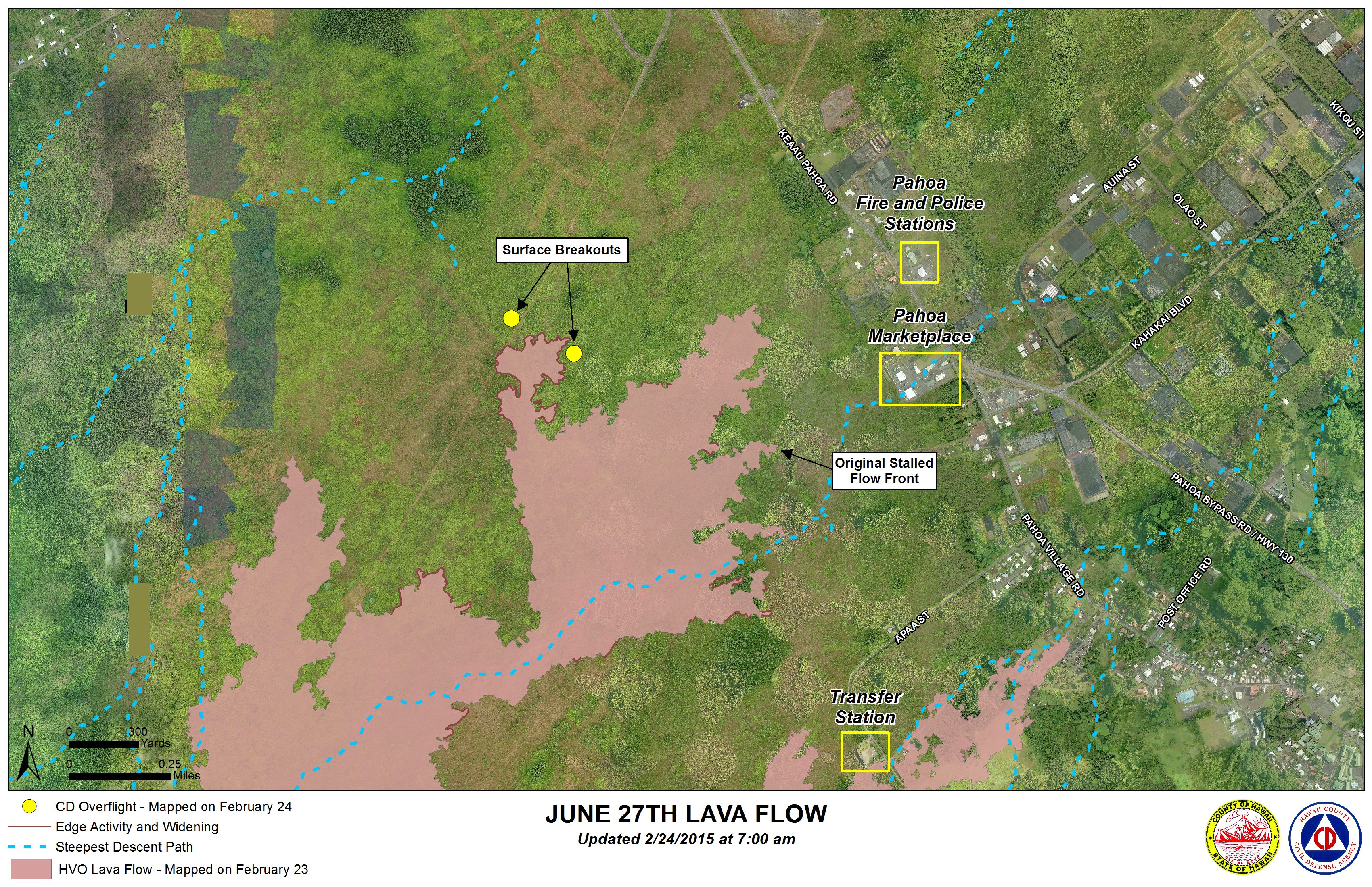
According to Civil Defense, the recent advancing north margin breakout that was located above the original stalled flow front continues to remain active, moving sluggishly and widening. At the current time, the flow remains about one mile west of Highway 130 and no advancement has been observed.
Although downslope areas of the flow remain stalled and activity varies, Civil Defense noted that surface breakouts and breakouts along each of the margins provide indication that lava continues to be supplied through the tube system from the source and is traveling downslope.
None of the lava flow activity is posing a current threat to communities in the area. Civil Defense, along with Hawaiian Volcano Observatory, will continue to monitor conditions and inform the public of any changes.
ARTICLE CONTINUES BELOW AD
ARTICLE CONTINUES BELOW AD
Light smoke conditions were reported Tuesday morning as a light north wind was blowing smoke in a southeast direction. As usual, these conditions have the possibility of increasing. Those who have respiratory issues are advised to take necessary precautions.
+
SWIPE LEFT OR RIGHT
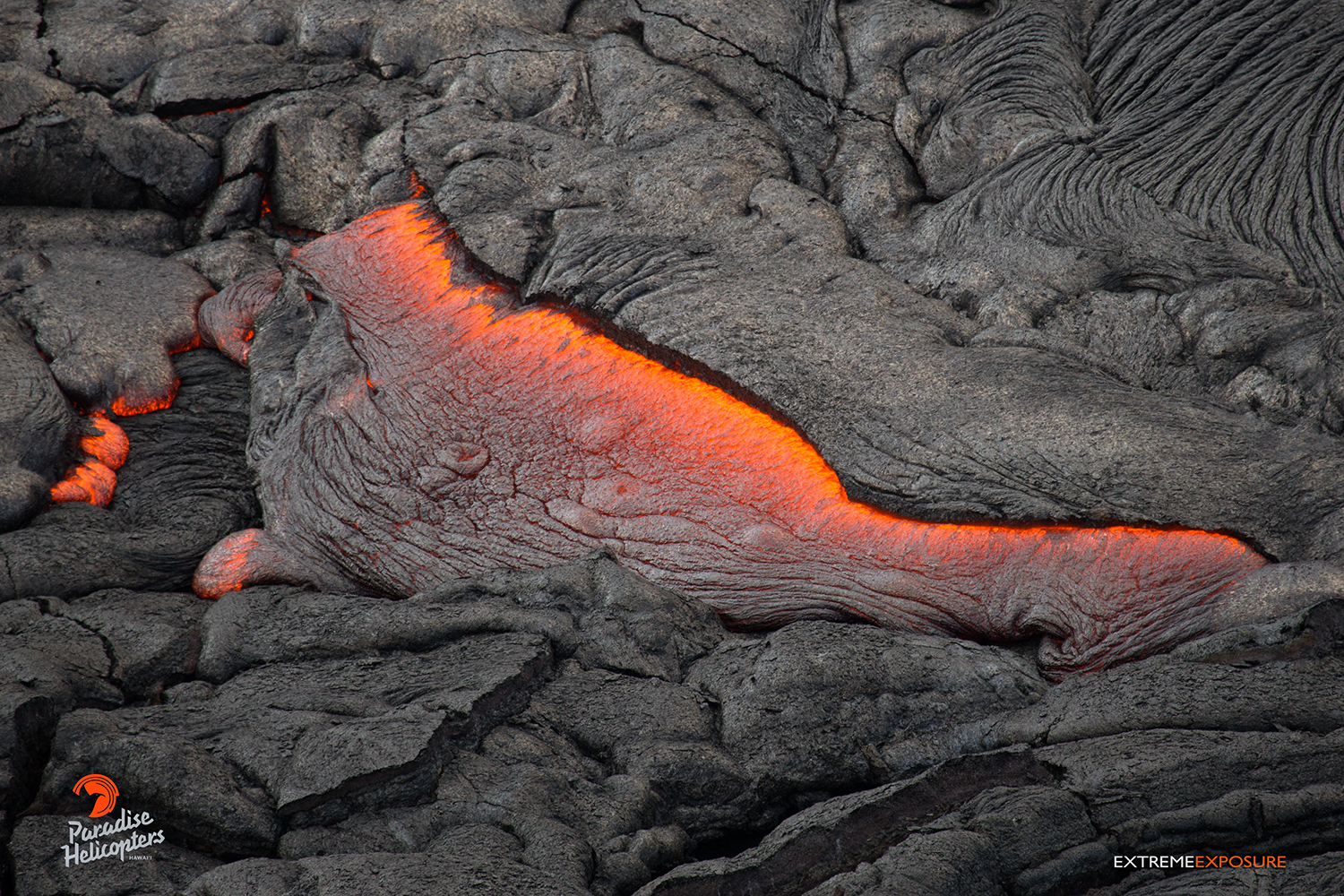
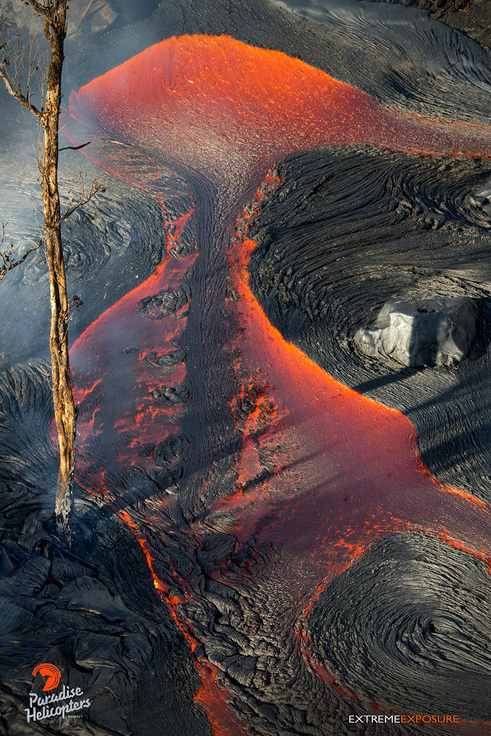
In this photo, taken Feb. 24 at 8 a.m., a tongue of lava oozes from beneath the hardened crust of the flow. Photo credit: Extreme Exposure Media/Paradise Helicopters.
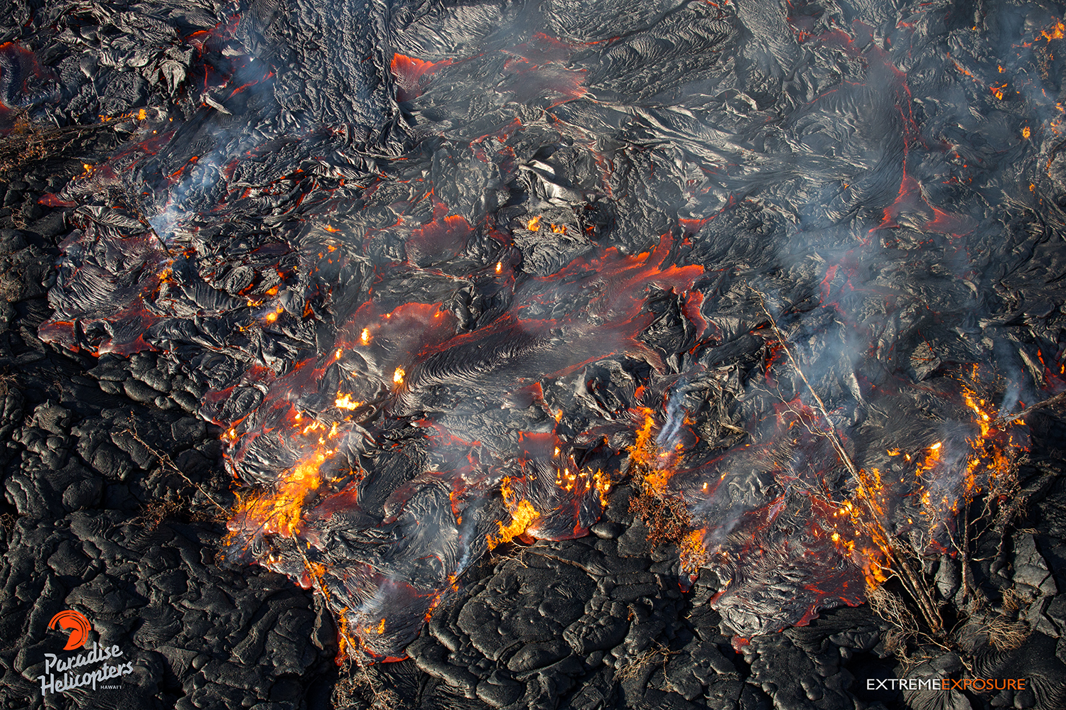
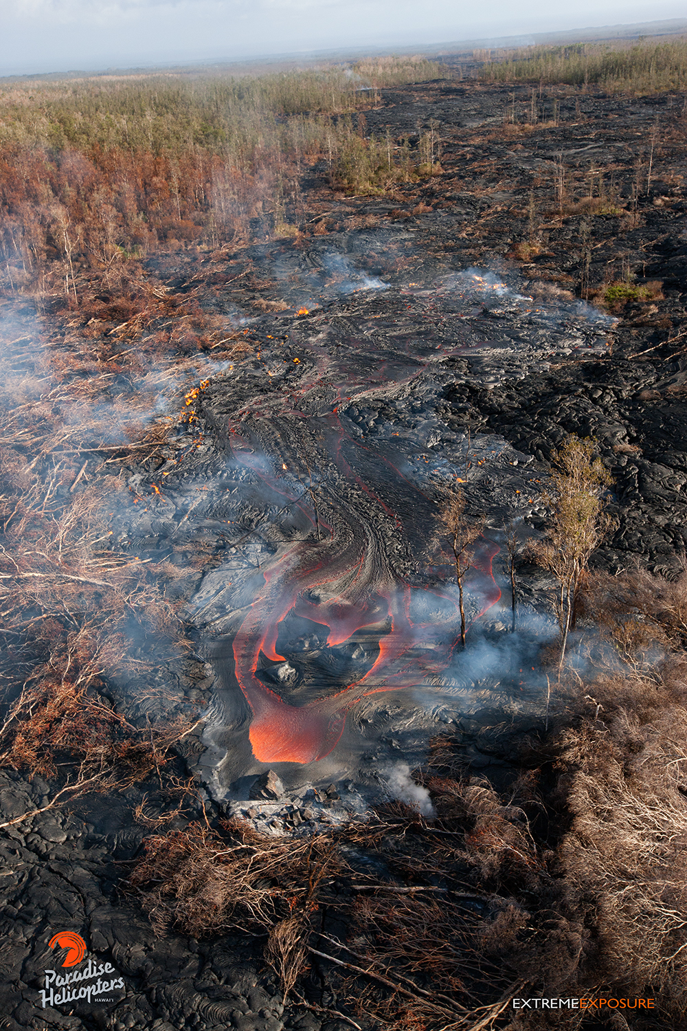
In this photo, taken Feb. 23 at 8 a.m., lava consumes toppled trees as it adds another layer of rock in the middle of the flow field. Photo credit: Extreme Exposure Media/Paradise Helicopters.
In this photo, taken Feb. 23, multiple streams of lava pour out of a breakout from the tube system about a half mile downslope of the old geothermal pad. Photo credit: Extreme Exposure Media/Paradise Helicopters.
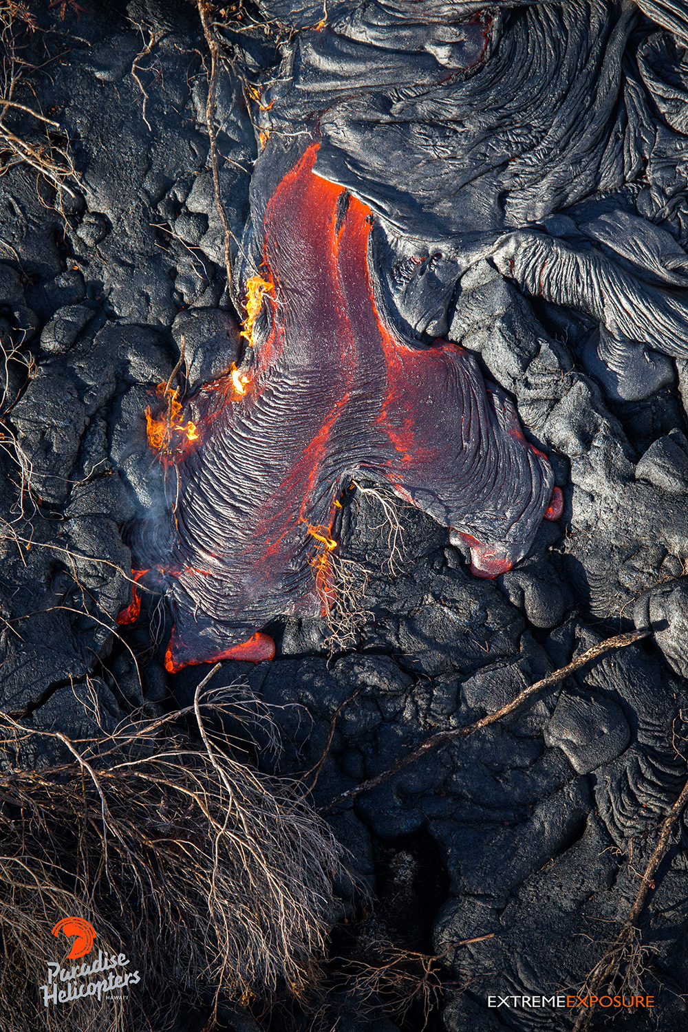
In this photo, taken Feb. 24 at 8 a.m., a leathery toe of lava ignites the dried branches of toppled trees on the flow field. Photo credit: Extreme Exposure Media/Paradise Helicopters.
In this photo, taken Feb. 23 at 8 a.m., a closer look at the large breakout just downslope of the old geothermal pad. Photo credit: Extreme Exposure Media/Paradise Helicopters.
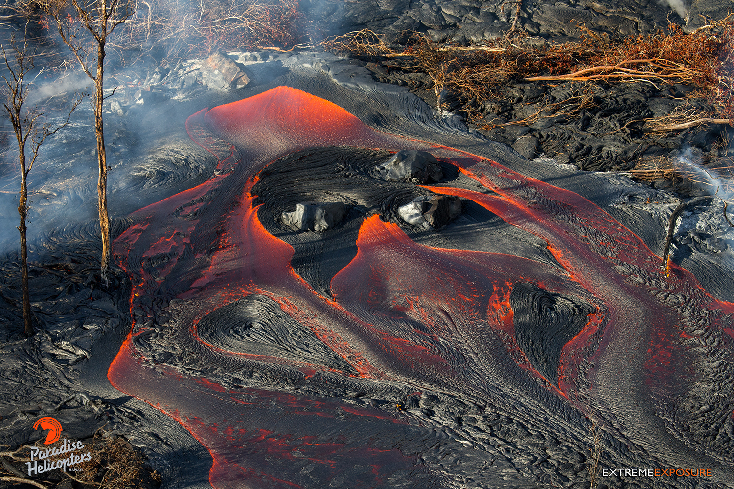
In this photo, taken Feb. 23 at 8 a.m., a large breakout, about a half mile downslope of the old geothermal pad, poured lava onto the middle of the flow field. Photo credit: Extreme Exposure Media/Paradise Helicopters.
In this photo, taken Feb. 23 at 8 a.m., a large breakout, about a half mile downslope of the old geothermal pad, poured lava onto the middle of the flow field. Photo credit: Extreme Exposure Media/Paradise Helicopters.
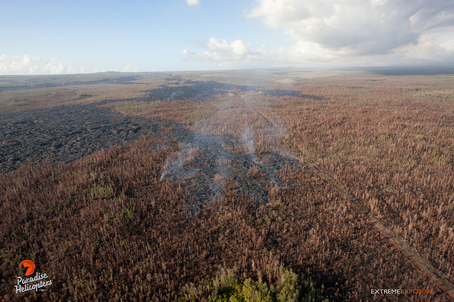
This photo, taken Feb. 23 at 8 a.m., shows a lobe to the north that has progressed and widened the flow field. Photo credit: Extreme Exposure Media/Paradise Helicopters.
In this photo, taken Feb. 23 at 8 a.m., a large breakout, about a half mile downslope of the old geothermal pad, poured lava onto the middle of the flow field. Photo credit: Extreme Exposure Media/Paradise Helicopters.
This photo, taken Feb. 23 at 8 a.m., shows a lobe to the north has progressed and widened the flow field. Photo credit: Extreme Exposure Media/Paradise Helicopters.
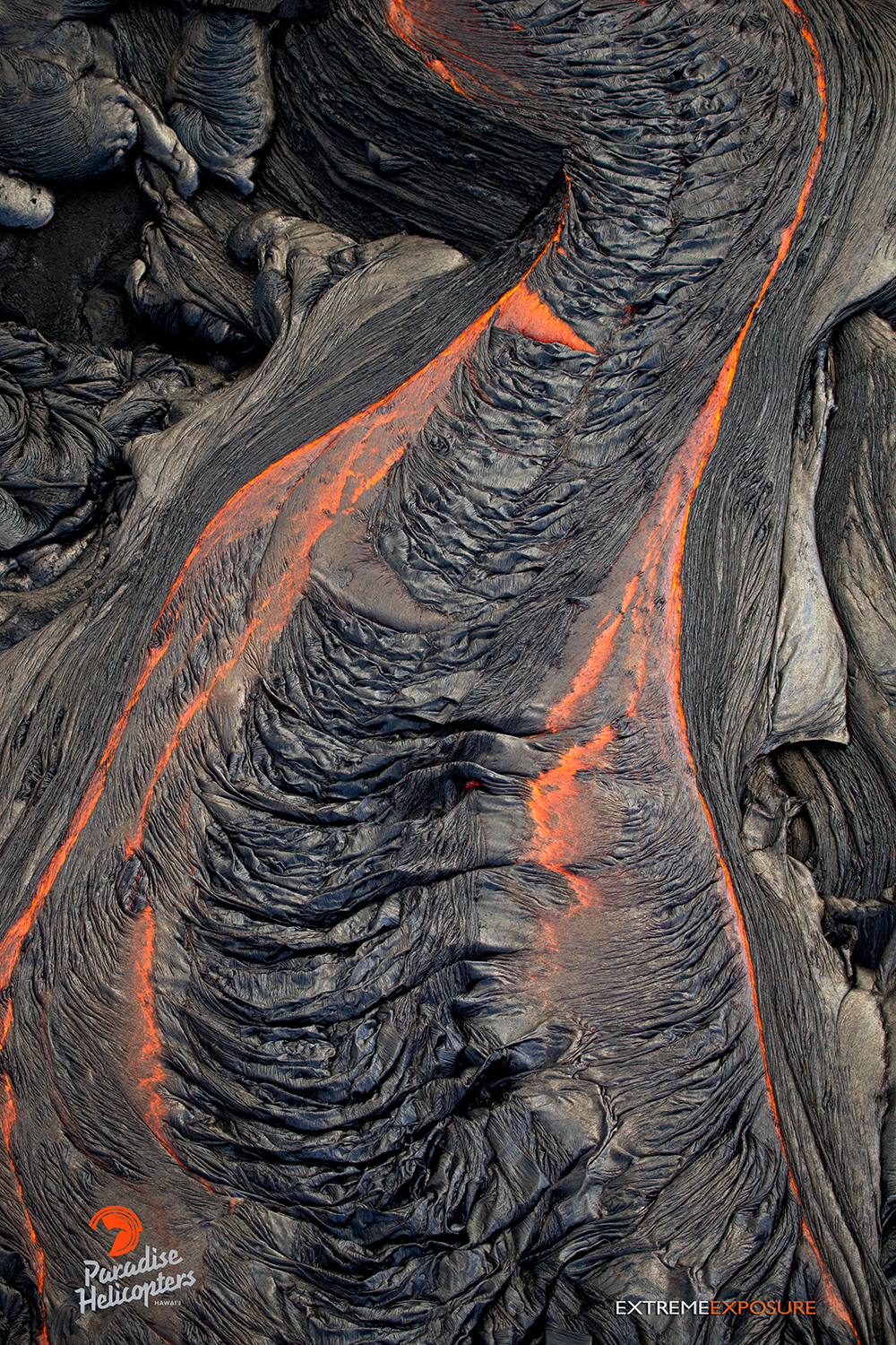
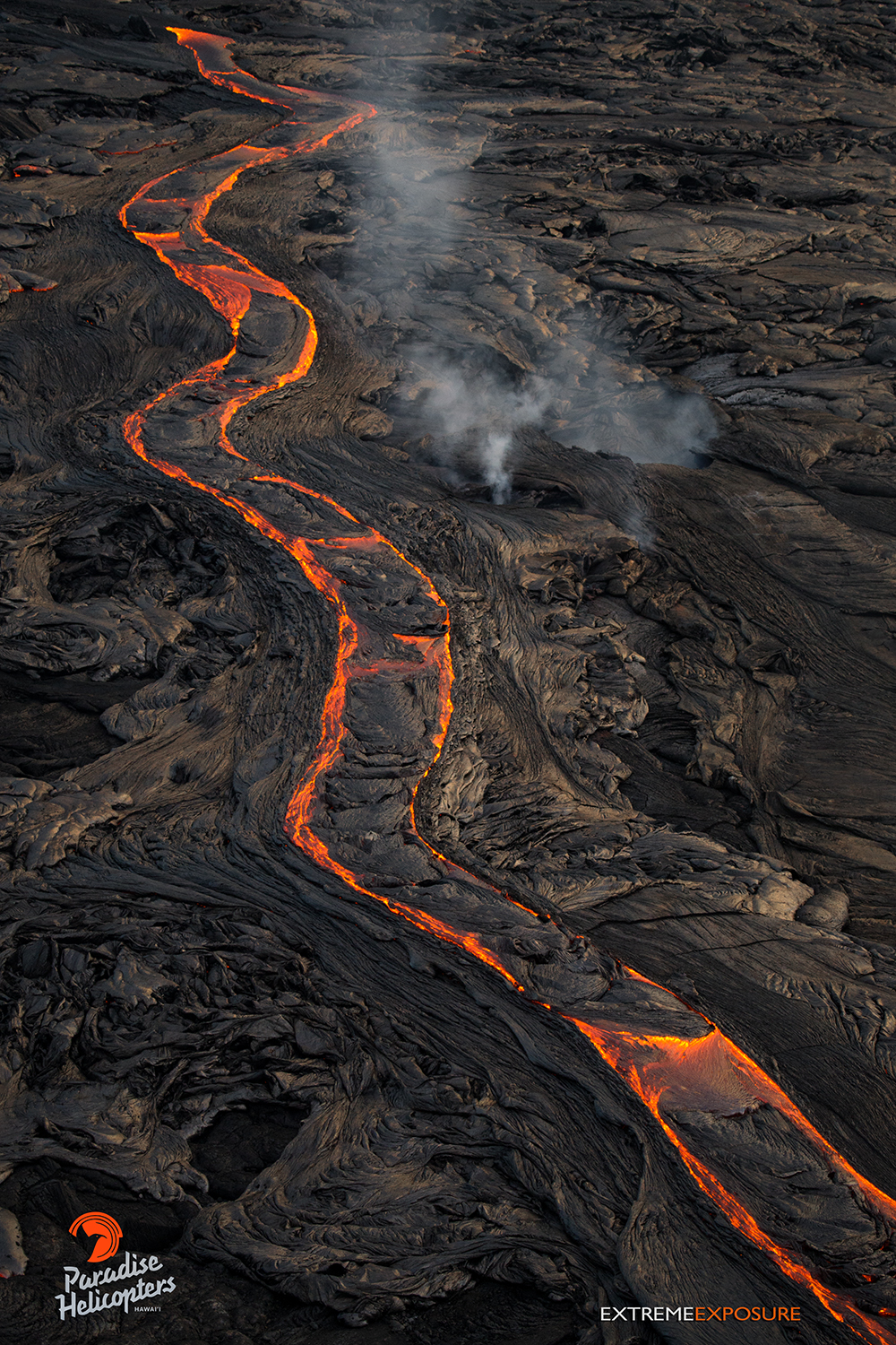
This photo, taken Feb. 23 at 6 p.m., shows the surface of a large river of lava cooling into folds that resemble a wrinkled sheet. Photo credit: Extreme Exposure Media/Paradise Helicopters.
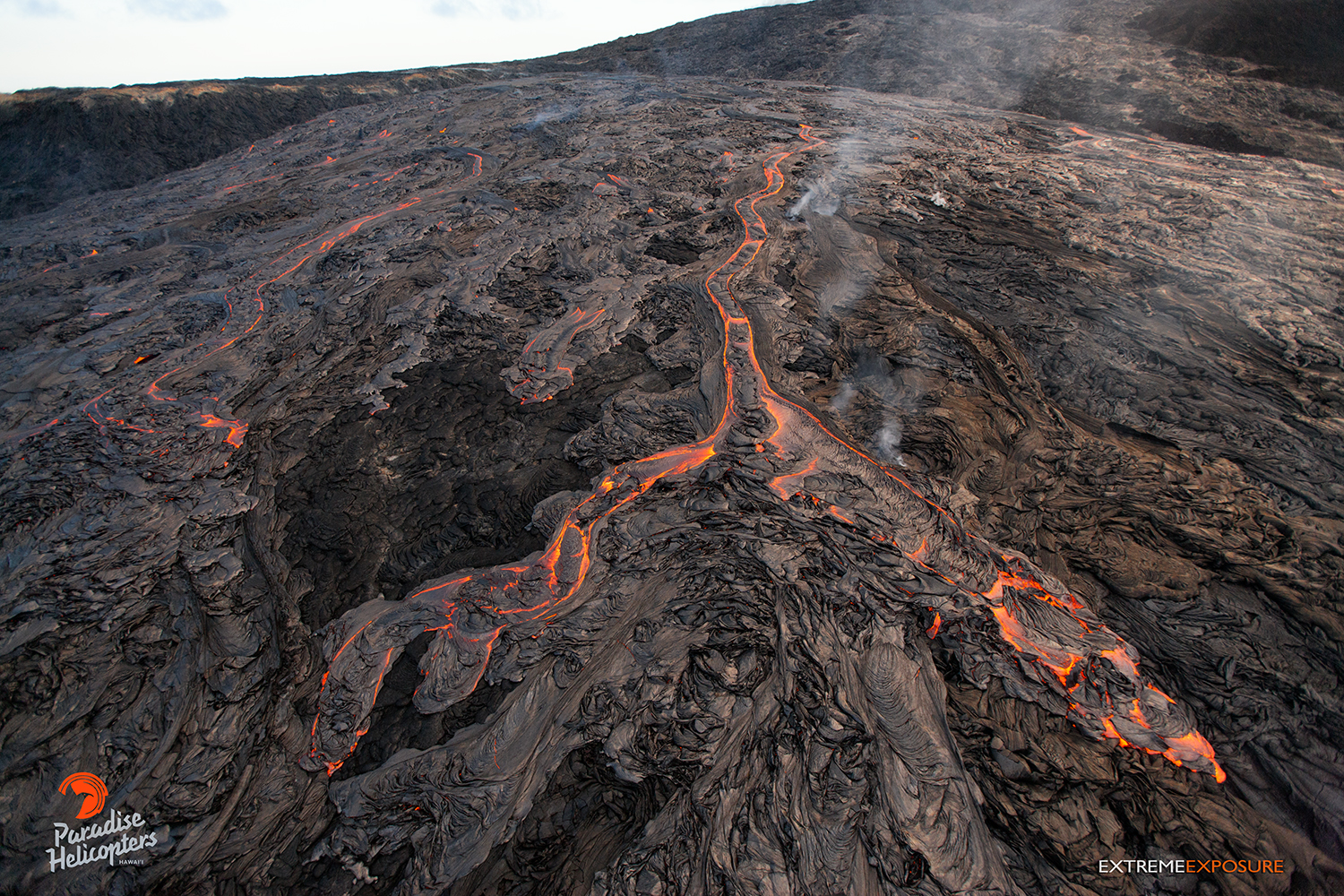
This photo, taken Feb. 23 at 6 p.m., shows a long river of lava snaking down the north flank of Pu‘u ‘O‘o. Photo credit: Extreme Exposure Media/Paradise Helicopters.
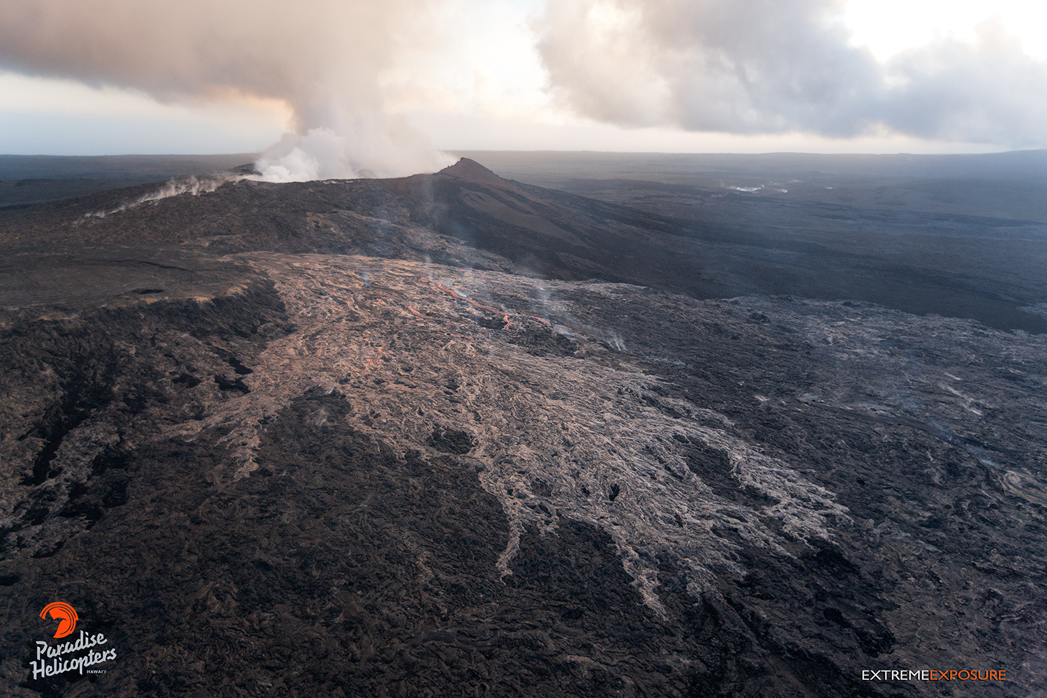
This photo, taken Feb. 23 at 6 p.m., shows a large flow (lighter colored area), approximately 1/4 mile long, that had erupted from a point between Pu‘u ‘O‘o and the perched pond, covering a large portion of the north flank. And, while most of the flow had crusted over, several large rivers of lava were still visible, and many little hotspots existed. Photo credit: Extreme Exposure Media/Paradise Helicopters.
This photo, taken Feb. 23 at 6 p.m., shows a large flow (lighter colored area), approximately 1/4 mile long, that had erupted from a point between Pu‘u ‘O‘o and the perched pond, covering a large portion of the north flank. And, while most of the flow had crusted over, several large rivers of lava were still visible, and many little hotspots existed. Photo credit: Extreme Exposure Media/Paradise Helicopters.
This photo, taken Feb. 23 at 6 p.m., shows a large flow (lighter colored area), approximately 1/4 mile long, that had erupted from a point between Pu‘u ‘O‘o and the perched pond, covering a large portion of the north flank. And, while most of the flow had crusted over, several large rivers of lava were still visible, and many little hotspots existed. Photo credit: Extreme Exposure Media/Paradise Helicopters.
This photo, taken Feb. 23 at 6 p.m. shows several large rivers of lava still flowing and numerous little breakouts. Photo credit: Extreme Exposure Media/Paradise Helicopters.
Hawai’i County Civil Defense lava flow map, as of Feb. 24 at 7 a.m. Civil Defense image.
Hawai’i County Civil Defense lava flow map, as of Feb. 24 at 7 a.m. Civil Defense image.
Hawai’i County Civil Defense lava flow map, as of Feb. 23 at 7 a.m. Civil Defense image.
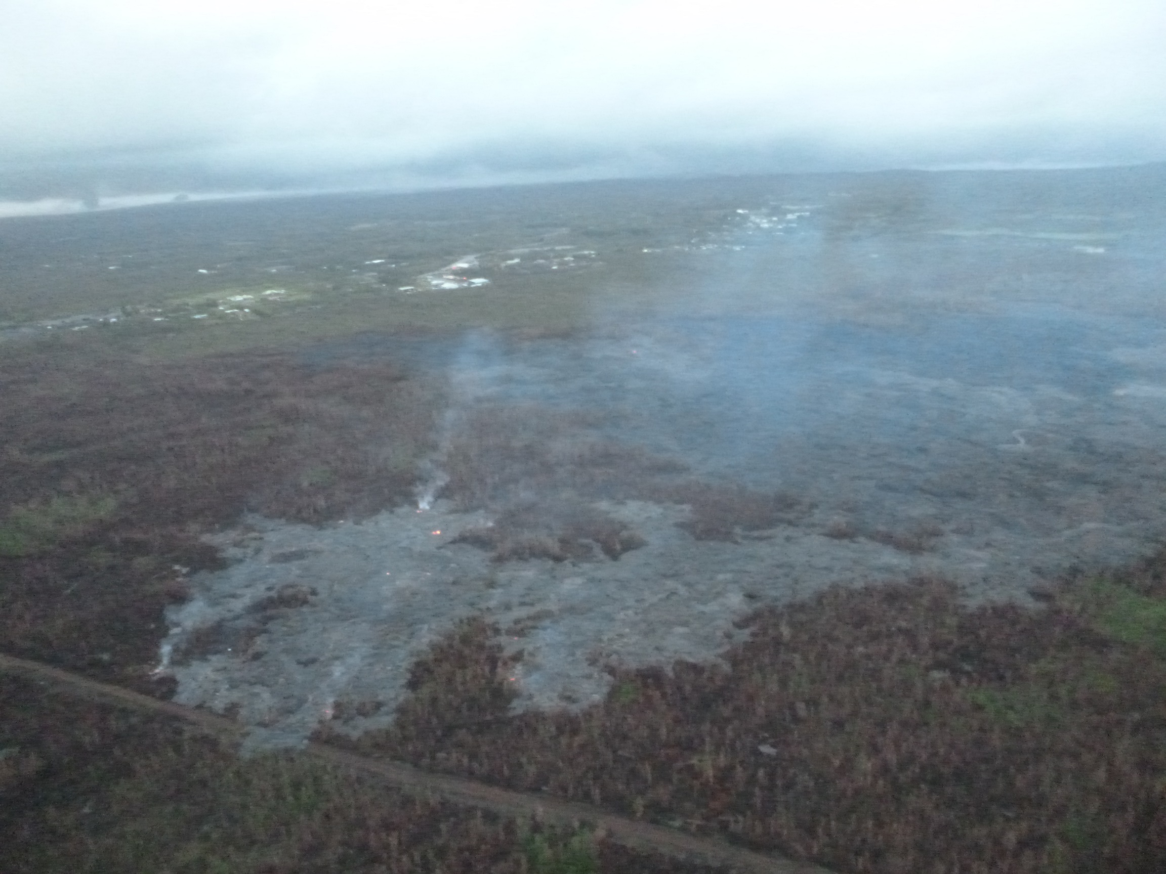
This photo, taken Feb. 24, shows a breakout along the north margin of the June 27 lava flow, looking down slope towards Highway 130. Civil Defense photo.
This comments section is a public community forum for the purpose of free expression. Although Big Island Now encourages respectful communication only, some content may be considered offensive. Please view at your own discretion. View Comments