A High Surf Advisory is posted for the west side from 6:00 a.m. Friday through 6:00 p.m. Saturday. Expect strong breaking waves, shore break and strong longshore and rip currents making swimming difficult and dangerous.
A Small Craft Advisory is in effect for Big Island windward waters and the Alenuihaha Channel through 6:00 a.m. Saturday. Inexperienced mariners should avoid navigating in these conditions.
A High Wind Warning is posted for the summits of Mauna Kea and Mauna Loa until 6:00 p.m. Saturday for west winds from 35 to 60 mph, gusting to over 80 mph. High winds make driving dangerous. Please delay travel to the summit areas until the wind subsides.
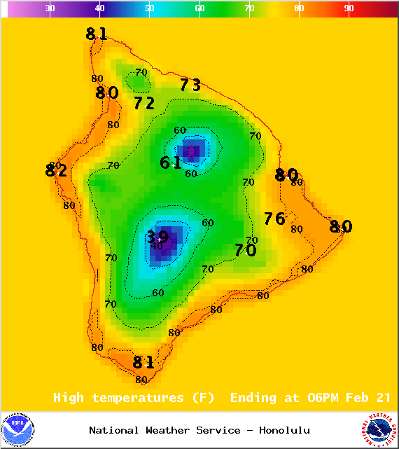
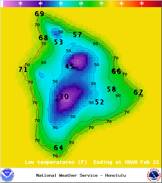
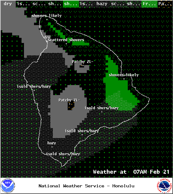
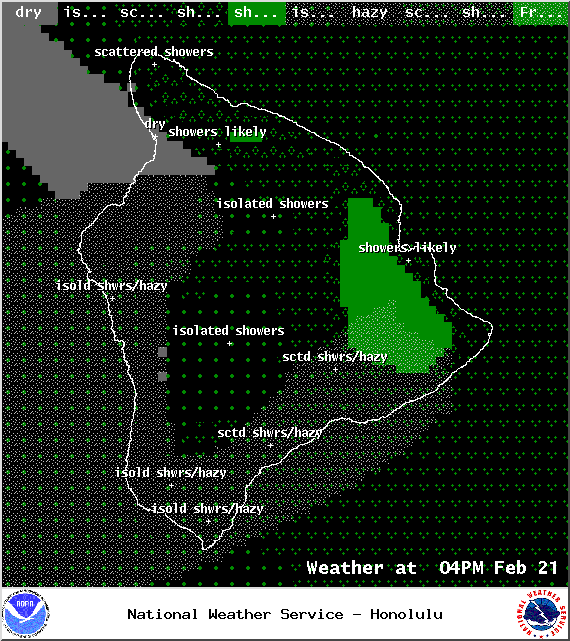
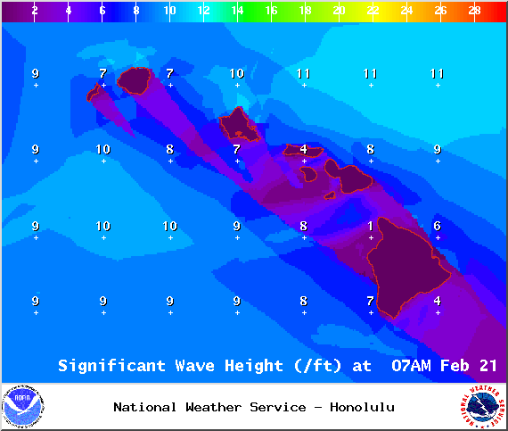
**Click directly on the images below to make them larger. Charts include: Big Island high/low forecasted temperatures, projected winds, chance of cloud cover, projected localized weather conditions, vog/SO2 forecast and expected wave heights.**
+
SWIPE LEFT OR RIGHT
ARTICLE CONTINUES BELOW AD
ARTICLE CONTINUES BELOW AD
Today
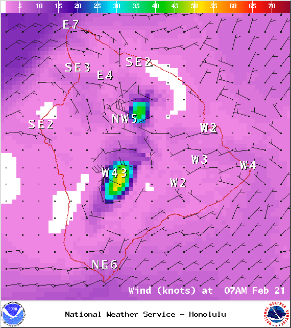
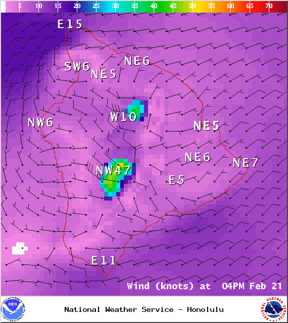
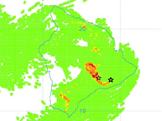
Today windward spots are expected to be mostly cloudy with numerous showers. The Kona side is forecasted to get morning sunshine and afternoon cloud cover. Hazy skies are expected for much of the Big Island (see UHSOEST vog model above). The rain will help to clear some of that vog out. Variable winds are forecasted from 10 to 15 mph. In the afternoon winds are expected to shift out of the northeast around 15 mph. High temperatures should fall in the range of 78° to 83°.
UV index at 7 (“high” exposure level)
Tonight
ARTICLE CONTINUES BELOW AD
Mostly cloudy skies are expected on the windward side with numerous showers. Leeward spots will get partly cloudy skies and isolated showers. Northeast winds are forecasted from 10 to 15 mph becoming light and variable. Low temperatures from 67° to 72° are expected.
Next Full Moon: 8:06 a.m. on Mar. 5
Sunday
Windward spots are expected to be mostly cloudy with numerous showers. The Kona side is forecasted to get partly cloudy skies and isolated showers. Winds are expected out of the east around 15 mph. High temperatures from 79° to 85° and low temperatures from 68° to 73°.
ARTICLE CONTINUES BELOW AD
Looking Ahead
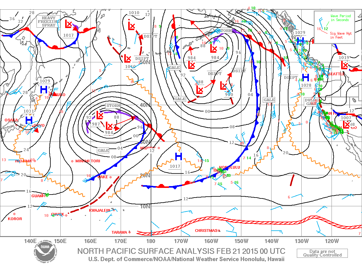
A weakening front is forecasted to stall and dissipate near the Big Island on Saturday. Strong winds are expected to continue over the Big Island summits. Remnant moisture from the old front will be drawn back northwest across the state Sunday through Monday as another front stalls several hundred miles northwest of Kauai. Drier trade wind weather is expected during the middle of next week. A front slowly approaching from the northwest and tropical moisture approaching from the southeast may bring unsettled weather to the state by late next week.
This comments section is a public community forum for the purpose of free expression. Although Big Island Now encourages respectful communication only, some content may be considered offensive. Please view at your own discretion. View Comments