A High Surf Advisory is posted for the west side from 6:00 a.m. Friday through 6:00 p.m. Saturday. Expect strong breaking waves, shore break and strong longshore and rip currents making swimming difficult and dangerous.
A Small Craft Advisory is in effect for Big Island windward waters and the Alenuihaha Channel through 6:00 a.m. Saturday. Inexperienced mariners should avoid navigating in these conditions.
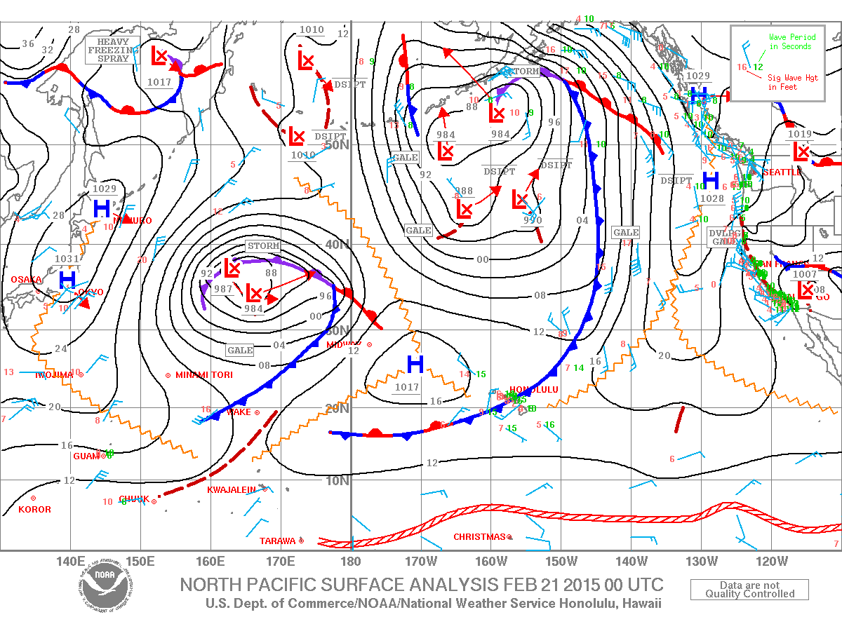
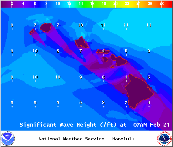
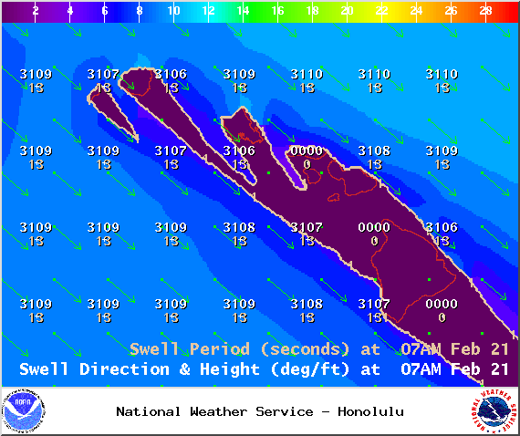
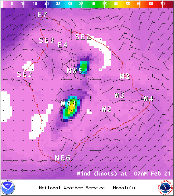
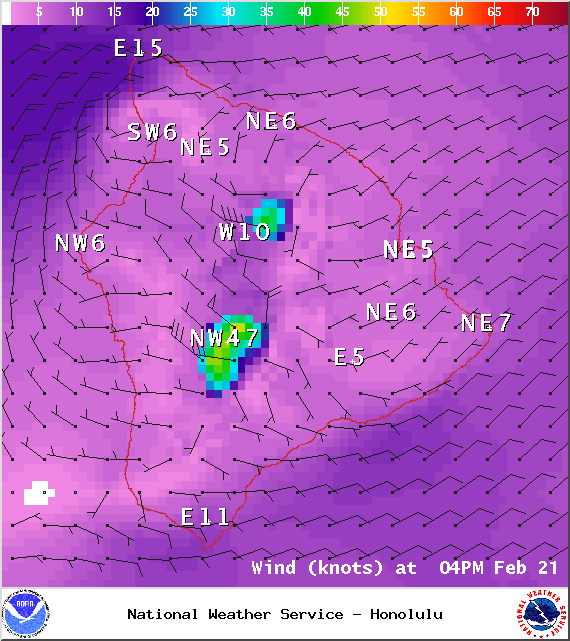
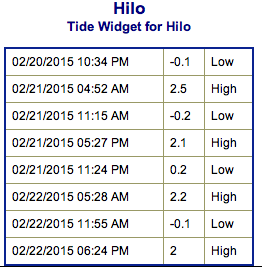
**Click directly on the images below to make them larger. Charts include: Big Island projected winds, tides, swell direction & period and expected wave heights.**
+
SWIPE LEFT OR RIGHT
ARTICLE CONTINUES BELOW AD
ARTICLE CONTINUES BELOW AD
Big Island Surf Forecast
Hilo side: Wave heights chest to head high today, maybe bigger at the best spots on the sets. Surf expected to fade through the afternoon.
Kona side: Wave heights from chest high to overhead are expected with larger waves possible at the best breaks on the sets, especially early in the day.
ARTICLE CONTINUES BELOW AD
South: Wave heights of chest high to overhead are expected for spots catching the west-northwest. A small south-southwest swell could get up to waist high on the sets.
Our current west-northwest swell is expected to peak into early Saturday morning with waves a few feet overhead on the sets. The swell should peak slightly overhead for the northeast side Sunday when the swell shifts. The swell will fade late Saturday through early next week.
Another west-northwest is possible for the middle of next week, expected to peak on Wednesday.
Only small SSW for now but a fun sized swell is possible the middle of next week.
ARTICLE CONTINUES BELOW AD
Keep in mind, surf heights are measured on the face of the wave from trough to crest. Heights vary from beach to beach, and at the same beach, from break to break.
This comments section is a public community forum for the purpose of free expression. Although Big Island Now encourages respectful communication only, some content may be considered offensive. Please view at your own discretion. View Comments


 Big Island Surf Forecast
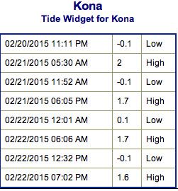 Our current west-northwest swell is expected to peak into early Saturday morning with waves a few feet overhead on the sets. The swell should peak slightly overhead for the northeast side Sunday when the swell shifts. The swell will fade late Saturday through early next week.