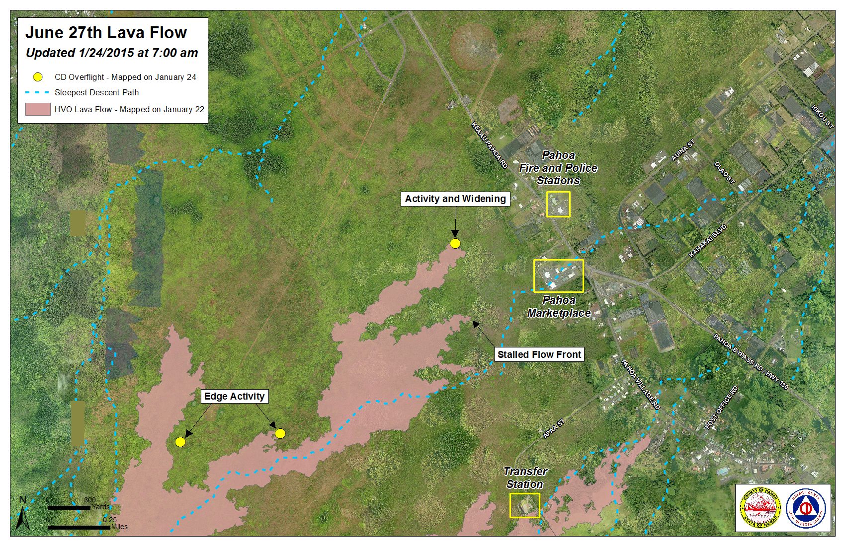
The north margin breakout of the June 27 lava flow continues to show very little activity, according to Hawai’i County Civil Defense.
Following its Saturday morning overflight, Civil Defense noted that although the flow continues to be active and widening, advancement over the past three days has not been substantial.
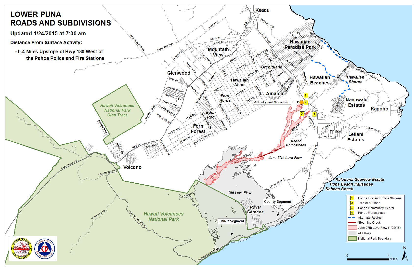
At the current time, the flow remains 0.4 miles from Highway 130 to the west of the Pahoa Police and Fire Stations.
Civil Defense also said that the original flow front that was nearing the Pahoa Marketplace just a handful of weeks ago and the south margin break that was also active during that time both continue to remain stalled.
ARTICLE CONTINUES BELOW AD
ARTICLE CONTINUES BELOW AD
Two additional breakouts that have been monitored, located 1-1.5 miles from the stalled flow front, have also shown little signs of activity and no forward advancement. Other breakouts have been noticed in the upslope areas along both margins of the flow, as well as within the flow pad.
At the current time, Civil Defense says there is no threat to communities in the area, and that they, along with Hawaiian Volcano Observatory, will continue to monitor the flow.
After numerous fire breakouts in the past two weeks, Hawai’i Fire Department personnel remain on scene with equipment monitoring fire conditions. Fires have all been contained within the breaks and burning activity is limited to hot spots and flare ups. There is no fire threat to area residents or properties.
ARTICLE CONTINUES BELOW AD
Light to moderate smoke conditions were reported Saturday morning as a light northwest wind was blowing smoke in a southeast direction. As usual, there is the possibility for these conditions to change and those who are sensitive should take necessary precautions.
+
SWIPE LEFT OR RIGHT
Hawai’i County Civil Defense lava flow map, as of Jan. 24 at 7 a.m. Civil Defense photo.
Hawai’i County Civil Defense lava flow map, as of Jan. 24 at 7 a.m. Civil Defense photo.
This comments section is a public community forum for the purpose of free expression. Although Big Island Now encourages respectful communication only, some content may be considered offensive. Please view at your own discretion. View Comments