The northern most distal tip of the active and advancing June 27 lava flow has been observed by Hawai’i County Civil Defense as stalled for the second day in a row.
During its morning overflight, Civil Defense noted that the breakout advancing from the north side of the flow continues to remain active and shows signs of widening, however is proving to be sluggish with little advancement since Wednesday.
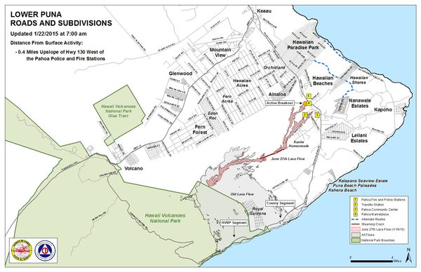
This portion of the lava flow was last active between Monday to Tuesday mornings, where it advanced about 15 yards. The leading edge of the breakout is about 0.4 miles from Highway 130 to the west of the Pahoa Police and Fire Stations.
In addition to the stalled advancement in the most recent moving portion of the flow in the downslope area, Civil Defense reported that the original flow front and south margin breakout both also continue to remain stalled.
ARTICLE CONTINUES BELOW AD
ARTICLE CONTINUES BELOW AD
The two breakouts located along the north margin and located about 1-1.5 miles upslope from the stalled original flow front were noted as showing little activity and no signs of advancement.
Additional breakouts were seen during Civil Defense’s morning overflight assessment in areas along both margins of the flow, as well as within the flow pad.
Despite numerous areas of activity and flow uncertainty, Civil Defense ensures the public that none of the current activity poses a threat to communities in the area. Civil Defense, along with Hawaiian Volcano Observatory, is committed to maintaining a watchful eye on the flow and its activity and will continue to keep the public informed.
ARTICLE CONTINUES BELOW AD
Fire conditions that caused brush fires last week remain contained within the fire break areas. Hawai’i Fire Department personnel continue to monitor conditions and remain on scene. Burning is limited to hot spots and flare ups within those fire perimeters and there is currently no threat to residents or property.
Smoke conditions have slightly improved over the past week as they were reported Thursday morning as light to moderate, as a light southwest wind was blowing the smoke in a northeast direction. As usual, these conditions have the potential to change and those who are sensitive or have respiratory issues should take necessary precautions and stay inside.
A Pahoa community lava meeting will be held Thursday evening at the Pahoa High School cafeteria, beginning at 6:30 p.m.
+
SWIPE LEFT OR RIGHT
This photo, taken on Jan. 21, shows a substantial breakout that was active about 4 miles downslope of Pu‘u ‘O‘o crater, spilling lava in the middle of the flow field. Photo credit: Extreme Exposure/Paradise Helicopters.
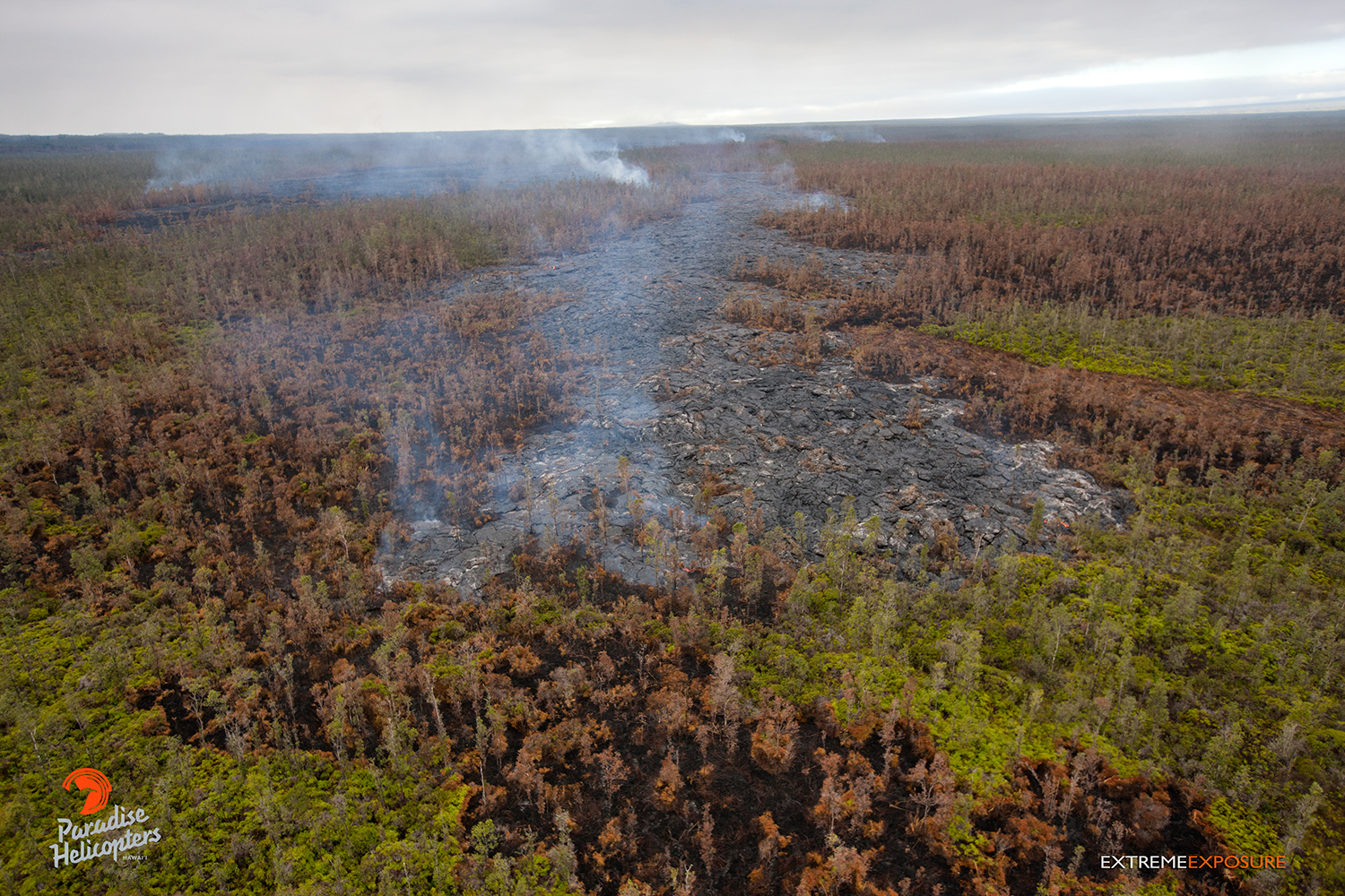
This photo, taken on Jan. 21, shows numerous breakouts that were visible in the general vicinity just upslope of the distal tip. Photo credit: Extreme Exposure/Paradise Helicopters.
This photo, taken Jan. 21, shows one of numerous breakouts that were visible in the general vicinity just upslope of the distal tip. Photo credit: Extreme Exposure/Paradise Helicopters.
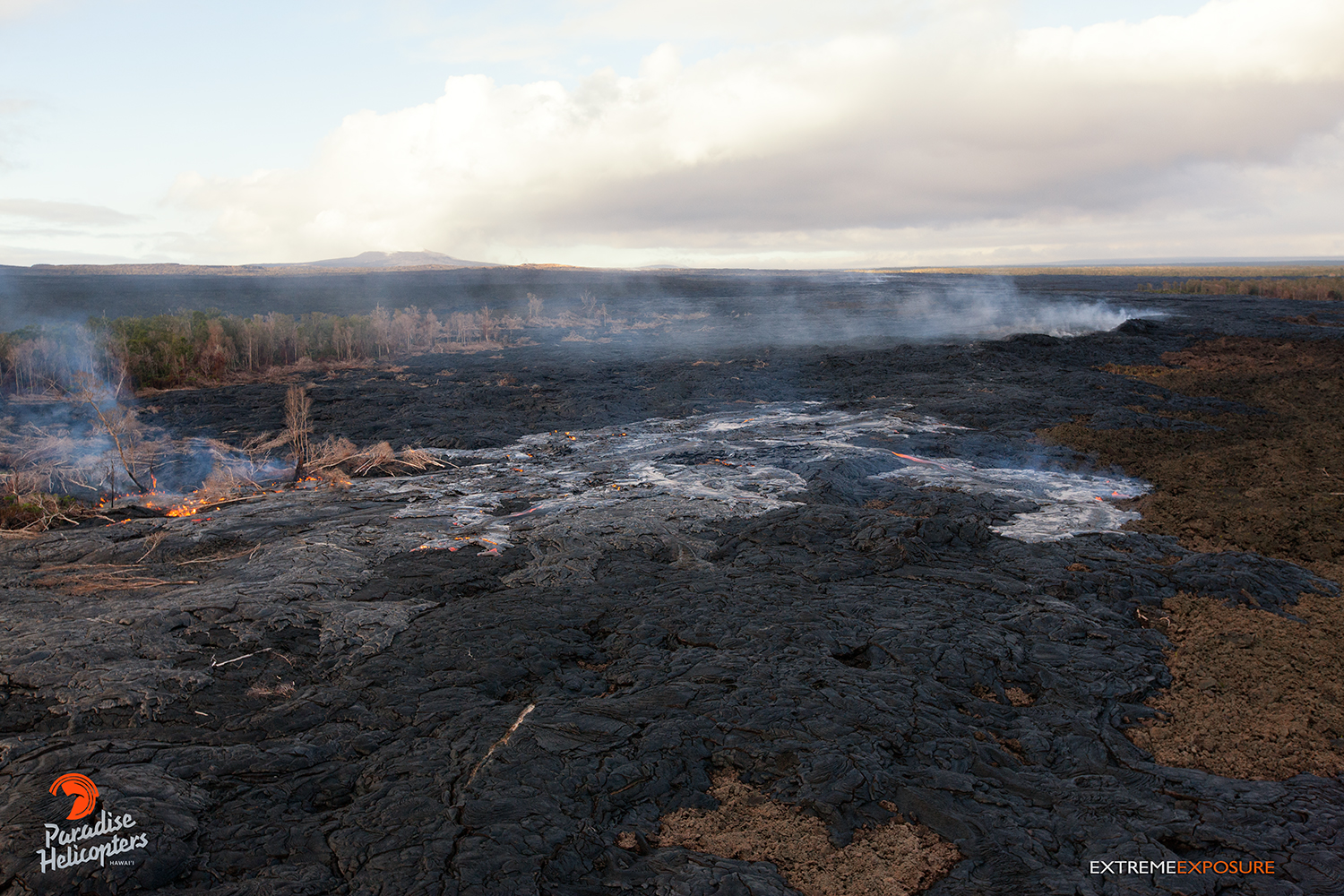
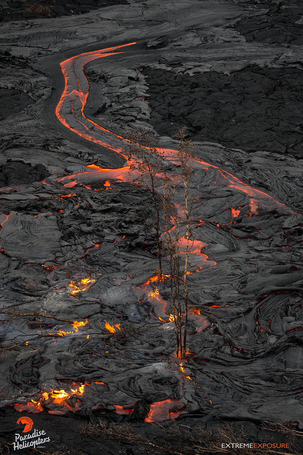
A little more robust activity resumes in the vicinity of the old geothermal pad. This photo, taken on Jan. 21, is pretty interesting, as different stages of the flow can be seen in it. The initial pass has toppled trees on its surface, while later passes consume those trees, just as this new breakout is doing, and leaves nothing on top of it. Photo credit: Extreme Exposure/Paradise Helicopters.
This photo, taken on Jan. 21, shows numerous breakouts that were visible in the general vicinity just upslope of the distal tip. Photo credit: Extreme Exposure/Paradise Helicopters.
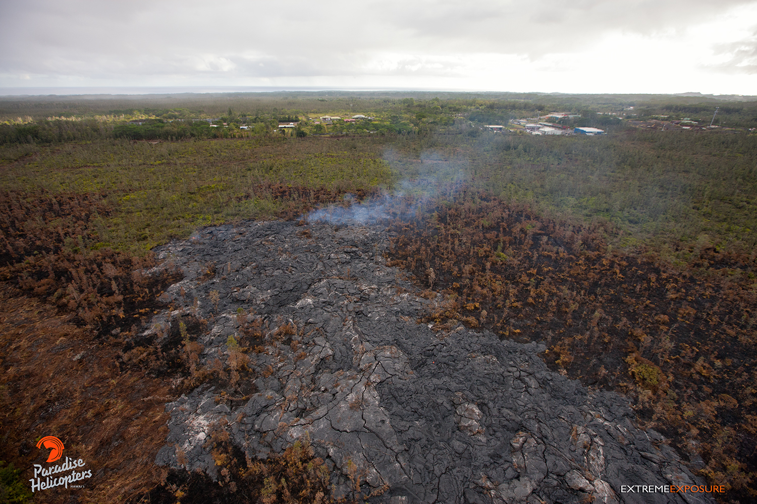
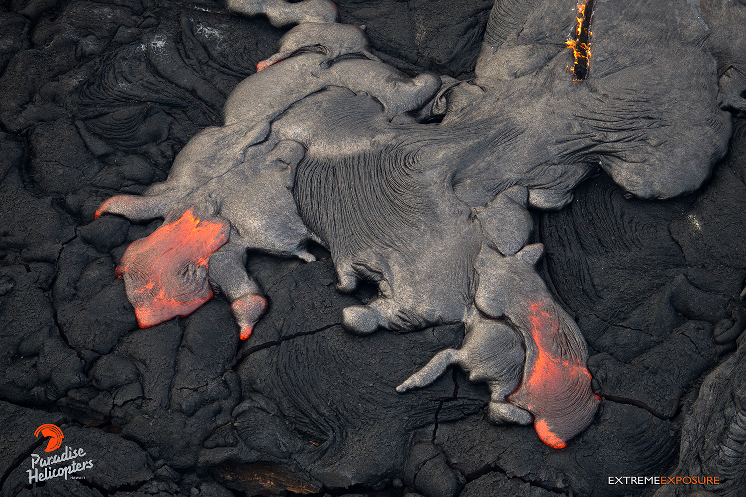
This photo, taken Jan. 21, features a breakout located about 2 miles upslope of the distal tip. Photo credit: Extreme Exposure/Paradise Helicopters.
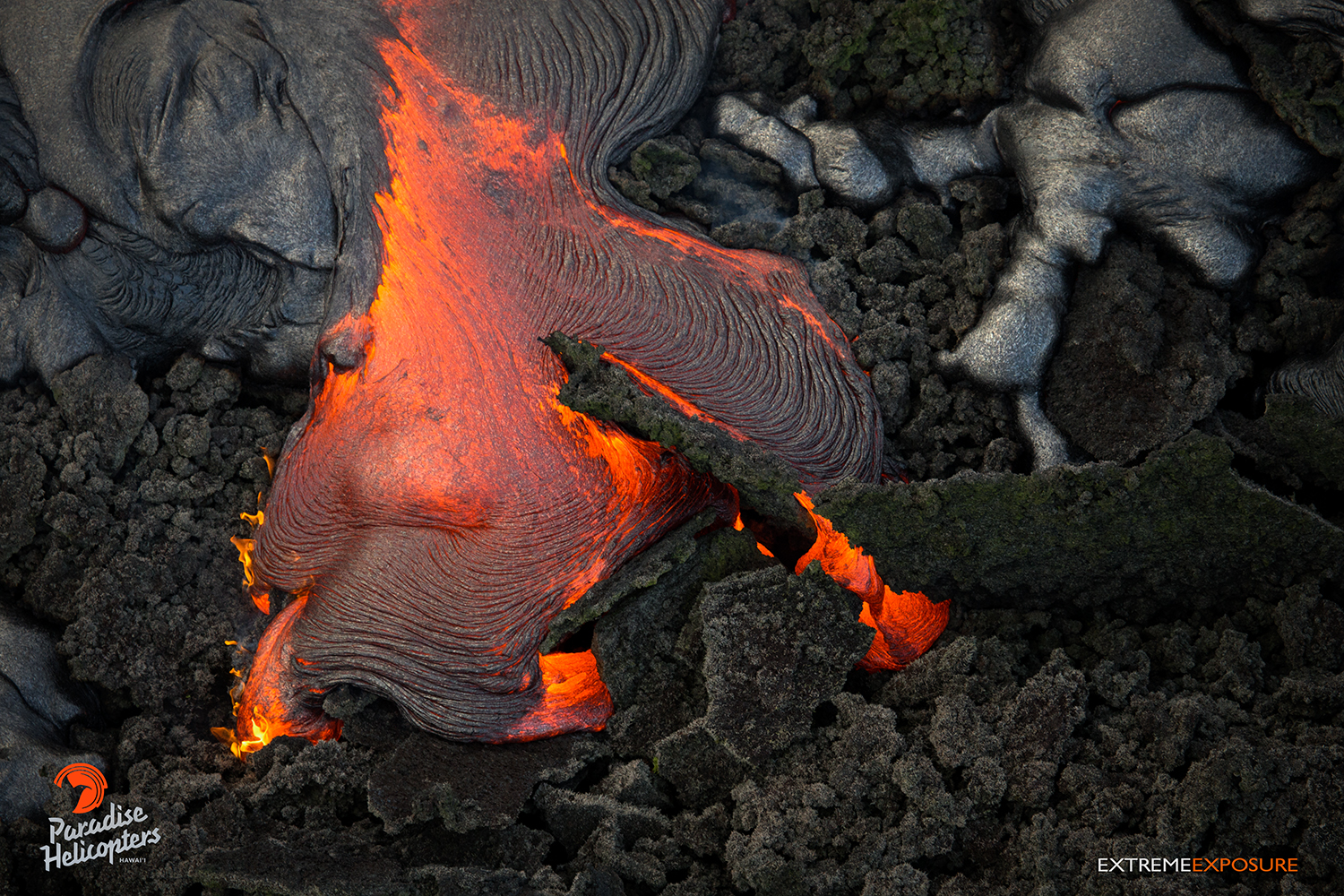
This vigorous breakout, photographed on Jan. 21, was located about 4 miles below Pu‘u ‘O‘o crater. Photo credit: Extreme Exposure/Paradise Helicopters.
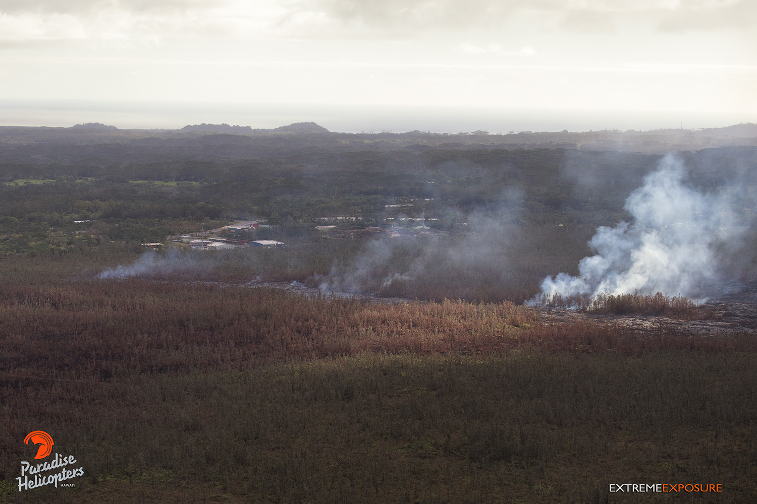
This photo, taken Jan. 21, shows more action from the flow field about 4 miles downslope from the vent. Photo credit: Extreme Exposure/Paradise Helicopters.
This breakout, photographed on Jan. 21, is located in the middle of the flow field near the old geothermal pad. Photo credit: Extreme Exposure/Paradise Helicopters.
This Hawai’i County Civil Defense photo taken on Jan. 22 at 6:30 a.m. shows a view looking upslope from the Pahoa Marketplace and Pahoa Fire and Police Stations. Civil Defense photo.
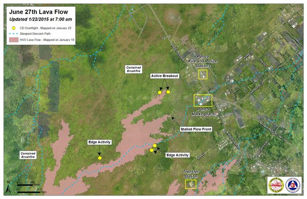
Hawai’i County Civil Defense lava flow map, as of Jan. 22 at 7 a.m. Civil Defense photo.
Hawai’i County Civil Defense lava flow map, as of Jan. 22 at 7 a.m. Civil Defense photo.
This comments section is a public community forum for the purpose of free expression. Although Big Island Now encourages respectful communication only, some content may be considered offensive. Please view at your own discretion. View Comments