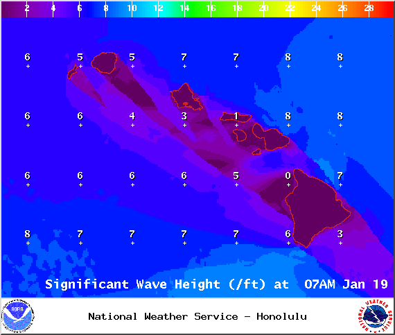
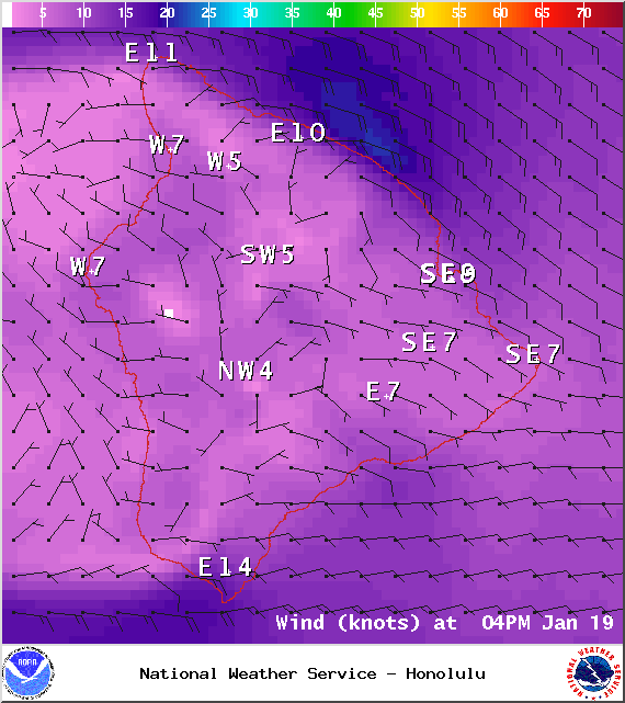
A High Surf Advisory is posted through 4:00 a.m. Monday for the west side of the Big Island. Surf from 6 to 10 feet is expected. Expect strong breaking waves, shore break and strong longshore and rip currents making swimming difficult and dangerous.
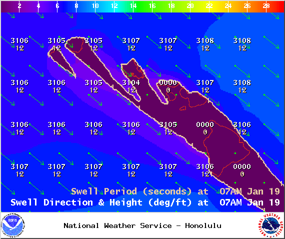
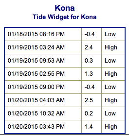
**Click directly on the images below to make them larger. Charts include: Big Island projected winds, tides, swell direction & period and expected wave heights.**
+
SWIPE LEFT OR RIGHT
ARTICLE CONTINUES BELOW AD
ARTICLE CONTINUES BELOW AD
Big Island Surf Forecast, Monday, January 19, 2015
Hilo side: Surf heights are expected waist to head high. The best breaks open to the swell could see larger waves on the sets, especially early in the day.
Kona side: Surf heights are forecasted from shoulder to head high as the swell continues to fade.
South: Southerly spots are below waist high today. Exposures open to the west-northwest wrap are forecasted to get knee to waist high surf, while spots open to the east-southeast trade swell could see waves in the chest to head high range.
ARTICLE CONTINUES BELOW AD
Our northwest swell is expected to continue to fade with bigger waves expected early in the day Monday and dropping through the day.
Another west-northwest is on tap for Tuesday with overhead+ waves expected.
Models are predicting a much larger west-northwest swell arriving around the middle of next week, producing surf well above warning levels. This XXL swell is forecasted to move in Wednesday. If it behaves as models are indicating, it would be the largest swell thus far this season.
Pending development of storms we could see another solid west-northwest swell next weekend with a smaller but still solid northwest a few days later.
ARTICLE CONTINUES BELOW AD
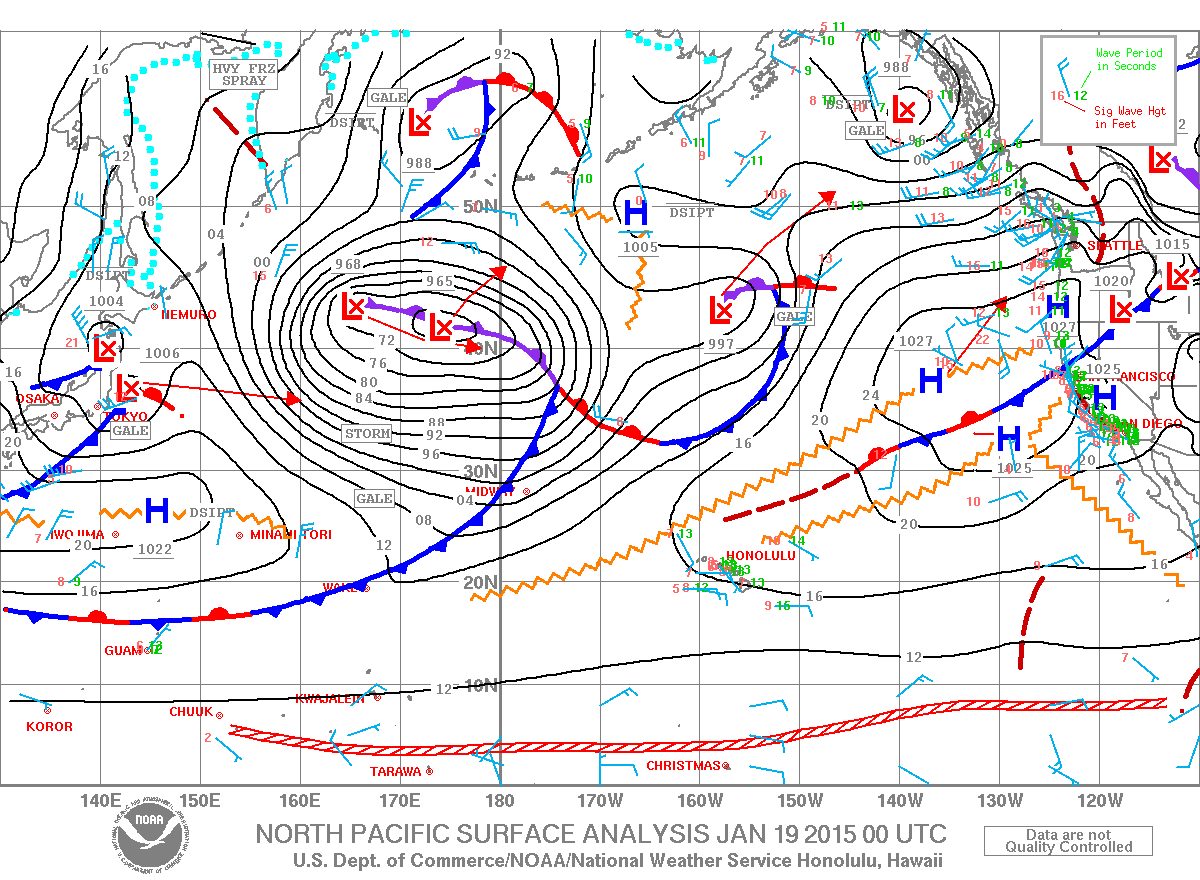
Nothing of note out of the SPAC to get excited about.
Keep in mind, surf heights are measured on the face of the wave from trough to crest. Heights vary from beach to beach, and at the same beach, from break to break.
This comments section is a public community forum for the purpose of free expression. Although Big Island Now encourages respectful communication only, some content may be considered offensive. Please view at your own discretion. View Comments


 Big Island Surf Forecast, Monday, January 19, 2015
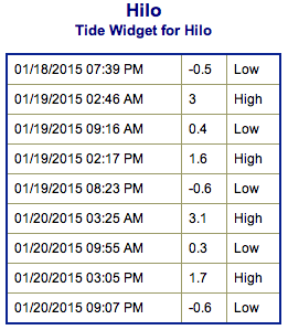 Our northwest swell is expected to continue to fade with bigger waves expected early in the day Monday and dropping through the day.