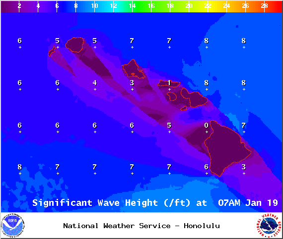
A High Surf Advisory is posted through 4:00 a.m. Monday for the west side of the Big Island. Surf from 6 to 10 feet is expected. Expect strong breaking waves, shore break and strong longshore and rip currents making swimming difficult and dangerous.
**Click directly on the images below to make them larger. Charts include: Big Island high/low forecasted temperatures, projected winds, chance of cloud cover, projected localized weather conditions, vog/SO2 forecast and expected wave heights.**
+
SWIPE LEFT OR RIGHT
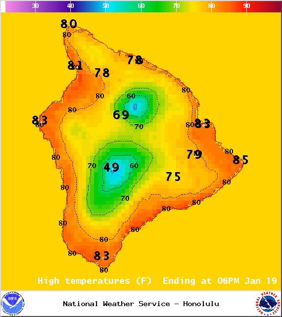
Today, Monday, January 19, 2015
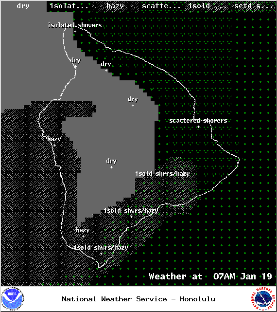
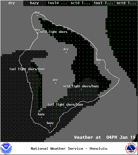
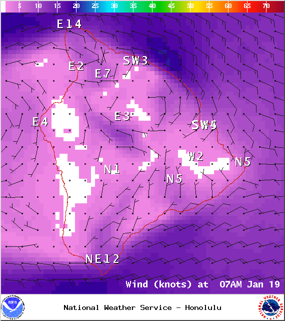
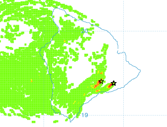
Partly cloudy skies are expected today. Light and variable winds up to 15 mph are forecasted. As the land heats up, sea breezes are expected to develop which will lead to afternoon cloud cover and possible isolated showers. Hazy skies are expected for the west side of the Big Island in the afternoon (see UHSOEST vog model above). High temperatures should fall in the range of 82° to 87°.
ARTICLE CONTINUES BELOW AD
ARTICLE CONTINUES BELOW AD
Sunrise: 6:58 a.m.
Sunset: 6:05 p.m.
UV index at 7 (“high” exposure level)
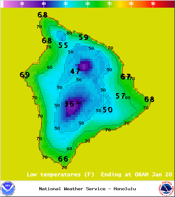
Tonight
ARTICLE CONTINUES BELOW AD
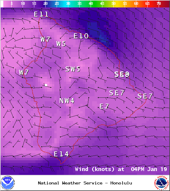
Mostly clear skies are expected. Leeward spots may be cloudy to start but are expected to clear as the land breeze takes hold. Light and variable winds up to 15 mph are expected. Low temperatures are forecasted from 64° to 69° degrees.
Moonrise: 6:03 a.m.
Moonset: 5:39 p.m.
Next New Moon: Jan. 20 at 3:14 a.m.
Next Full Moon: 1:09 p.m. on Feb. 3
ARTICLE CONTINUES BELOW AD
Looking Ahead
Light and variable wind conditions will return by Monday night, while light trades continue elsewhere. All islands are expected to be under southerly wind flow by Thursday as a front approaches the island from the west. The front is slated to reach Kauai early Friday morning and move down the island chain all day Friday, reaching the Big Island early Saturday morning. Cooler drier weather may move in behind the front.
This comments section is a public community forum for the purpose of free expression. Although Big Island Now encourages respectful communication only, some content may be considered offensive. Please view at your own discretion. View Comments