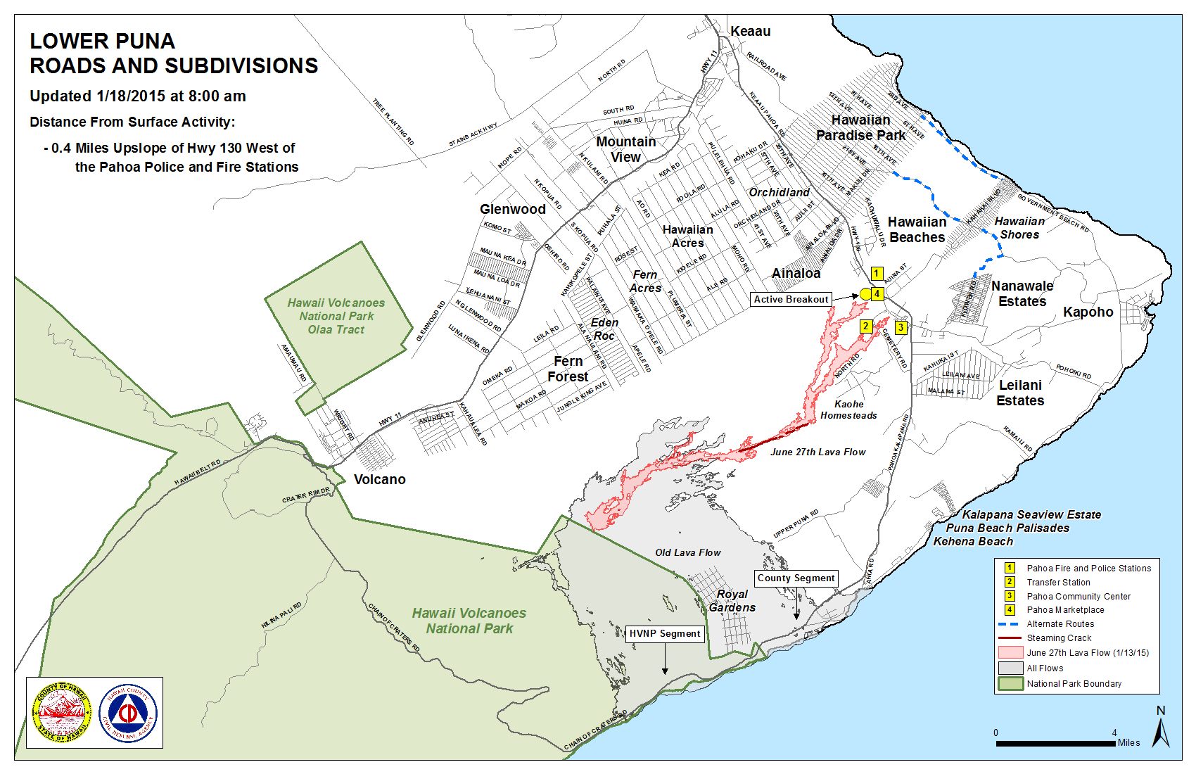
Hawai’i County Civil Defense’s Sunday morning overflight assessment of the June 27 lava flow showed little advancement in areas outside of the breakout that began about 765 yards upslope from the stalled flow front on Tuesday. The lava is now the closest to Highway 130 than any other lobe has been.
Activity and downslope advancement continues for the north margin breakout, advancing towards Highway 130 to the west of the Pahoa Police and Fire Stations. Civil Defense reported that the flow had advanced 70 yards since Saturday morning and is currently 0.4 miles from the Highway 130 area.
The once active and advancing leading edge of the flow headed towards the Pahoa Marketplace remains stalled. According to Civil Defense, the south margin breakout that was active during the same time also remains stalled.
Additionally, the two breakouts 1-1.5 miles upslope from the stalled original flow front continue to show signs of activity, however, officials say that those two breakouts are sluggish and showing little signs of advancement.
ARTICLE CONTINUES BELOW AD
ARTICLE CONTINUES BELOW AD
None of the flow activity poses an immediate threat to communities in the area. Civil Defense, along with Hawaiian Volcano Observatory personnel, continues to maintain close observation of the flow’s activity and advancement. The public will continue to remain informed.
Fire conditions are being monitored by the Hawai’i County Fire Department as personnel and equipment are on scene. Brush fires that occurred over the past week have been contained within the fire break perimeter. Burning activity at the current time is limited to hot sports and flare ups. Officials say that there is no fire threat to residents and properties in the area.
Smoke conditions have slightly improved from heavy to moderate Sunday, as a light northeast wind is blowing smoke in a southwest direction. During Civil Defense’s morning overflight, a light rain was observed. This is expected to help with fire and smoke conditions. As usual, smoke conditions have the possibility of increasing and it is advised that individuals who are sensitive or have a history of respiratory issues take necessary precautions and remain indoors.
+
SWIPE LEFT OR RIGHT
Hawai’i County Civil Defense lava flow map, as of Jan. 18 at 8 a.m. Civil Defense photo.
Hawai’i County Civil Defense lava flow map, as of Jan. 18 at 8 a.m. Civil Defense photo.
This comments section is a public community forum for the purpose of free expression. Although Big Island Now encourages respectful communication only, some content may be considered offensive. Please view at your own discretion. View Comments