Activity and advancement has reached a lull for the June 27 lava flow.
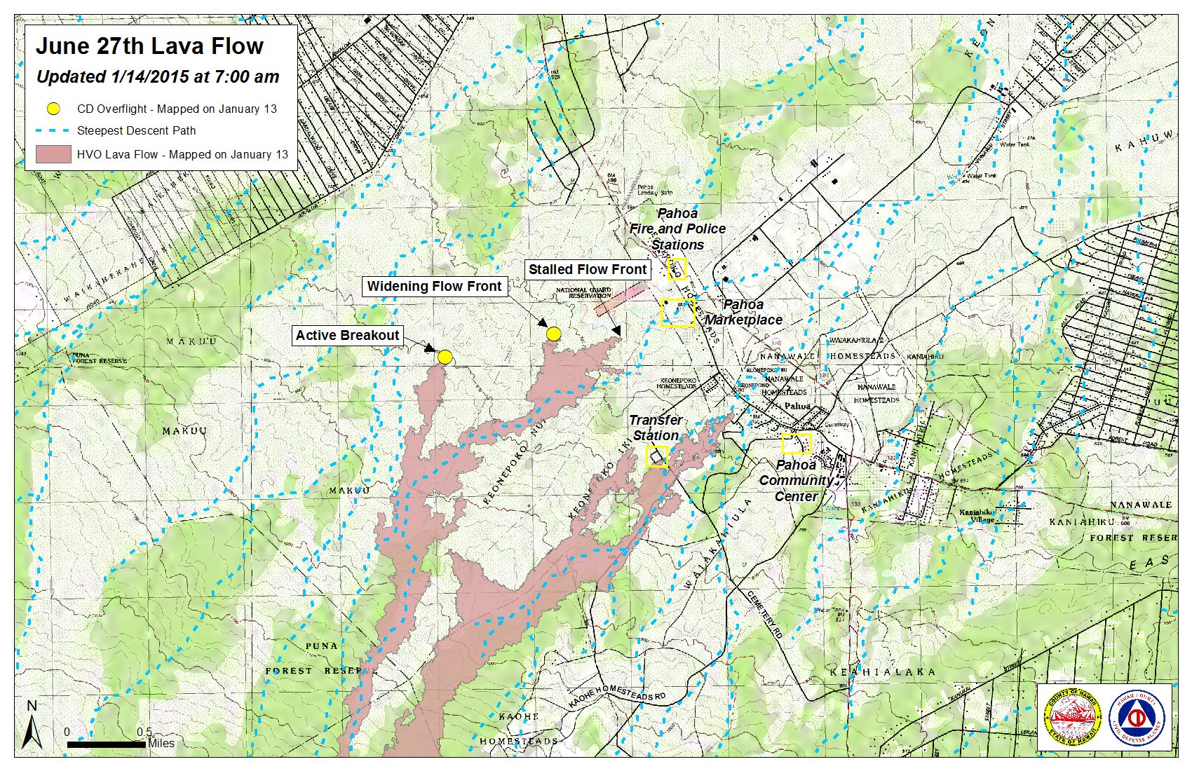
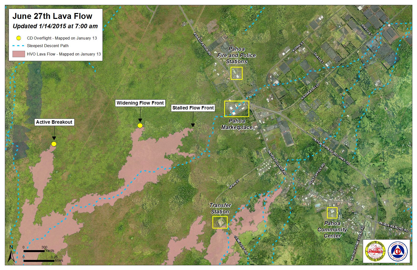
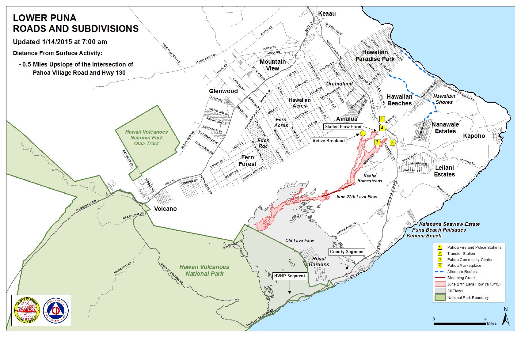
Hawai’i County Civil Defense’s Wednesday morning overflight assessment showed that the leading edge of the flow front continues to remain stalled about 0.5 miles from the Highway 130 and Pahoa Village Road intersection, as it has for about a week and a half. The once active breakout on the south margin of the flow has also remained stalled along with the flow front.
Hawaiian Volcano Observatory observed during its Tuesday afternoon overflight that small breakouts were active in an area in the crack system that has persistent activity, near the True/Mid-Pacific geothermal well pad, about 4 miles from Pahoa. HVO officials say that no additional breakouts were observed upslope from the well pad area.
ARTICLE CONTINUES BELOW AD
ARTICLE CONTINUES BELOW AD
Additional activity also continues above the flow front and in further upslope areas along both the south and north margins. Civil Defense says none of the activity is posing any immediate threat to communities in the area and, along with HVO, will continue to monitor activity.
A brush fire that broke out on Tuesday evening as a result of the lava flow activity has been contained within the fire break. Brush fire activity as of Wednesday morning was limited to hot spots and smoldering, according to Civil Defense. The Hawai’i Fire Department remains on the scene monitoring fire conditions.
For the third day in a row heavy smoke and vog conditions were reported as a south-west wind was blowing smoke in a northeast direction over lower Puna and into Hilo. Officials advise individuals who are sensitive or who have respiratory issues to take necessary precautions and remain indoors.
+
SWIPE LEFT OR RIGHT
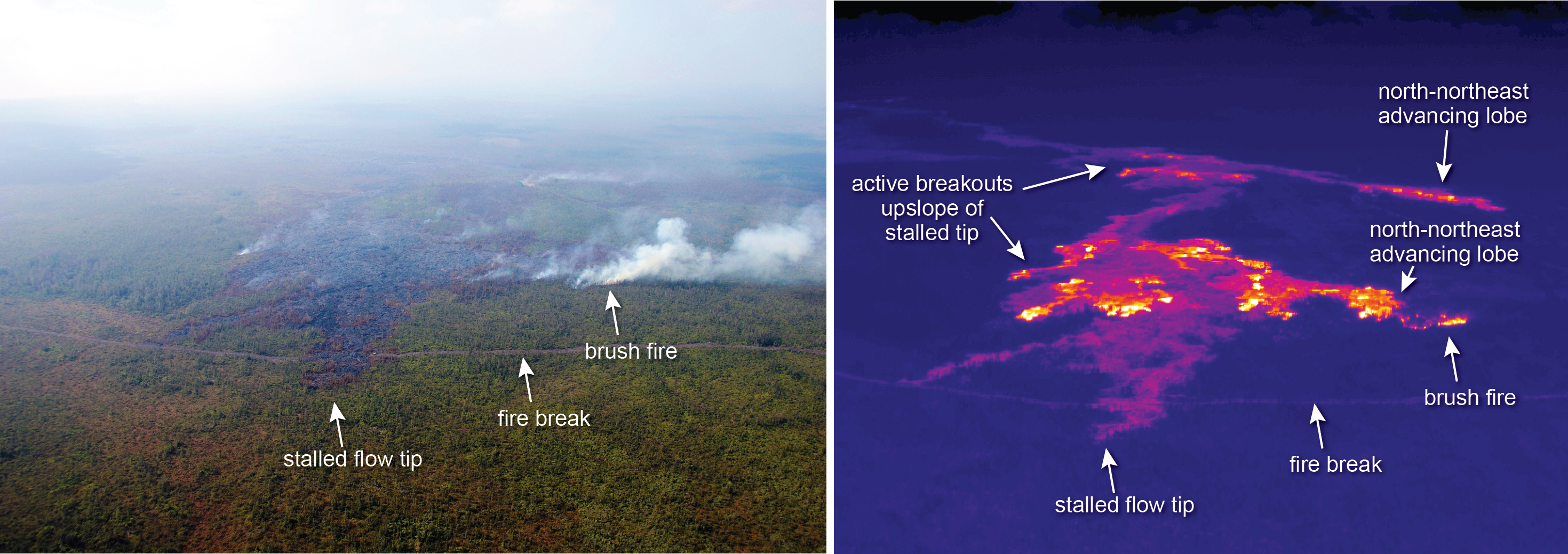
In this image taken and compared on Jan. 13, you can see a comparison of a normal photograph and a thermal image that shows the position of active breakouts relative to the stalled flow tip. In the thermal image, active breakouts are visible as white and yellow areas. HVO photo.
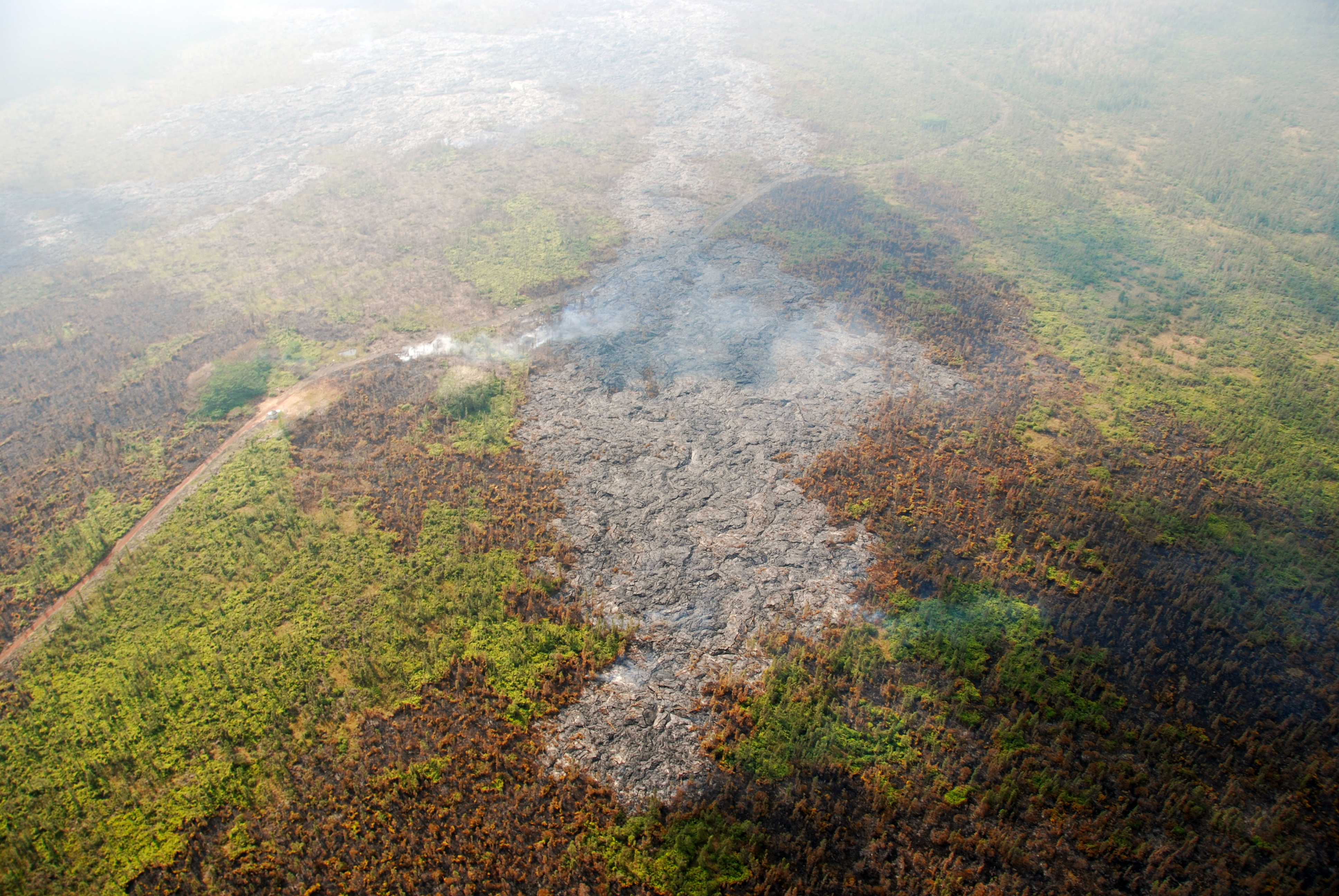
This image, taken on Jan. 13, shows a closer look at the leading edge of the north-northeast advancing lobe. HVO photo.
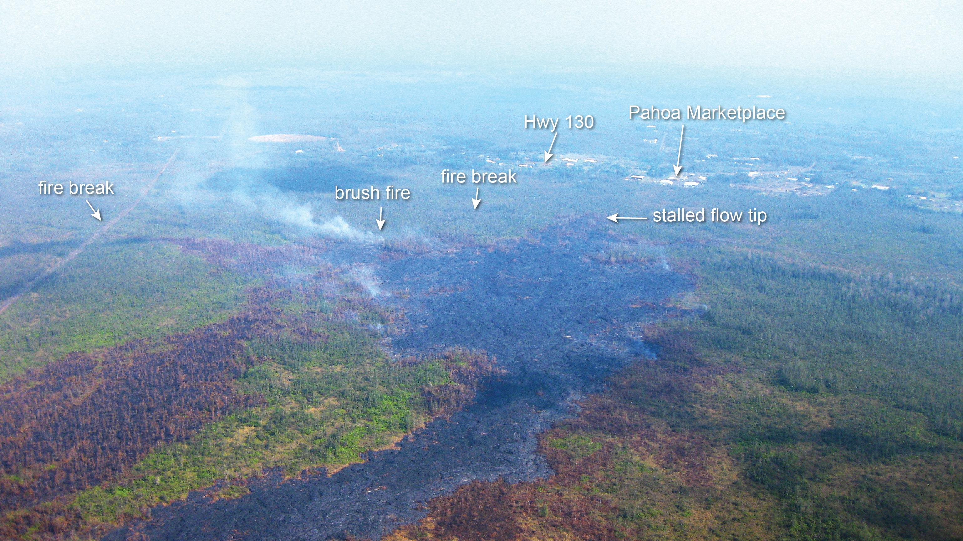
This photo, taken on Jan. 13, shows a view of the leading edge of the flow, looking downslope towards Pahoa Marketplace and Highway 130. HVO image.
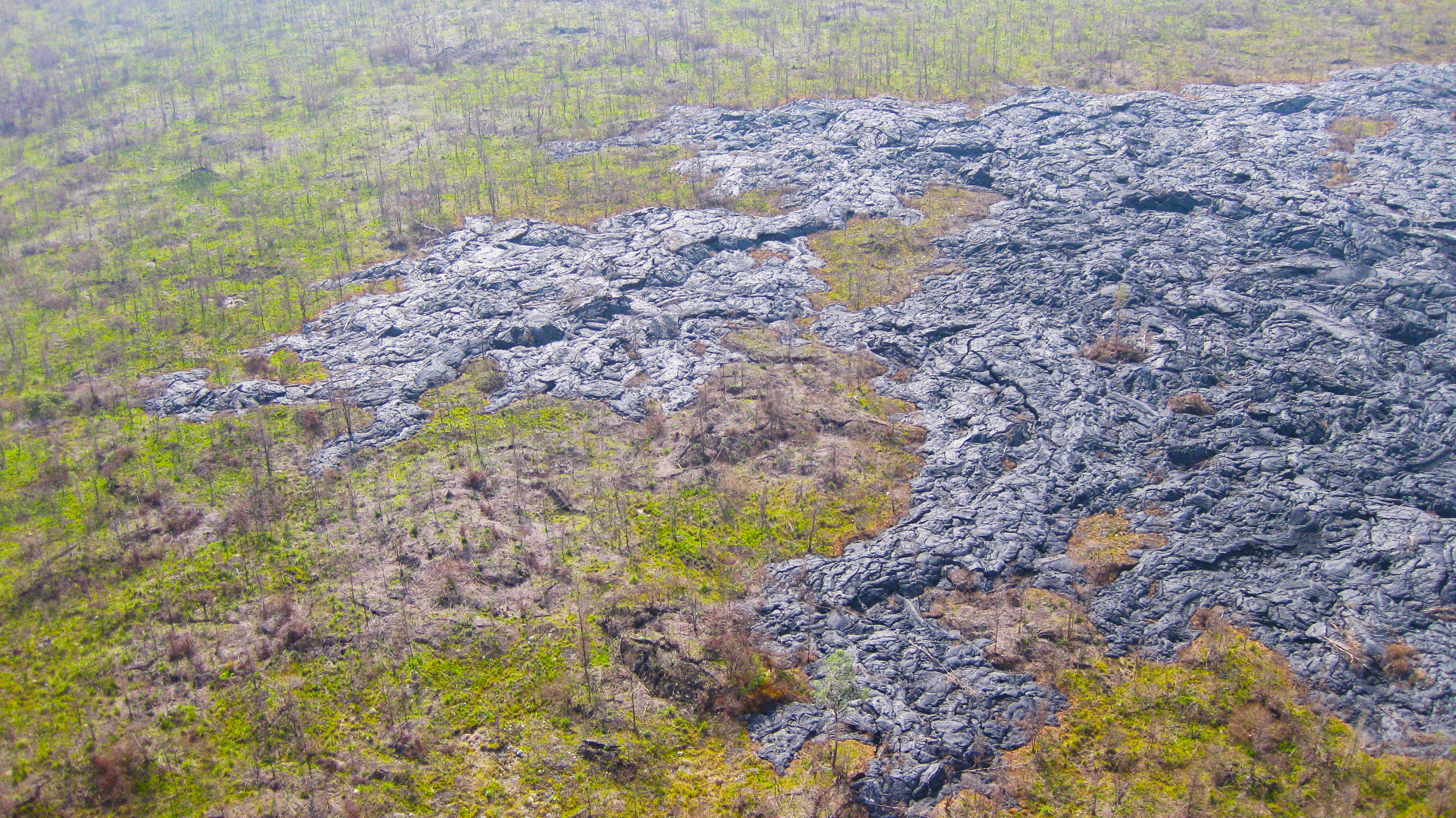
This photo, taken on Jan. 13, shows a close-up view of an inactive portion of the flow margin showing the irregular surface relief created from pāhoehoe flow inflation. HVO image.
ARTICLE CONTINUES BELOW AD
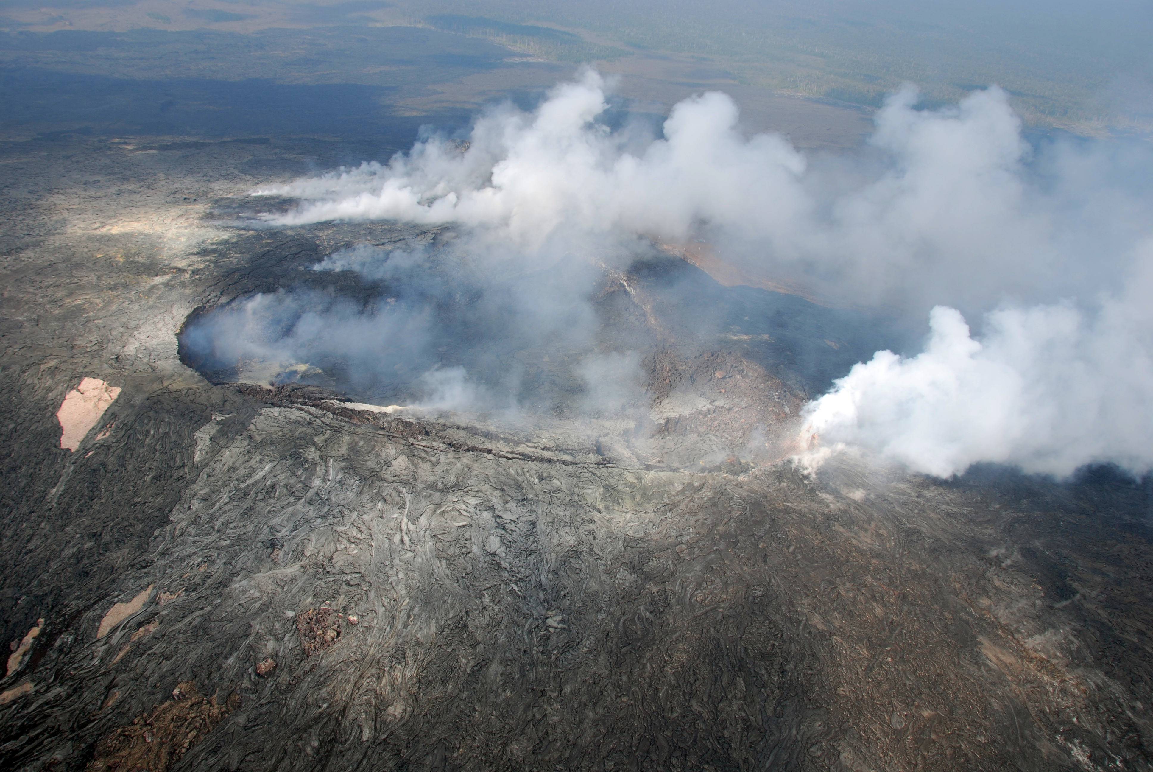
This photo, taken on Jan. 13, shows winds from the south providing a fairly clear view in Puʻu ʻŌʻō Crater. At the right side of the photo, a thick fume source is situated on the northeast rim of the crater. HVO photo.
Hawai’i County Civil Defense lava flow map, as of Jan. 14 at 7 a.m. Civil Defense photo.
Hawai’i County Civil Defense lava flow map, as of Jan. 14 at 7 a.m. Civil Defense photo.
Hawai’i County Civil Defense lava flow map, as of Jan. 14 at 7 a.m. Civil Defense photo.
This comments section is a public community forum for the purpose of free expression. Although Big Island Now encourages respectful communication only, some content may be considered offensive. Please view at your own discretion. View Comments