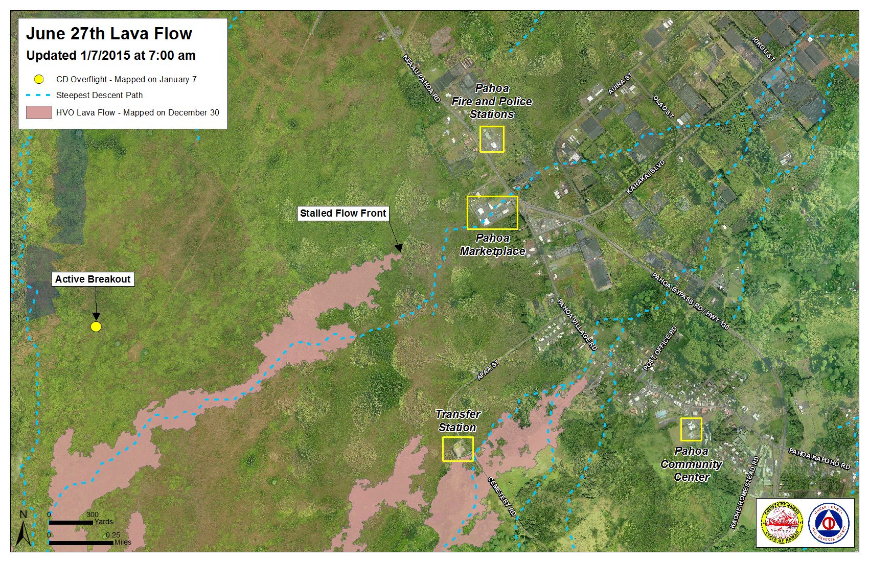
The flow front of the June 27 lava flow and south margin breakout have both remain stalled since Friday, according to Hawai’i County Civil Defense. The leading edge of the flow front remains 0.5 miles from the Highway 130 and Pahoa Village intersection.
Civil Defense said Wednesday that “surface activity continues approximately 200 yards above, or upslope, of the flow front.”
Two breakouts upslope from the stalled flow front, located about 1-1.5 miles from the area, advanced about 75 yards since Tuesday and continues to extend in a north-northeast direction.
Additionally, surface breakouts and activity also continues to occur in upslope areas of both the south and north flow margins. Civil Defense says that none of the activity in these areas poses a threat to nearby communities and, in partnership with Hawaiian Volcano Observatory, the activity will be monitored closely, and any changes will be reported to the public.
Civil Defense reported moderate smoke conditions Wednesday as a light north north-east wind was blowing smoke in a southwest direction. As usual, these smoke conditions have the possibility of changing, and individuals who are sensitive or have a history of respiratory problems are advised to take necessary precautions and stay indoors.
ARTICLE CONTINUES BELOW AD
ARTICLE CONTINUES BELOW AD
The Railroad Avenue alternative access road will close at 12 p.m. Wednesday to all traffic. Civil Defense says that “this closure is necessary to allow for road maintenance and to preserve the road until such time that it is needed.”
The next lava flow community meeting will be held at the Pahoa High School cafeteria on Thursday at 6:30 p.m.
+
SWIPE LEFT OR RIGHT
Hawai’i County Civil Defense lava flow map, as of Jan. 7 at 7 a.m. Civil Defense image.
Hawai’i County Civil Defense lava flow map, as of Jan. 7 at 7 a.m. Civil Defense image.
ARTICLE CONTINUES BELOW AD
Hawai’i County Civil Defense lava flow map, as of Jan. 7 at 7 a.m. Civil Defense image.
This comments section is a public community forum for the purpose of free expression. Although Big Island Now encourages respectful communication only, some content may be considered offensive. Please view at your own discretion. View Comments