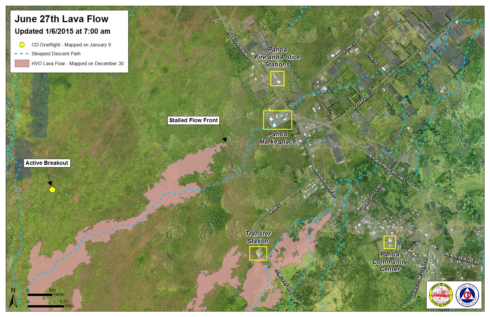
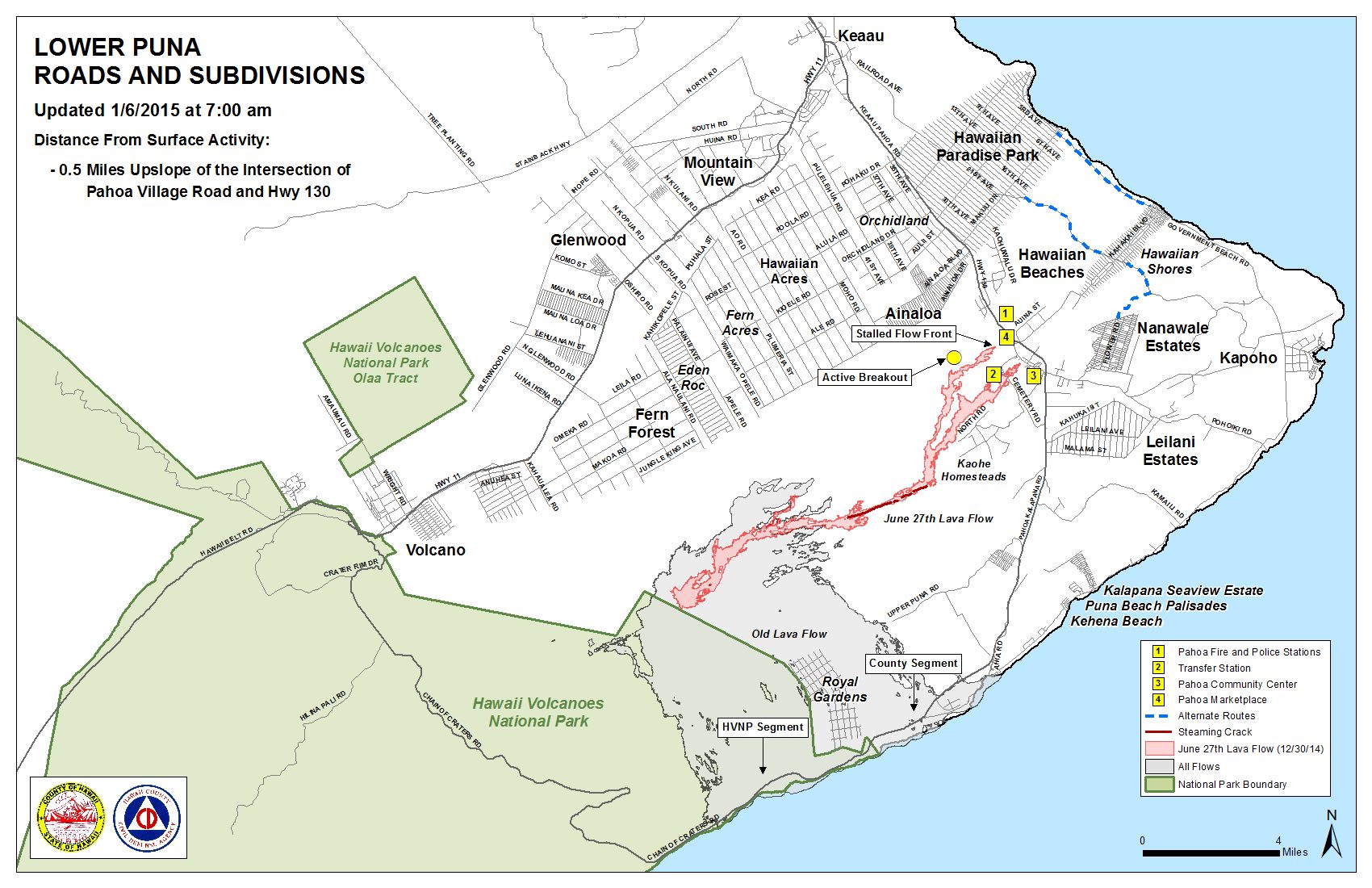
Hawai’i County Civil Defense’s Tuesday morning overflight shows that both the June 27 lava flow front and south margin breakout continue to remain stalled with no advancement since Friday.
At the current time, the flow front remains 0.5 miles upslope from the Highway 130 and Pahoa Village Road intersection.
Civil Defense says that about 200 yards upslope from the area where the flow front is currently stalled, activity continues. Officials say that two breakouts, both along the north margin and about 1-1.5 miles behind the flow front, remain active and have advanced about 150 yards since Monday. These breakouts are moving in a north direction.
In the upslope areas along both the south and north margin, activity continues, including breakouts. Civil Defense says that none of the activity is posing a threat to communities in the area.
ARTICLE CONTINUES BELOW AD
ARTICLE CONTINUES BELOW AD
Civil Defense, in partnership with Hawaiian Volcano Observatory, will continue to maintain close watch over flow activity and continue to keep the public informed.
Moderate smoke conditions were reported Tuesday morning as a light north northeast wind was blowing smoke in a southwest direction. These smoke conditions, as usual, have the possibility of increasing. Officials advise individuals who are sensitive or have a history of respiratory issues take necessary precautions and remain inside.
Beginning Wednesday, Jan. 7, Railroad Avenue will be closed to all traffic beginning at 12 p.m. The closure will allow access for road maintenance, as well as the opportunity to preserve the road until it is needed. Civil Defense ensures the public that alternated access roads will open well in advance of any threat or impact of the lava flow.
+
SWIPE LEFT OR RIGHT
Civil Defense lava flow map, as of Jan. 6 at 7 a.m. Civil Defense image.
ARTICLE CONTINUES BELOW AD
ARTICLE CONTINUES BELOW AD
Civil Defense lava flow map, as of Jan. 6 at 7 a.m. Civil Defense image.
This comments section is a public community forum for the purpose of free expression. Although Big Island Now encourages respectful communication only, some content may be considered offensive. Please view at your own discretion. View Comments