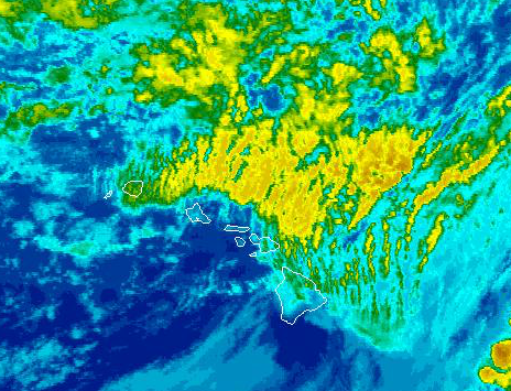
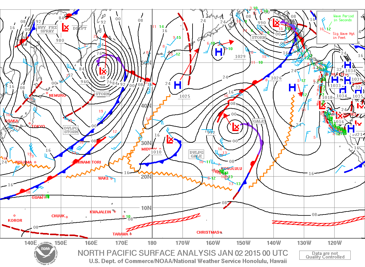
A Special Weather Statement has been issued by the National Weather Service. A strong front is expected to dig toward the Hawaiian Islands Friday and Saturday. Southwest winds will increase in the afternoon in front of the weather feature and become strong and gusty by night. Heavy rain and thunderstorms are expected as the front moves through Saturday morning. Strong winds, lightning and intense rainfall could occur with these thunderstorms if they become severe. While not everyone is expected to experience severe weather, the National Weather Service is asking that everyone be prepared to move indoors should intense weather appear in your area.
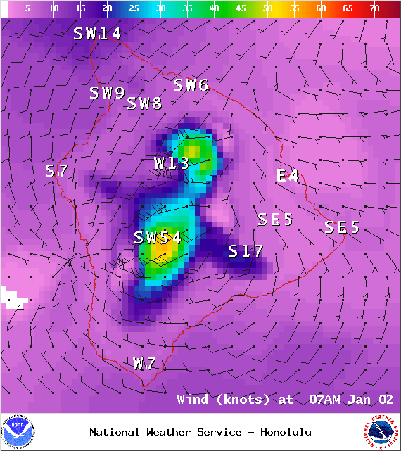
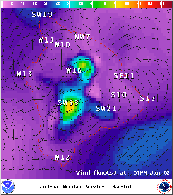
A Small Craft Advisory is posted for all Big Island coastal waters and channels from 6 p.m. Friday through 6 a.m. Sunday. Rough seas up to 6 to 17 feet are expected with southwest winds from 20 to 30 knots with higher gusts. Inexperienced mariners should avoid navigating in these conditions.
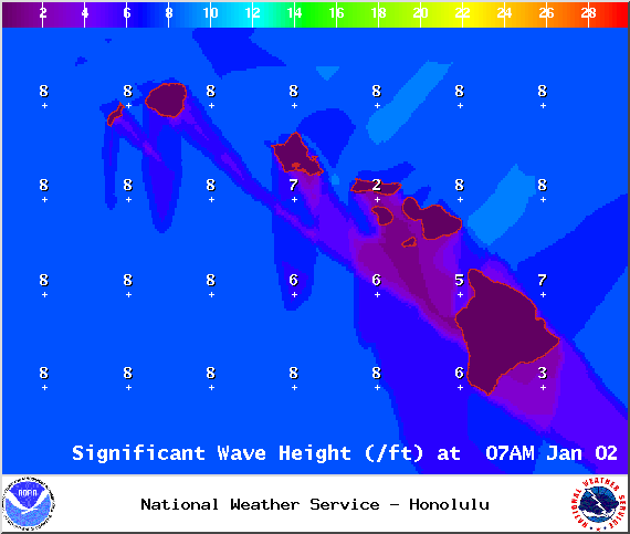
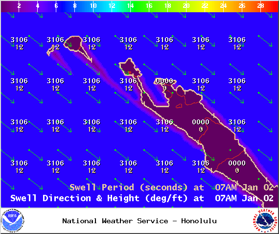
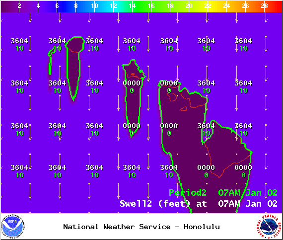
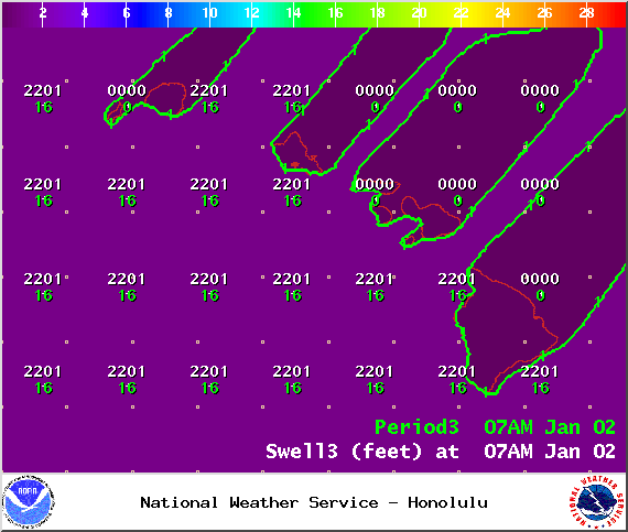
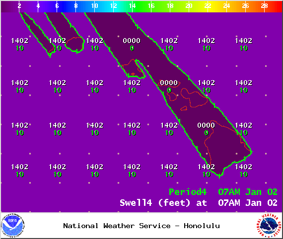
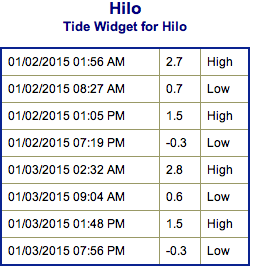
**Click directly on the images below to make them larger. Charts include: Big Island projected winds, tides, swell direction & period and expected wave heights.**
+
SWIPE LEFT OR RIGHT
ARTICLE CONTINUES BELOW AD
ARTICLE CONTINUES BELOW AD
Big Island Surf Forecast, Friday, January 2, 2015
Hilo side: Surf heights are expected from head high to a little overhead at the best breaks along the Hamakua coast.
Kona side: Surf heights expected from knee to about waist high.
ARTICLE CONTINUES BELOW AD
South: Surf is knee to shoulder high waves are expected.
A mix of north and northwest swell energy is expected through the end of the week. Energy lingers into the weekend as it fades out. Since the energy is coming from several directions, it will be a bit haphazard at times.
New overlapping swells are expected for the weekend and beyond for north and west shores.
Nothing of note out of the SPAC to get excited about.
ARTICLE CONTINUES BELOW AD
Keep in mind, surf heights are measured on the face of the wave from trough to crest. Heights vary from beach to beach, and at the same beach, from break to break.
This comments section is a public community forum for the purpose of free expression. Although Big Island Now encourages respectful communication only, some content may be considered offensive. Please view at your own discretion. View Comments


 Big Island Surf Forecast, Friday, January 2, 2015
 New overlapping swells are expected for the weekend and beyond for north and west shores.