A Small Craft Advisory is posted for Big Island windward coastal waters through 6:00 p.m. Thursday. Rough seas of 6 to 12 feet are expected. Inexperienced mariners should avoid navigating in these conditions.
A High Wind Warning was issued by the National Weather Service for the summits of Mauna Kea and Mauna Loa through 6:00 p.m. Friday. Southwest winds are expected from 45 to 65 mph with gusts over 90 mph possible. Late Friday winds from 60 to 80 mph gusting to 100 mph are possible.
A High Surf Advisory is in effect for north-facing shores of the Big Island through Thursday at 6:00 p.m. Expect strong breaking waves, shore break and strong longshore and rip currents making swimming difficult and dangerous.
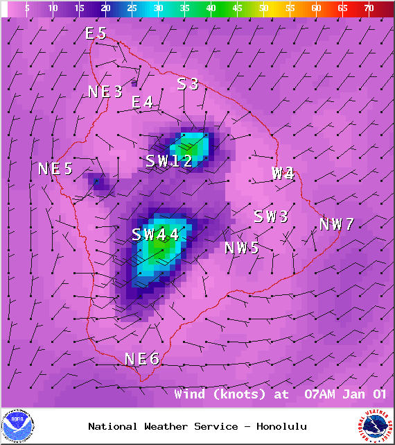
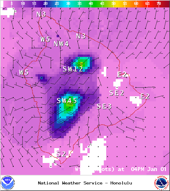
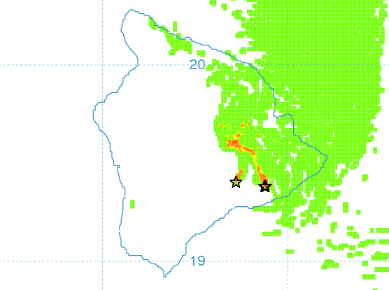
**Click directly on the images below to make them larger. Charts include: Big Island high/low forecasted temperatures, projected winds, chance of cloud cover, projected localized weather conditions, vog/SO2 forecast and expected wave heights.**
+
SWIPE LEFT OR RIGHT
ARTICLE CONTINUES BELOW AD
ARTICLE CONTINUES BELOW AD
Today, New Year’s Day, January 1, 2014
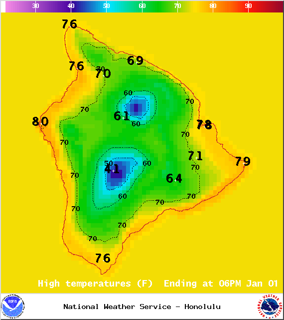
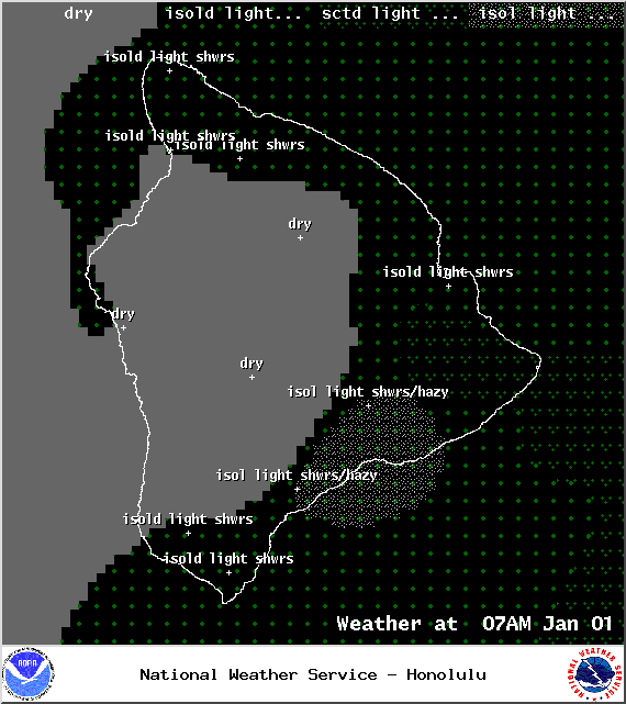
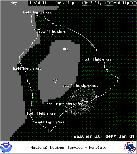
Today, we expect partly sunny skies and passing broken clouds with periods of overcast skies but just light isolated windward showers. The UHSOEST vog model shows haze over the Hilo side in the afternoon. Winds are expected out of the northwest from 10 to 15 mph. High temperatures should fall in the range of 74° to 80°.
Sunrise: 6:55 a.m.
Sunset: 5:53 p.m.
UV index at 6 (“high” exposure level)
ARTICLE CONTINUES BELOW AD
Tonight
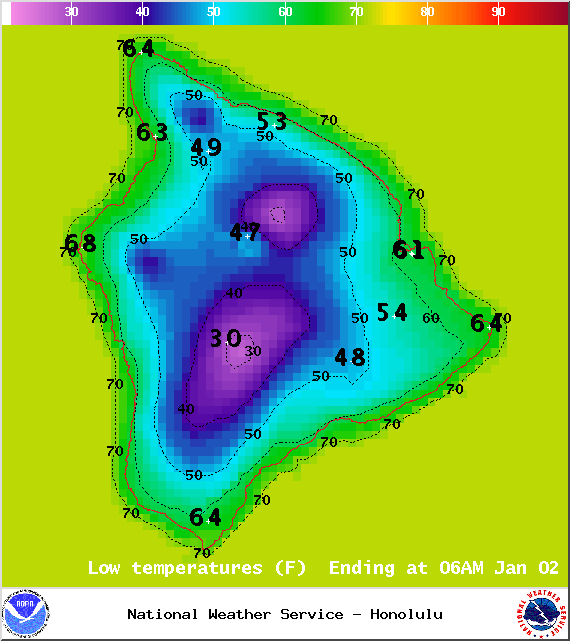
Partly cloudy skies are expected with isolated showers. Northwest winds are expected from 10 to 15 mph and shifting out of the west. Low temperatures are forecasted from 62° to 67° degrees.
Moonrise: 3:23 p.m.
Moonset: 4:42 a.m. on Jan. 2
ARTICLE CONTINUES BELOW AD
Next Full Moon: Jan. 4 at 6:54 p.m.
Next New Moon: Jan. 20 at 3:14 a.m.
Looking Ahead
Quiet, cool conditions are expected to start the new year, as very dry air streaming in from the north dominates our weather. Another cold front sweeping down the island chain from Friday into Saturday is expected to bring strong and gusty southwesterly winds with rainy weather and a chance for thunderstorms. The front is expected to clear the Big Island on Saturday. Fair and cool weather will return to the islands again for the first weekend of 2015.
This comments section is a public community forum for the purpose of free expression. Although Big Island Now encourages respectful communication only, some content may be considered offensive. Please view at your own discretion. View Comments