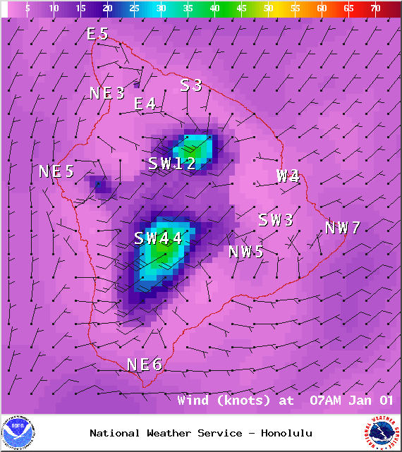
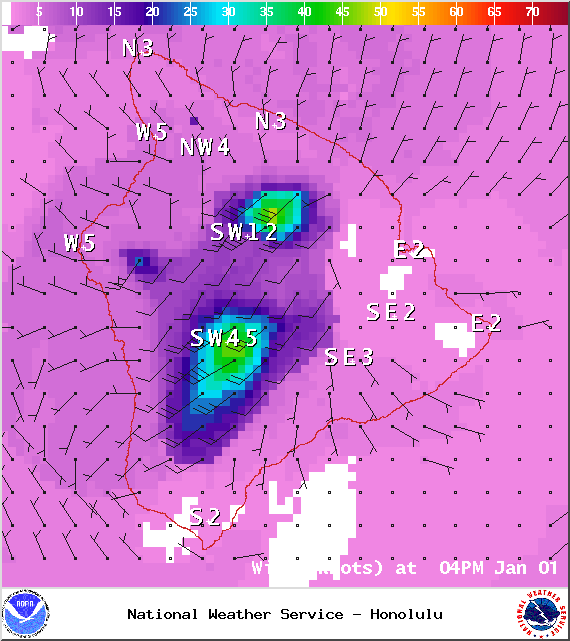
A Small Craft Advisory is posted for Big Island windward coastal waters through 6:00 p.m. Thursday. Rough seas of 6 to 12 feet are expected. Inexperienced mariners should avoid navigating in these conditions.
A High Surf Advisory is in effect for north-facing shores of the Big Island through Thursday at 6:00 p.m. Expect strong breaking waves, shore break and strong longshore and rip currents making swimming difficult and dangerous.
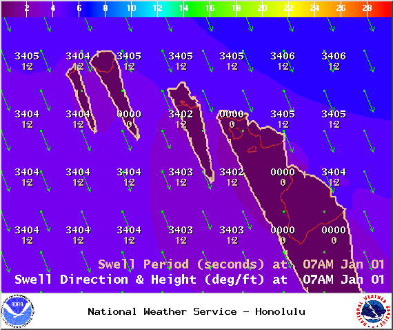
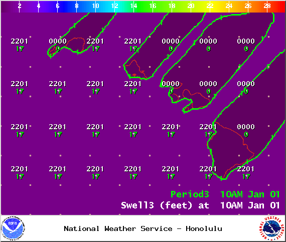
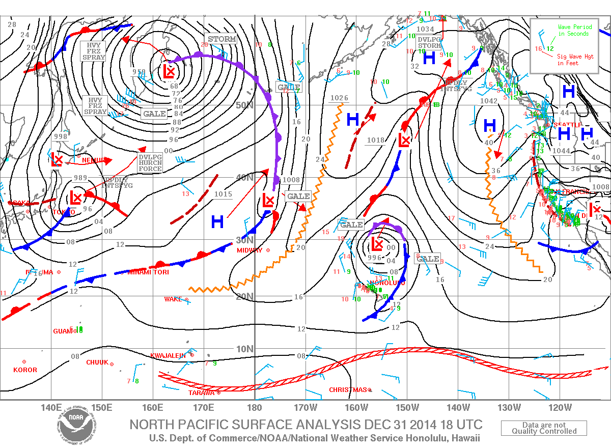
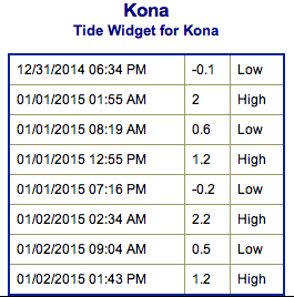
**Click directly on the images below to make them larger. Charts include: Big Island projected winds, tides, swell direction & period and expected wave heights.**
+
SWIPE LEFT OR RIGHT
ARTICLE CONTINUES BELOW AD
ARTICLE CONTINUES BELOW AD
Big Island Surf Forecast, New Year’s Day, January 1
Hilo side: Surf heights are expected from overhead to possibly double overhead at the best breaks along the Hamakua coast rising as the day goes on.
Kona side: Surf heights expected from knee to about shoulder high.
ARTICLE CONTINUES BELOW AD
South: Surf is ankle to waist high waves are expected.
A mix of north and northwest swell energy is expected through the end of the week. Energy lingers into the weekend as it fades out. Since the energy is coming from several directions, it will be a bit haphazard at times.
New overlapping swells are expected for the weekend and beyond for north and west shores. Still pending development of storms. Will keep an eye on it.
Nothing of note out of the SPAC to get excited about.
ARTICLE CONTINUES BELOW AD
Keep in mind, surf heights are measured on the face of the wave from trough to crest. Heights vary from beach to beach, and at the same beach, from break to break.
This comments section is a public community forum for the purpose of free expression. Although Big Island Now encourages respectful communication only, some content may be considered offensive. Please view at your own discretion. View Comments


 Big Island Surf Forecast, New Year’s Day, January 1
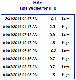 New overlapping swells are expected for the weekend and beyond for north and west shores. Still pending development of storms. Will keep an eye on it.