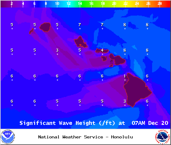
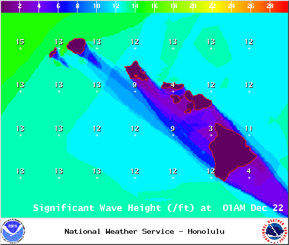
A High Surf Warning is in effect for the Kona side of the Big Island from 10:00 a.m. this morning through 6:00 a.m. Tuesday for a large west-northwest swell. Warning level surf is expected by late Sunday with wave heights building up to 8 to 12 foot faces by sundown. Early in the day (advisory level) 6 to 10 foot faces are expected.
A High Surf Advisory is in effect for the Hamakua Coast through 6:00 p.m. today for a short period southeast trade swell bringing 6 to 10 foot faces today.
A Small Craft Advisory is in effect for all Big Island waters from 4:00 a.m. Sunday through 6:00 a.m. Tuesday as well.
**Click directly on the images below to make them larger. Charts include: Big Island high/low forecasted temperatures, projected winds, chance of cloud cover, projected localized weather conditions, vog/SO2 forecast and expected wave heights.**
+
SWIPE LEFT OR RIGHT
ARTICLE CONTINUES BELOW AD
ARTICLE CONTINUES BELOW AD
Today, Saturday, December 20, 2014
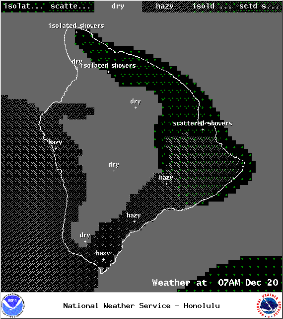
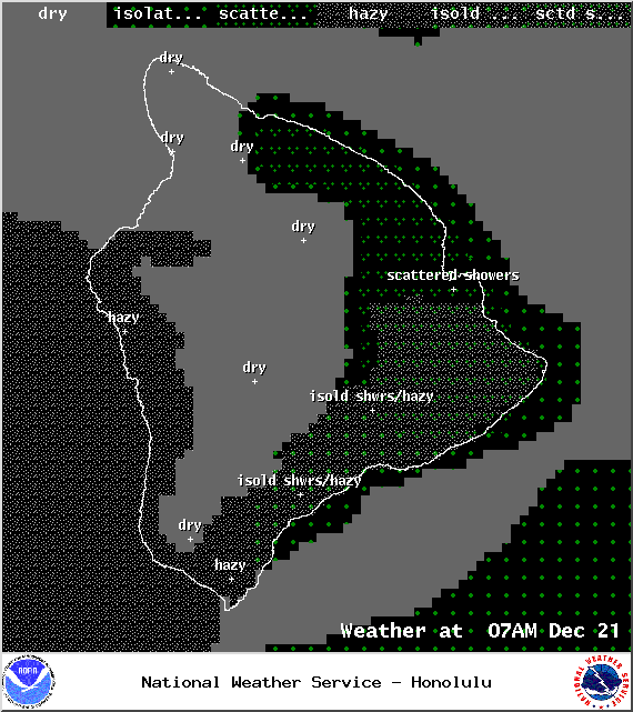
Today, we expect partly cloudy skies and scattered windward and mauka showers in the morning. The Kona side is forecasted to get mostly clear skies in the morning but as the sea breeze develops due to daytime heating some clouds could move in through the afternoon and evening. Winds are breezy and out of the east from 15 to 20 mph. High temperatures should fall in the range of 79° to 84° and around 69° at 5000 feet.
Sunrise: 6:50 a.m.
Sunset: 5:46 p.m.
UV index at 6 (“high” exposure level)
ARTICLE CONTINUES BELOW AD
Tonight
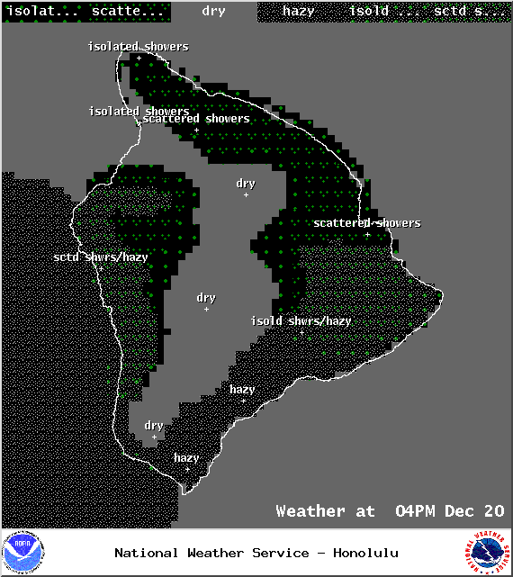
Partly to mostly cloudy skies and breezy conditions are expected tonight for the Big Island. Scattered windward and mauka showers are forecasted. Winds will be around 15 to 20mph. Low temperatures from 67° to 72° degrees.
Moonset: 4:58 p.m.
Moonrise: 6:26 a.m. on Dec 21
ARTICLE CONTINUES BELOW AD
Next New Moon: Dec. 21 at 3:36 p.m.
Next Full Moon: Jan. 4 at 6:54 p.m.
Almanac for Hilo Airport
Maximum Temperature for today:
Normal 79°
Record 87° / Set in 1964
Minimum Temperature for today:
Normal 65°
Record 58° / Set in 1972
Sunday, December 21, 2014
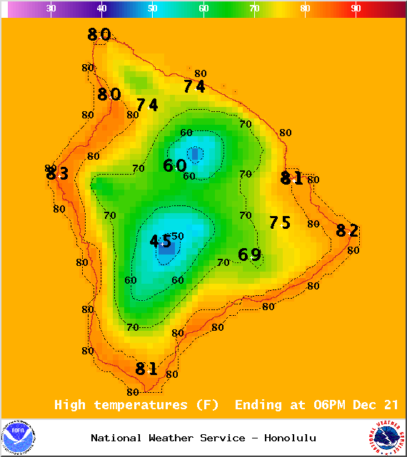
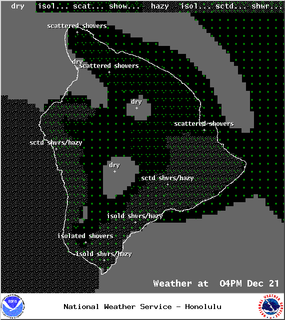
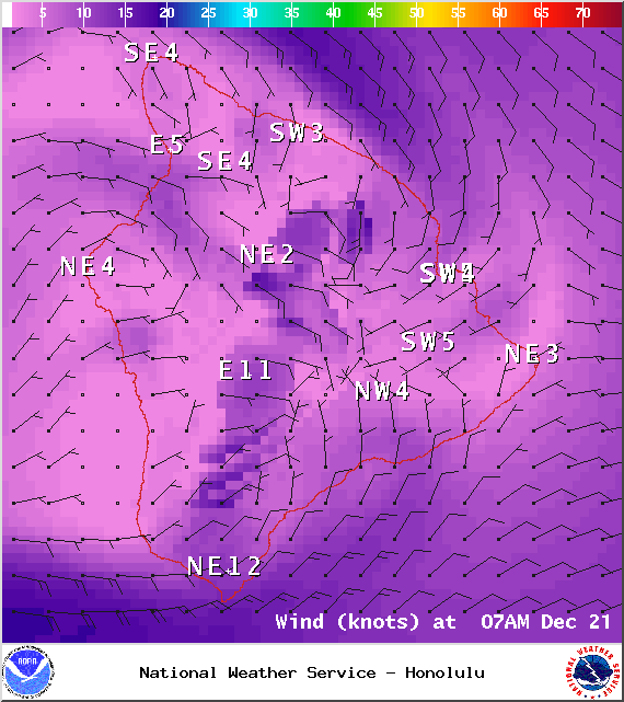
Winds are expected to weaken today, decreasing to 10 to 15 mph. This will allow for a more pronounced sea breeze to develop on the Kona side and the possibility of scattered afternoon showers along with cloud cover in the afternoon. Some scattered showers in the morning for windward and mauka areas with clearing expected during the day. Highs from 80° to 85°.
Sunrise: 6:50 a.m.
Sunset: 5:47 p.m.
UV index at 6 (“high” exposure level)
Looking Ahead
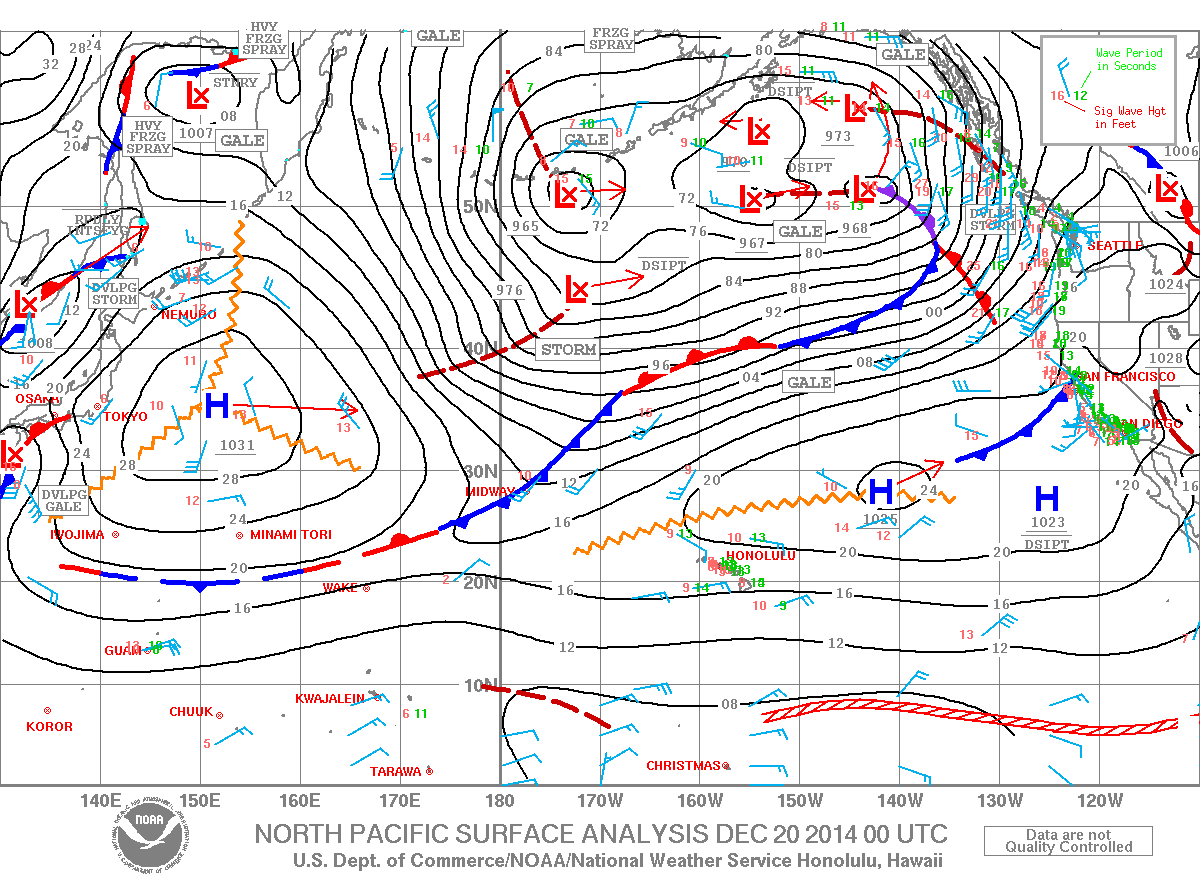
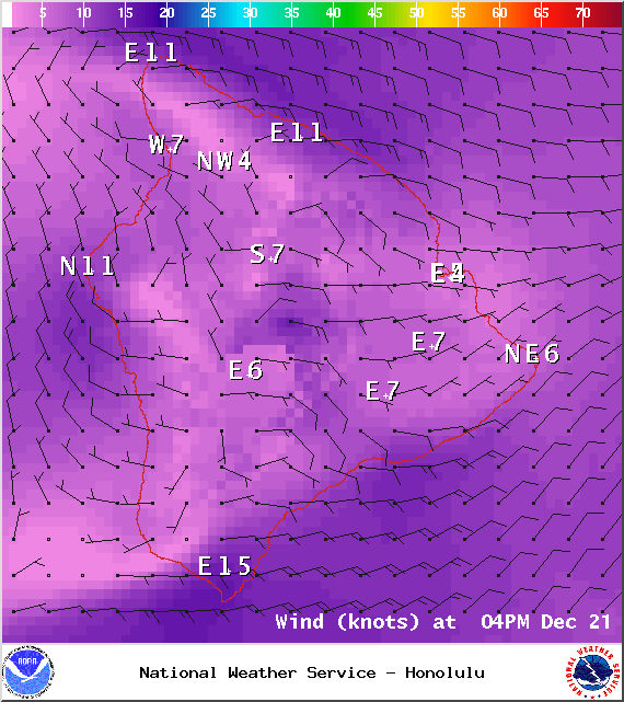
Trade winds will push showers into our usual windward and mauka areas and some of that moisture may pass leeward from time to time. Over the weekend, winds are expected to shift and become light as our “natural air conditioner” – high pressure – moves away from the islands and a cold front approaches. The cold front is expected to spread rain, cold air and strong northerly winds across the state from Kauai down to the Big Island starting Sunday night. Arrival time for the Big Island is expected overnight Monday and Tuesday. Snow conditions are possible for the summits of Mauna Kea and Mauna Loa during that time. Will keep an eye on it. Conditions will gradually return to typical trade wind weather after the passage of the front.
This comments section is a public community forum for the purpose of free expression. Although Big Island Now encourages respectful communication only, some content may be considered offensive. Please view at your own discretion. View Comments